MyTopo
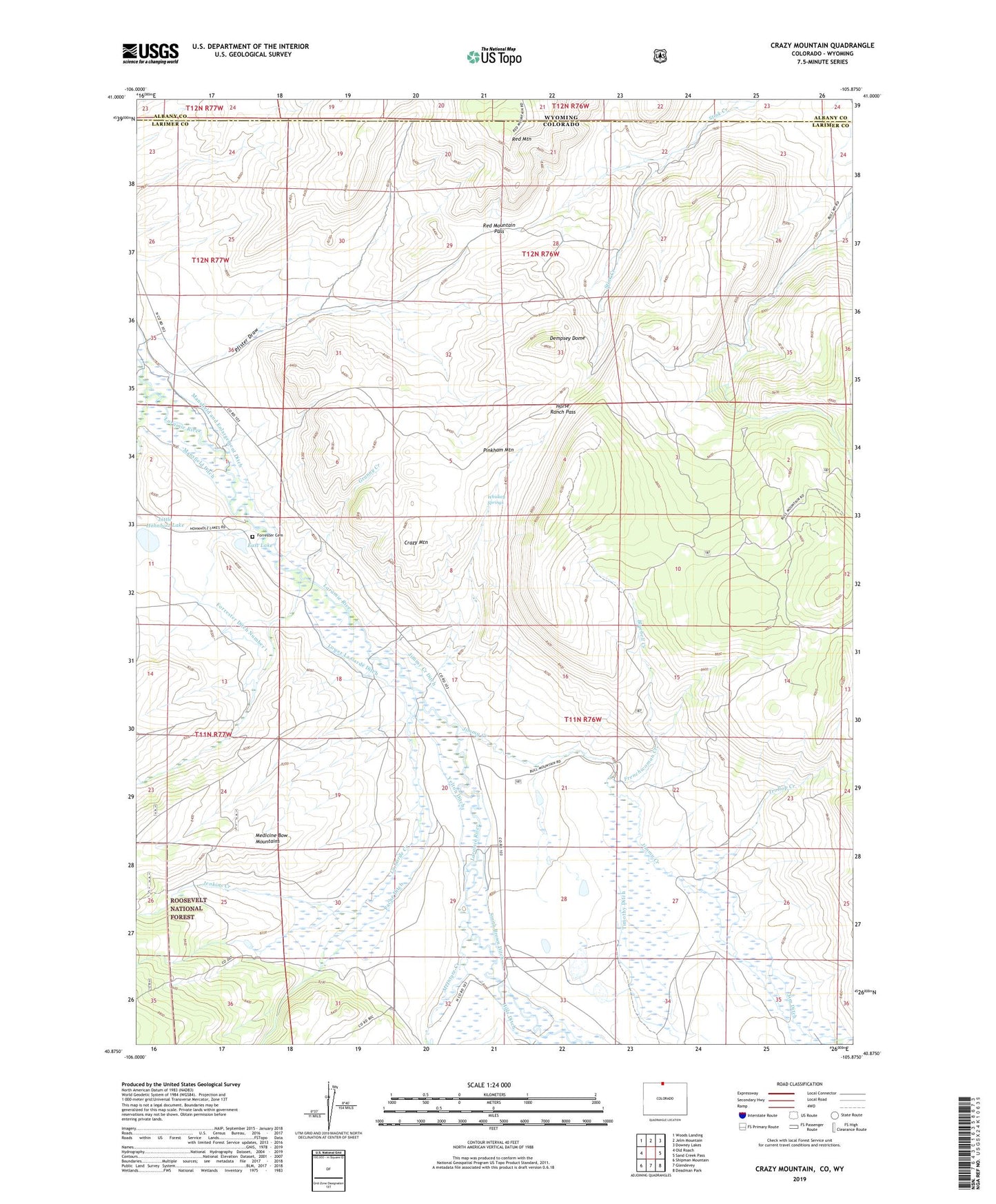
Crazy Mountain Colorado US Topo Map
Couldn't load pickup availability
Also explore the Crazy Mountain Forest Service Topo of this same quad for updated USFS data
2022 topographic map quadrangle Crazy Mountain in the state of Colorado. Scale: 1:24000. Based on the newly updated USGS 7.5' US Topo map series, this map is in the following counties: Larimer, Albany. The map contains contour data, water features, and other items you are used to seeing on USGS maps, but also has updated roads and other features. This is the next generation of topographic maps. Printed on high-quality waterproof paper with UV fade-resistant inks.
Quads adjacent to this one:
West: Old Roach
Northwest: Woods Landing
North: Jelm Mountain
Northeast: Downey Lakes
East: Sand Creek Pass
Southeast: Deadman Park
South: Glendevey
Southwest: Shipman Mountain
Contains the following named places: Bluebell Creek, Crazy Mountain, Dempsey Dome, East Lake, Forrester Cemetery, Forrester Creek, Forrester Ditch Number 1, Frenchwoman Creek, Grace Creek, Granny Creek, Hills Ditch, Hohnholz Lakes Campground, Homestead Ditch 1, Homestead Ditch 2, Horse Ranch Pass, Jenkins Creek, Jim Ditch, Jimmy Creek, Jimmy Creek Ditch, La Garde Creek, La Garde Ditch, Little Hohnholtz Dam, Little Hohnholz Lake, Little Jenkins Creek, Lower La Garde Ditch, Mansfield and Enlargement Ditch, Mansfield Ditch, McIntyre Creek, Pache Ditch, Pfister Draw, Red Mountain, Red Mountain Pass, Smith Brown Ditch, Trollop Creek, Whiskey Springs, Yelton Ditch, ZIP Code: 82063