MyTopo
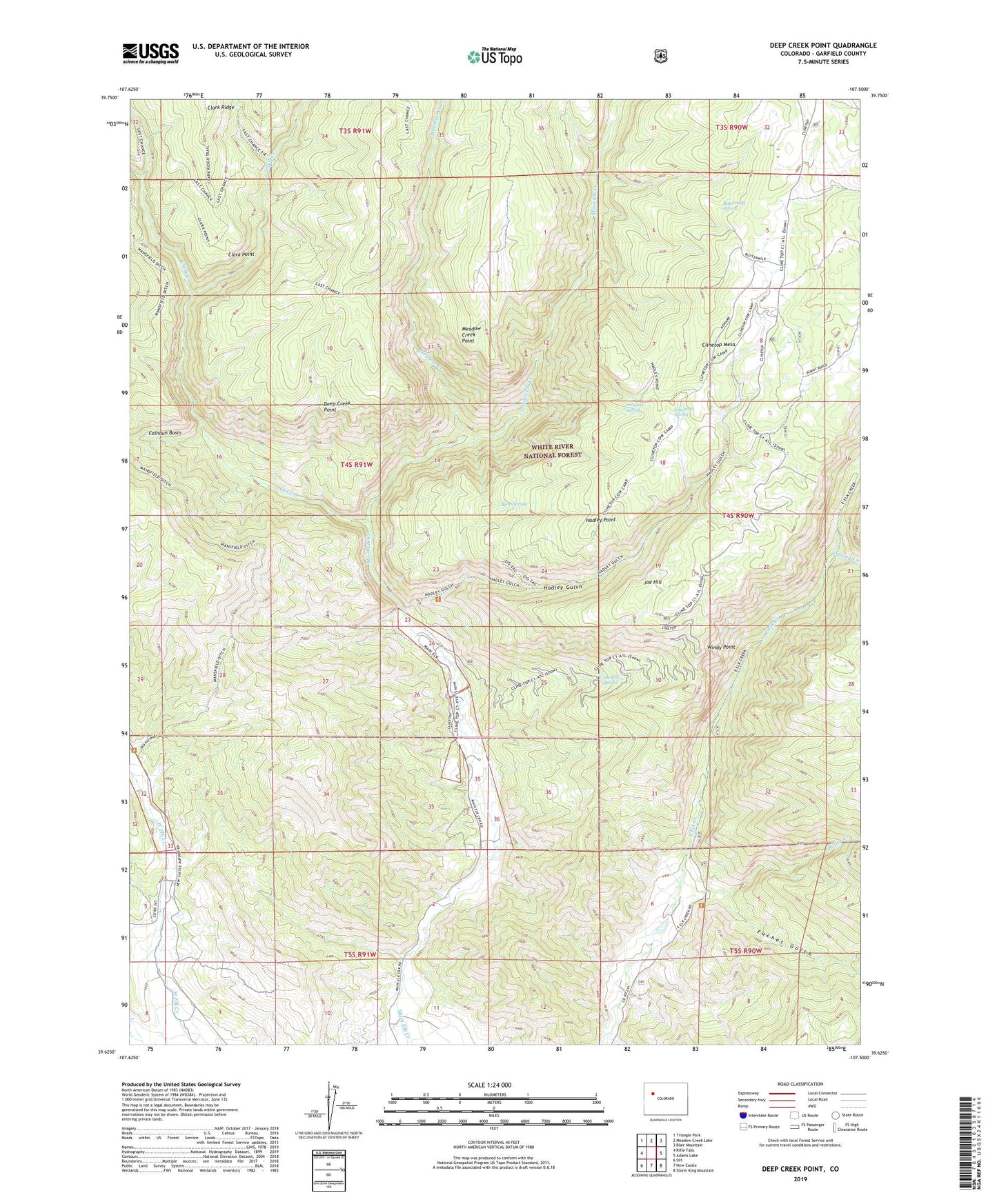
Deep Creek Point Colorado US Topo Map
Couldn't load pickup availability
Also explore the Deep Creek Point Forest Service Topo of this same quad for updated USFS data
2022 topographic map quadrangle Deep Creek Point in the state of Colorado. Scale: 1:24000. Based on the newly updated USGS 7.5' US Topo map series, this map is in the following counties: Garfield. The map contains contour data, water features, and other items you are used to seeing on USGS maps, but also has updated roads and other features. This is the next generation of topographic maps. Printed on high-quality waterproof paper with UV fade-resistant inks.
Quads adjacent to this one:
West: Rifle Falls
Northwest: Triangle Park
North: Meadow Creek Lake
Northeast: Blair Mountain
East: Adams Lake
Southeast: Storm King Mountain
South: New Castle
Southwest: Silt
This map covers the same area as the classic USGS quad with code o39107f5.
Contains the following named places: Bear Spring, Boiler Creek, Buttermilk SPring, Calhoun Basin, Clark Creek, Clark Point, Clinetop Cow Camp, Deep Creek, Deep Creek Point, Edwards Spring, Fuches Gulch, Gray Eagle Mine, Hadley Gulch, Hadley Point, Joe Hill, Joe Hill Spring, Last Chance Trail, Mansfield Creek, Mansfield Ditch Trail, Meadow Creek, Meadow Creek Point, Prospect Spring, Spring Creek, Windy Point