MyTopo
Storm King Mountain Colorado US Topo Map
Couldn't load pickup availability
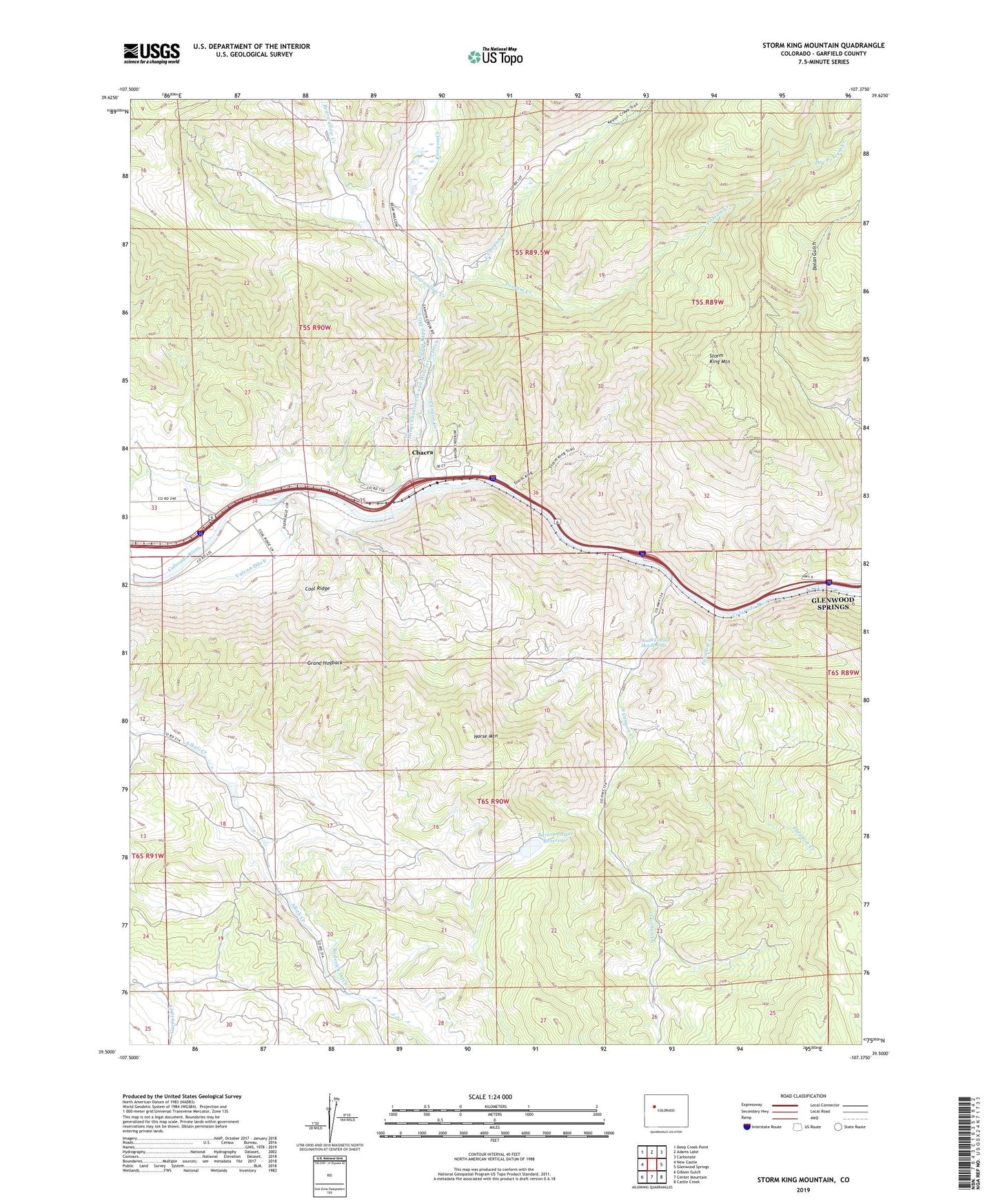
2022 topographic map quadrangle Storm King Mountain in the state of Colorado. Scale: 1:24000. Based on the newly updated USGS 7.5' US Topo map series, this map is in the following counties: Garfield. The map contains contour data, water features, and other items you are used to seeing on USGS maps, but also has updated roads and other features. This is the next generation of topographic maps. Printed on high-quality waterproof paper with UV fade-resistant inks.
Quads adjacent to this one:
West: New Castle
Northwest: Deep Creek Point
North: Adams Lake
Northeast: Carbonate
East: Glenwood Springs
Southeast: Cattle Creek
South: Center Mountain
Southwest: Gibson Gulch
This map covers the same area as the classic USGS quad with code o39107e4.
Contains the following named places: Barton Porter Dam, Bearwallow Creek, Canyon Creek, Canyon Creek School, Chacra, Chacra Census Designated Place, Coal Ridge, Dalsas Mine, Dry Possum Creek, East Canyon Creek, East Canyon Creek Mine, Horse Mountain, Mings Chenoweth and Wolverton Ditch, Okanela Lodge, Paradise Creek, Porter Reservoir, Possum Creek, Revelation Group Mine, Roderick Ditch, South Canyon Creek, South Canyon Hot Springs, South Canyon Landfill, South Canyon Mine, Spion Kapp Ditch, Storm King Mountain, Sykes and Alford Ditch, Valcan Ditch