
MyTopo
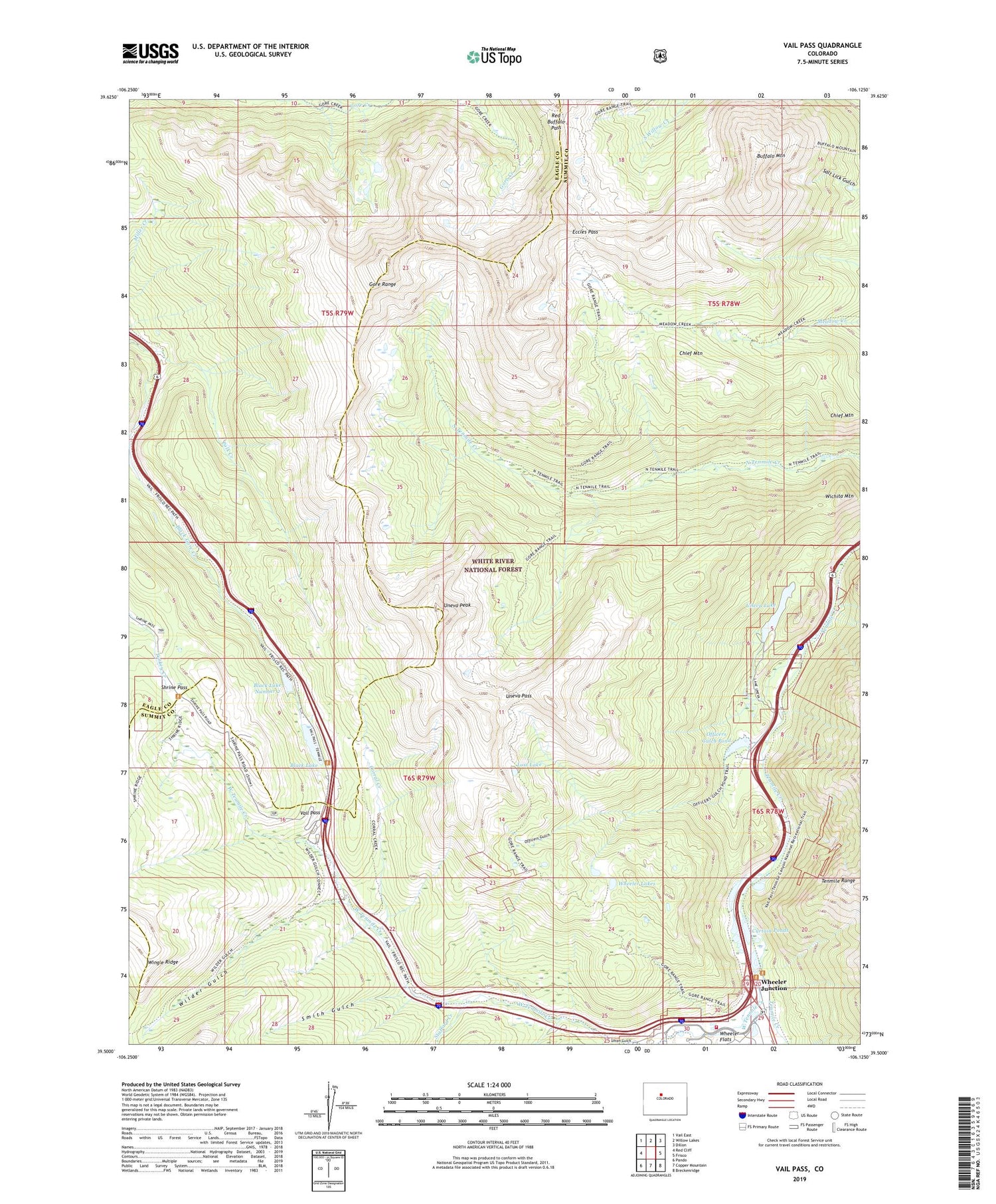
Vail Pass Colorado US Topo Map
Couldn't load pickup availability
Also explore the Vail Pass Forest Service Topo of this same quad for updated USFS data
2022 topographic map quadrangle Vail Pass in the state of Colorado. Scale: 1:24000. Based on the newly updated USGS 7.5' US Topo map series, this map is in the following counties: Summit, Eagle. The map contains contour data, water features, and other items you are used to seeing on USGS maps, but also has updated roads and other features. This is the next generation of topographic maps. Printed on high-quality waterproof paper with UV fade-resistant inks.
Quads adjacent to this one:
West: Red Cliff
Northwest: Vail East
North: Willow Lakes
Northeast: Dillon
East: Frisco
Southeast: Breckenridge
South: Copper Mountain
Southwest: Pando
This map covers the same area as the classic USGS quad with code o39106e2.
Contains the following named places: Black Lake, Black Lake Number 1 Dam, Black Lake Number 2, Black Lake Number 2 Dam, Black Lakes Campground, Buffalo Mountain, Chief Mountain, Copper Mountain, Copper Mountain Fire Department, Corral Creek, Curtain Ponds, Eagle Number One Mine, Eccles Pass, Guller Creek, Lost Lake, Officers Gulch, Officers Gulch Pond, Polk Creek, Red Buffalo Pass, Shrine Pass, Smith Gulch, Stafford Creek, Uneva Lake, Uneva Pass, Uneva Peak, Union Gulch, Vail Pass, Vail Pass Mine, West Tenmile Creek, Wheeler Dillion Trail, Wheeler Flats, Wheeler Junction, Wheeler Lakes, Wichita Mountain, Wilder Gulch, ZIP Code: 80443


