MyTopo
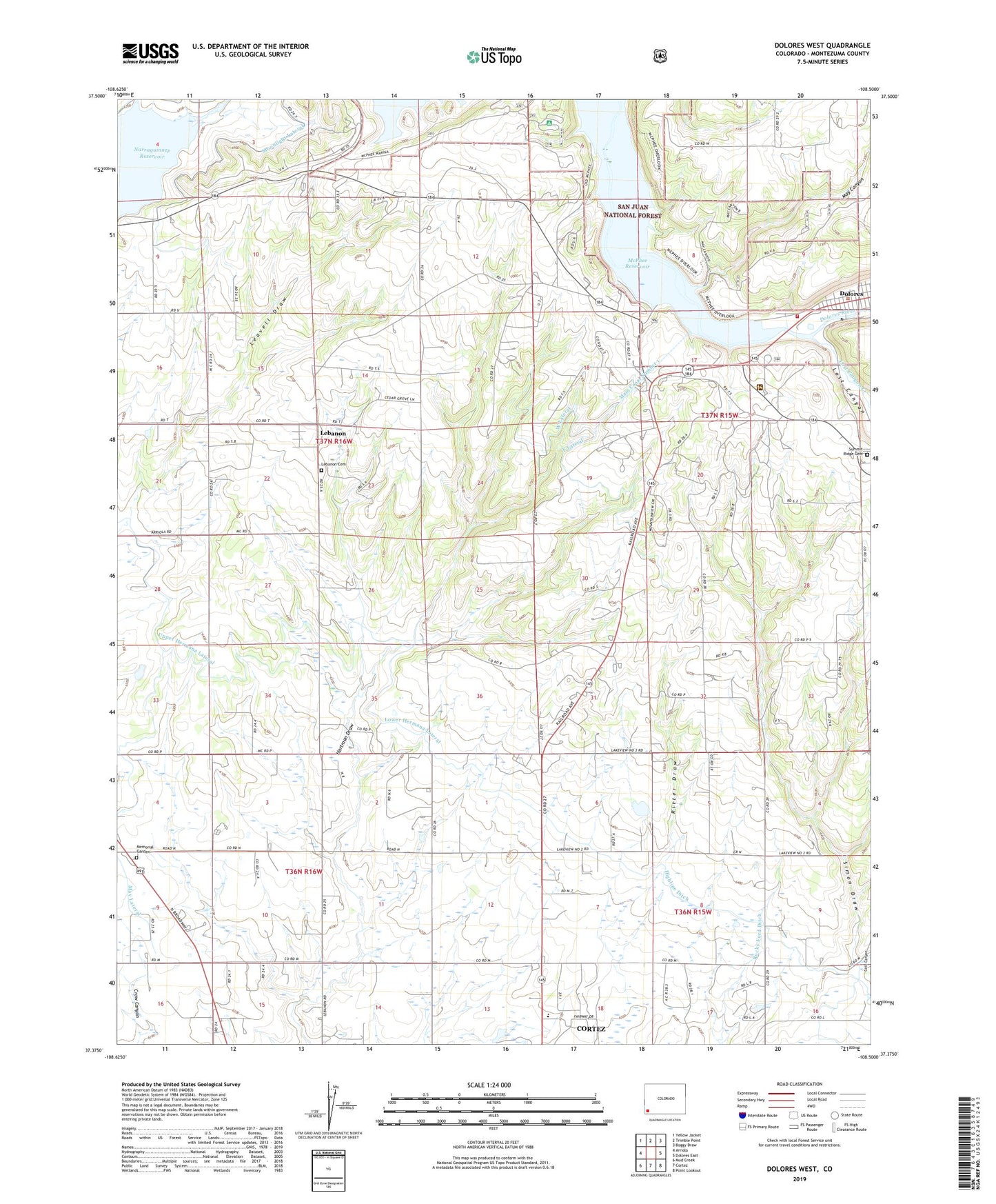
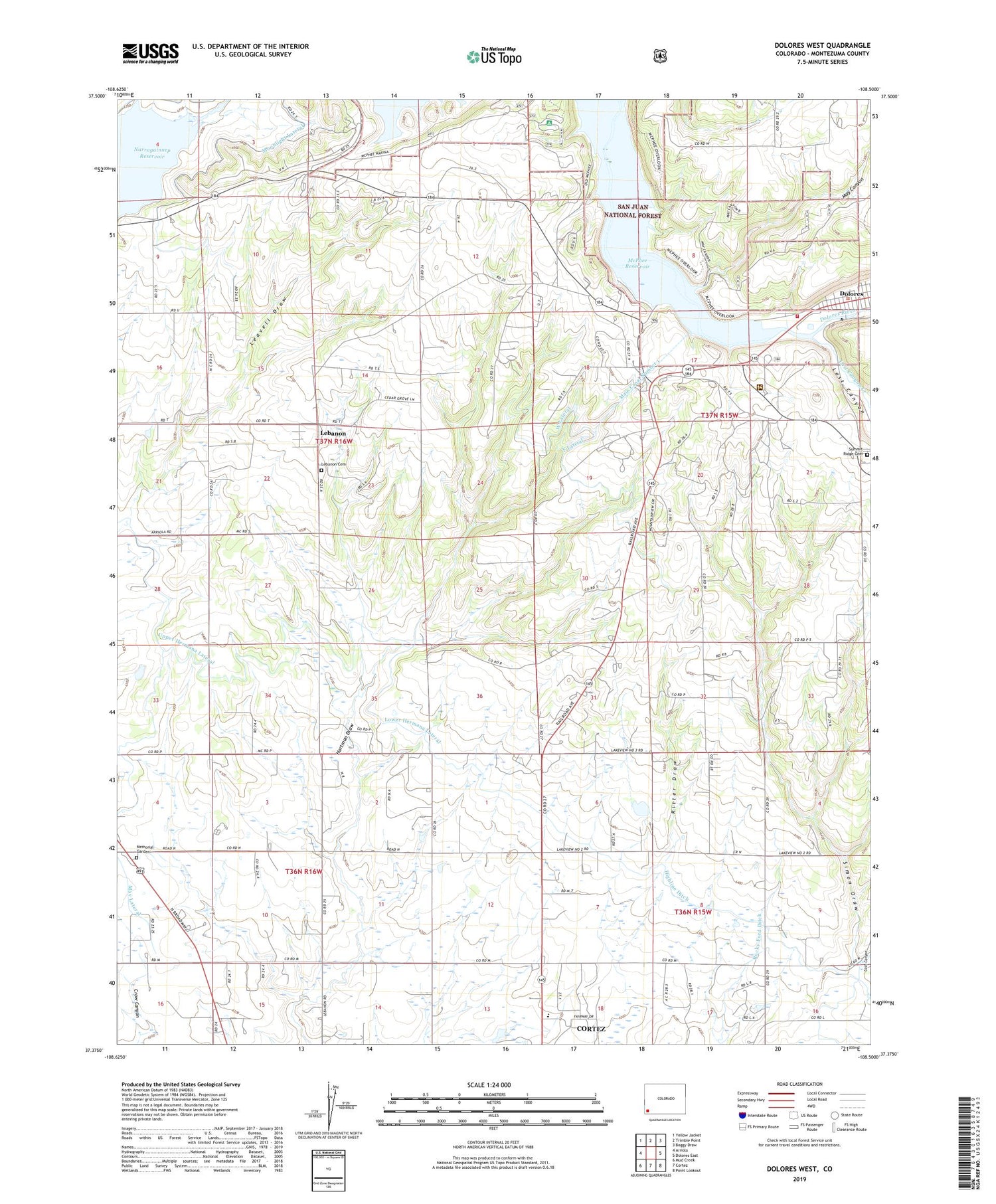
Dolores West Colorado US Topo Map
Couldn't load pickup availability
Also explore the Dolores West Forest Service Topo of this same quad for updated USFS data
2022 topographic map quadrangle Dolores West in the state of Colorado. Scale: 1:24000. Based on the newly updated USGS 7.5' US Topo map series, this map is in the following counties: Montezuma. The map contains contour data, water features, and other items you are used to seeing on USGS maps, but also has updated roads and other features. This is the next generation of topographic maps. Printed on high-quality waterproof paper with UV fade-resistant inks.
Quads adjacent to this one:
West: Arriola
Northwest: Yellow Jacket
North: Trimble Point
Northeast: Boggy Draw
East: Dolores East
Southeast: Point Lookout
South: Cortez
Southwest: Mud Creek
This map covers the same area as the classic USGS quad with code o37108d5.
Contains the following named places: Cash Canyon, Cortez Filtration Plant, Cortez Number 1 Dam, Cortez Number 1 Reservoir, Dolores, Dolores Fire Department, Dolores Medical Center, Dolores Public Library, Dolores Southern Baptist Church, Dolores Town Hall, East Lateral, First Baptist Church, Flanders Park, Friendship Assembly of God, Joe Rowell Park, Lakeview School, Lebanon, Lebanon Cemetery, Lighthouse Baptist Church, Lighthouse Christian Academy, Lost Canyon, Lost Canyon Creek, Lower Hermana Lateral, Main Canal Number 1, May Canyon, May Lateral, Memorial Garden, Mildred School, Moonlight Lateral, Narraguinnep Reservoir, Our Lady of Victory Catholic Church, Rio Grande Southern Railroad Museum, Ritter Draw, Summit Ridge Cemetery, Upper Hermana Lateral, West Lateral