MyTopo
Dominguez Colorado US Topo Map
Couldn't load pickup availability
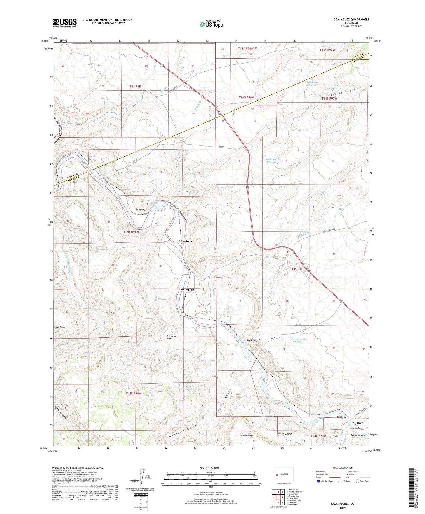
2022 topographic map quadrangle Dominguez in the state of Colorado. Scale: 1:24000. Based on the newly updated USGS 7.5' US Topo map series, this map is in the following counties: Delta, Mesa. The map contains contour data, water features, and other items you are used to seeing on USGS maps, but also has updated roads and other features. This is the next generation of topographic maps. Printed on high-quality waterproof paper with UV fade-resistant inks.
Quads adjacent to this one:
West: Triangle Mesa
Northwest: Whitewater
North: Juniata Reservoir
Northeast: Indian Point
East: Point Creek
Southeast: Roubideau
South: Good Point
Southwest: Escalante Forks
This map covers the same area as the classic USGS quad with code o38108g3.
Contains the following named places: Beaver Gulch, Broughton, County Line Reservoir, Deer Creek, Dominguez, Dominguez Rim, Dominguez Rim Reservoir, Edds Reservoir, Escalante, Escalante Creek, Gunnison Gulch, Huff, King Creek, Leonards Basin, McCarty Bench, Palmer Gulch, Peeples, Rocky Wash Reservoir, Wells Gulch, Wells Gulch Spring, Windy Creek