MyTopo
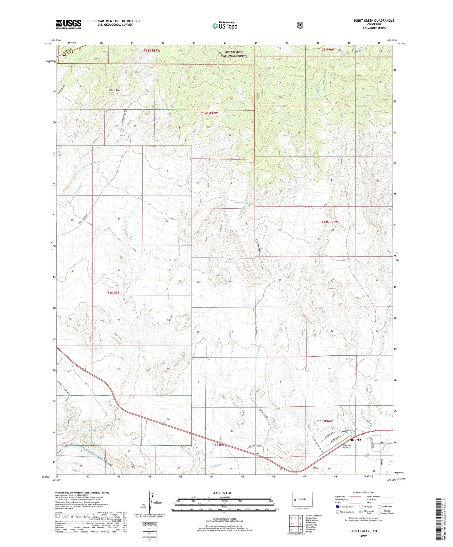
Point Creek Colorado US Topo Map
Couldn't load pickup availability
Also explore the Point Creek Forest Service Topo of this same quad for updated USFS data
2022 topographic map quadrangle Point Creek in the state of Colorado. Scale: 1:24000. Based on the newly updated USGS 7.5' US Topo map series, this map is in the following counties: Delta, Mesa. The map contains contour data, water features, and other items you are used to seeing on USGS maps, but also has updated roads and other features. This is the next generation of topographic maps. Printed on high-quality waterproof paper with UV fade-resistant inks.
Quads adjacent to this one:
West: Dominguez
Northwest: Juniata Reservoir
North: Indian Point
Northeast: Hells Kitchen
East: North Delta
Southeast: Delta
South: Roubideau
Southwest: Good Point
This map covers the same area as the classic USGS quad with code o38108g2.
Contains the following named places: Alkali Reservoir, Delta Division, Hawkin Reservoir Number 3, Hawkins Number 3 Dam, Lone Star Ditch, Lone Starr Number 1 Dam, Point Creek, Point Creek Heliport, Sheep Rock, Star Nelson Ranch, Westwinds Airport, ZIP Code: 81416