
MyTopo
Roubideau Colorado US Topo Map
Couldn't load pickup availability
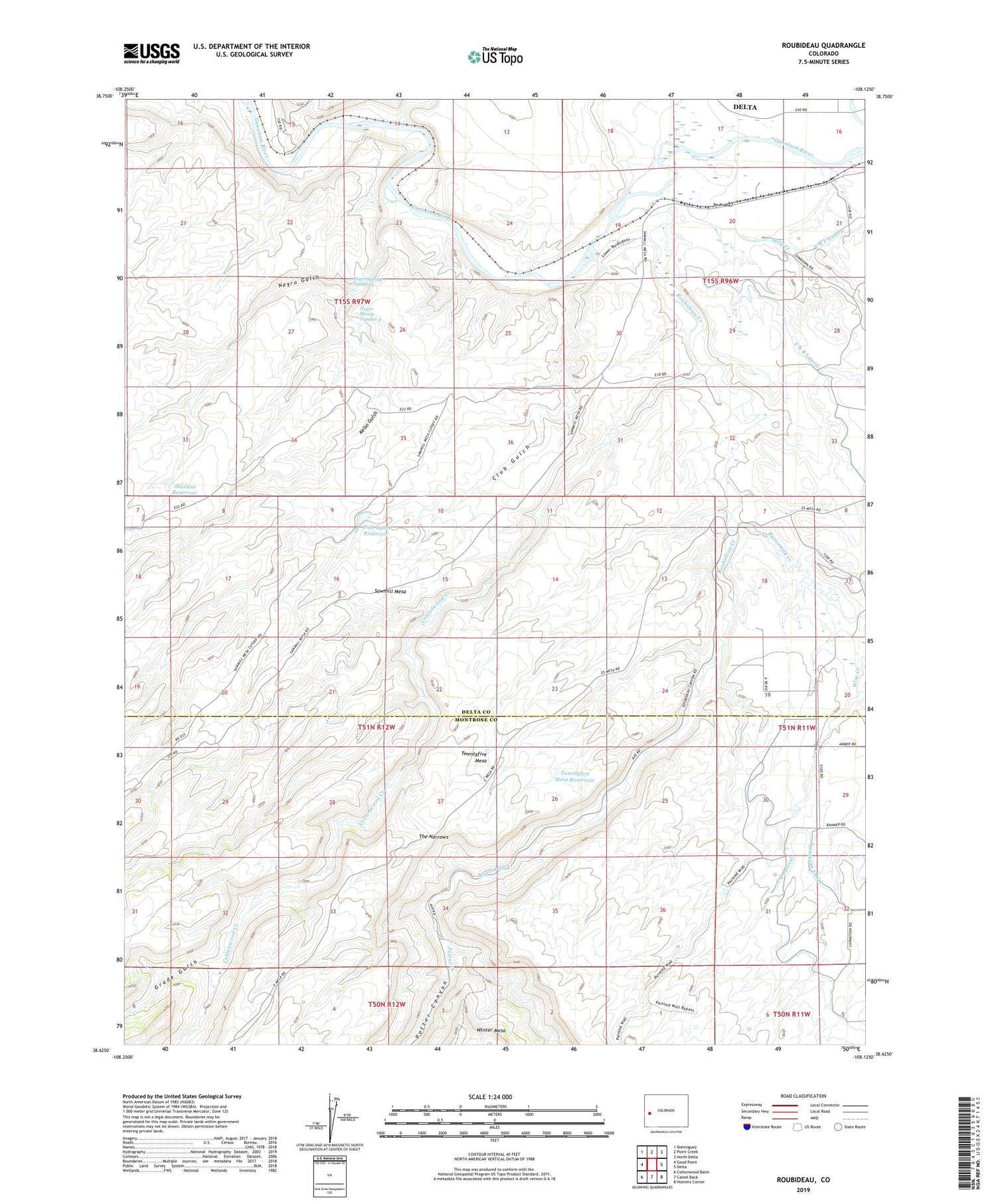
2022 topographic map quadrangle Roubideau in the state of Colorado. Scale: 1:24000. Based on the newly updated USGS 7.5' US Topo map series, this map is in the following counties: Delta, Montrose. The map contains contour data, water features, and other items you are used to seeing on USGS maps, but also has updated roads and other features. This is the next generation of topographic maps. Printed on high-quality waterproof paper with UV fade-resistant inks.
Quads adjacent to this one:
West: Good Point
Northwest: Dominguez
North: Point Creek
Northeast: North Delta
East: Delta
Southeast: Hoovers Corner
South: Camel Back
Southwest: Cottonwood Basin
This map covers the same area as the classic USGS quad with code o38108f2.
Contains the following named places: Alkali Creek, Buttermilk Creek, Cactus Park, Club Gulch, Club Gulch Reservoir, Cottonwood Creek, Delta Correctional Facility, F N F Lateral, Grade Gulch, Kelso Gulch, Negro Gulch, Negro Spring Number 1, Negro Spring Number 2, Porter Retention Dam, Potter Canyon, Potter Creek, Roubideau, Roubideau Conservation Training Camp, Roubideau Creek, Seep Creek, Shortcut Reservoir, The Narrows, Twentyfive Mesa Reservoir


