MyTopo
Good Point Colorado US Topo Map
Couldn't load pickup availability
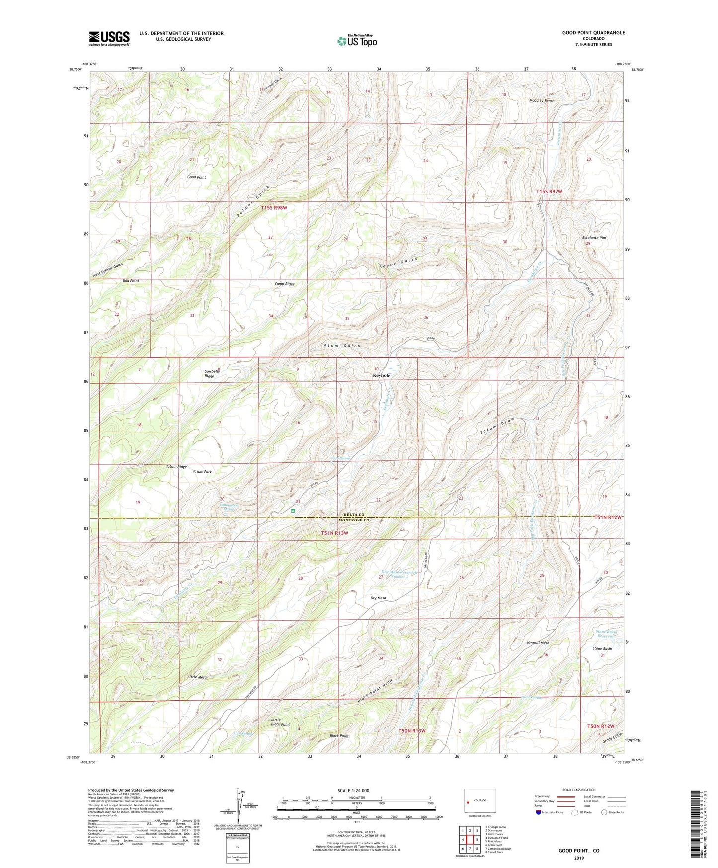
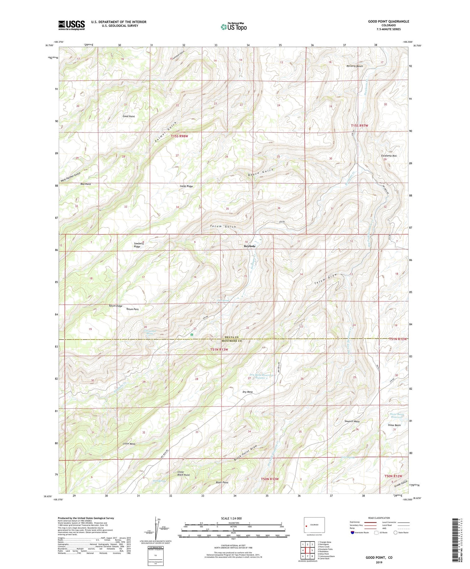
2022 topographic map quadrangle Good Point in the state of Colorado. Scale: 1:24000. Based on the newly updated USGS 7.5' US Topo map series, this map is in the following counties: Delta, Montrose. The map contains contour data, water features, and other items you are used to seeing on USGS maps, but also has updated roads and other features. This is the next generation of topographic maps. Printed on high-quality waterproof paper with UV fade-resistant inks.
Quads adjacent to this one:
West: Escalante Forks
Northwest: Triangle Mesa
North: Dominguez
Northeast: Point Creek
East: Roubideau
Southeast: Camel Back
South: Cottonwood Basin
Southwest: Kelso Point
This map covers the same area as the classic USGS quad with code o38108f3.
Contains the following named places: Alum Spring, Black Point Draw, Boyce Gulch, Caps Spring, Cottonwood Spring, Dry Fork Escalante Creek, Dry Mesa Reservoir Number 2, Escalante Rim, Gunnison Trail, Keyhole, Little Mesa, McCarthy Trail, Porter Spring, Stone Basin, Stone Basin Reservoir, Tatum Draw, Tatum Gulch, Tatum Park, West Palmer Gulch