MyTopo
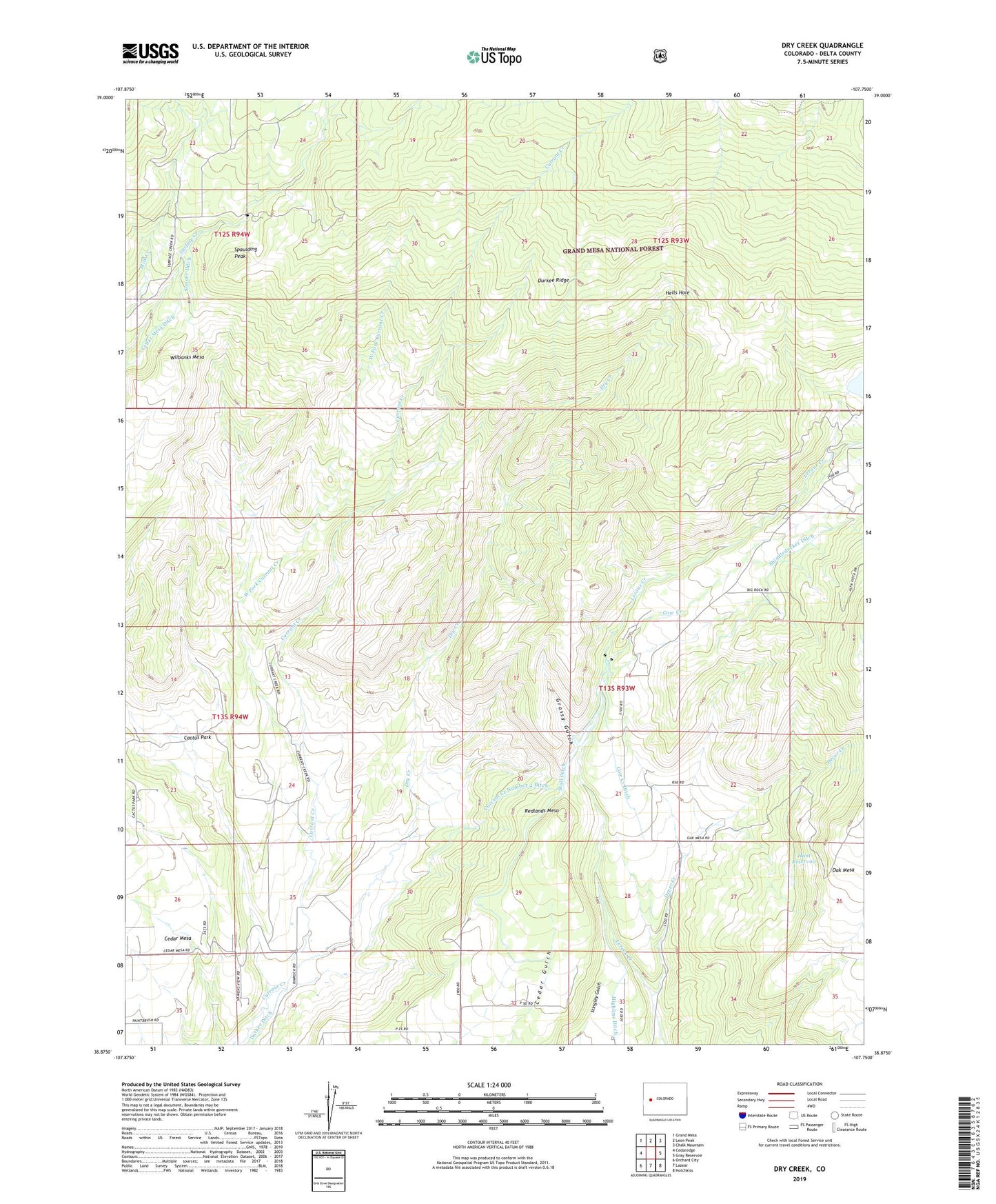
Dry Creek Colorado US Topo Map
Couldn't load pickup availability
Also explore the Dry Creek Forest Service Topo of this same quad for updated USFS data
2022 topographic map quadrangle Dry Creek in the state of Colorado. Scale: 1:24000. Based on the newly updated USGS 7.5' US Topo map series, this map is in the following counties: Delta. The map contains contour data, water features, and other items you are used to seeing on USGS maps, but also has updated roads and other features. This is the next generation of topographic maps. Printed on high-quality waterproof paper with UV fade-resistant inks.
Quads adjacent to this one:
West: Cedaredge
Northwest: Grand Mesa
North: Leon Peak
Northeast: Chalk Mountain
East: Gray Reservoir
Southeast: Hotchkiss
South: Lazear
Southwest: Orchard City
This map covers the same area as the classic USGS quad with code o38107h7.
Contains the following named places: Bennett Mine, Cactus Park, Caesar Creek, Carl Smith Dam, Cow Creek, Cow Creek Ditch, Currant Creek Number 2 Ditch, Dever Creek, Dry Creek, Durkee Ridge, Farmers Mine, Grassy Gulch, Hells Hole, Hunt Dam, Hunt Reservoir, Landerth Mine, Newman Mine, Overland Canal, Owens Mine, Redlands Mesa, Seven X Ranch, Shindledecker Ditch, Sooner Ditch, Spaulding Peak, Stull Ditch, Ward Mine, West Fork Currant Creek, Wilbanks Mesa