MyTopo
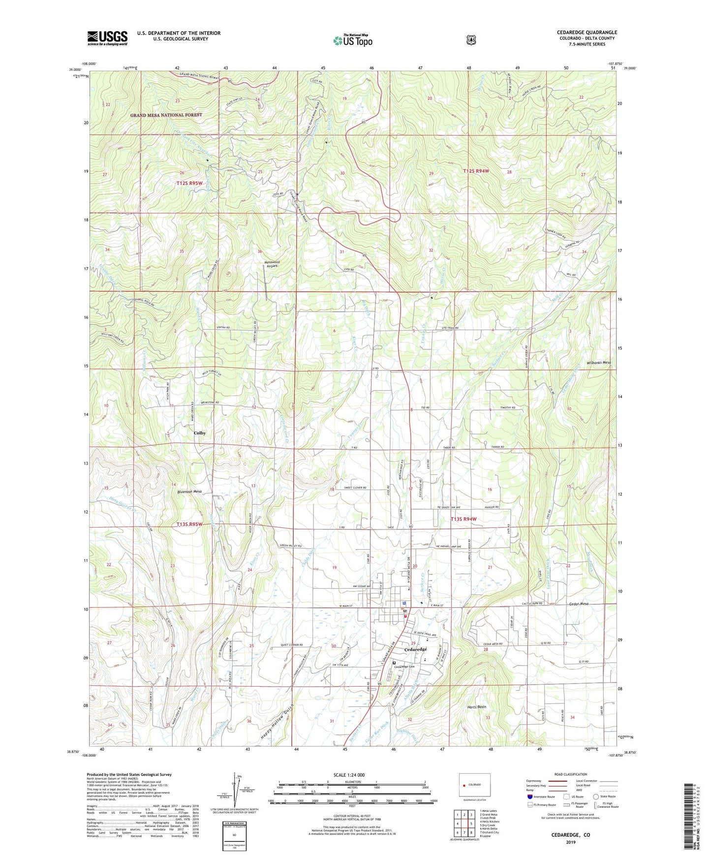
Cedaredge Colorado US Topo Map
Couldn't load pickup availability
Also explore the Cedaredge Forest Service Topo of this same quad for updated USFS data
2022 topographic map quadrangle Cedaredge in the state of Colorado. Scale: 1:24000. Based on the newly updated USGS 7.5' US Topo map series, this map is in the following counties: Delta. The map contains contour data, water features, and other items you are used to seeing on USGS maps, but also has updated roads and other features. This is the next generation of topographic maps. Printed on high-quality waterproof paper with UV fade-resistant inks.
Quads adjacent to this one:
West: Hells Kitchen
Northwest: Mesa Lakes
North: Grand Mesa
Northeast: Leon Peak
East: Dry Creek
Southeast: Lazear
South: Orchard City
Southwest: North Delta
This map covers the same area as the classic USGS quad with code o38107h8.
Contains the following named places: Big Ditch, Black Diamond Mine, Bluenose Mesa, Brimstone Corner, Cedar Mesa, Cedar Mesa Ditch, Cedar Run Ditch, Cedaredge, Cedaredge Cemetery, Cedaredge Division, Cedaredge Police Department, Cedaredge Post Office, Childs Ditch, Coalby Mine Number Two, Colby, Colby Mine, Cottonwood Creek, Delta County Fire Protection District - Station 3 Cedaredge, Dirty George Creek, Green Valley Mine, Horse Creek, Ideal Number One Mine, Ideal Number Three Mine, Ideal Number Two Mine, Independence Mine, Kiser Creek, Lambert Pit, Lone Pine Ditch, McGruder Mine, Mesa Ditch, Mesawood Airpark, Milk Creek, Morning Star Mine, Red Canyon Mine, States Mine, Top Mine, Town of Cedaredge, Ward Creek, Williams Creek, Youngs Creek, ZIP Code: 81413