MyTopo
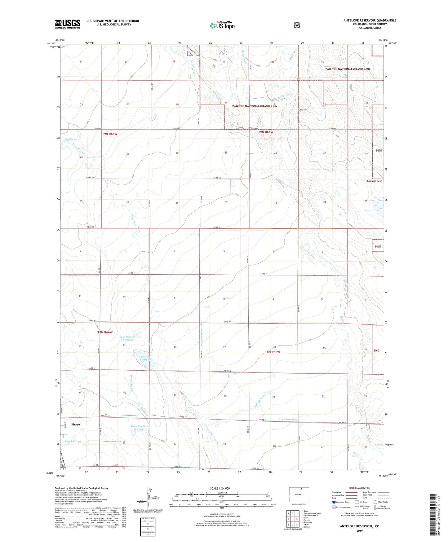
Antelope Reservoir Colorado US Topo Map
Couldn't load pickup availability
Also explore the Antelope Reservoir Forest Service Topo of this same quad for updated USFS data
2022 topographic map quadrangle Antelope Reservoir in the state of Colorado. Scale: 1:24000. Based on the newly updated USGS 7.5' US Topo map series, this map is in the following counties: Weld. The map contains contour data, water features, and other items you are used to seeing on USGS maps, but also has updated roads and other features. This is the next generation of topographic maps. Printed on high-quality waterproof paper with UV fade-resistant inks.
Quads adjacent to this one:
West: Nunn
Northwest: Dover
North: Eastman Creek South
Northeast: Eastman Creek SE
East: Purcell
Southeast: Galeton
South: Eaton
Southwest: Severance
This map covers the same area as the classic USGS quad with code o40104f6.
Contains the following named places: Antelope Reservoir, Boyd Number 2 Reservoir, Boyd Springs, Burger-Gault Lateral, Eastman Creek, Good Lateral, King Solomon Mine, Little Owl Creek, Lone Tree Ditch, McGrew Dam, McGrew Reservoir, Robinson Creek, Rowe Brothers Reservoir, Rush Windmill, Weld County Gravel Pit