MyTopo
Iron Mountain Colorado US Topo Map
Couldn't load pickup availability
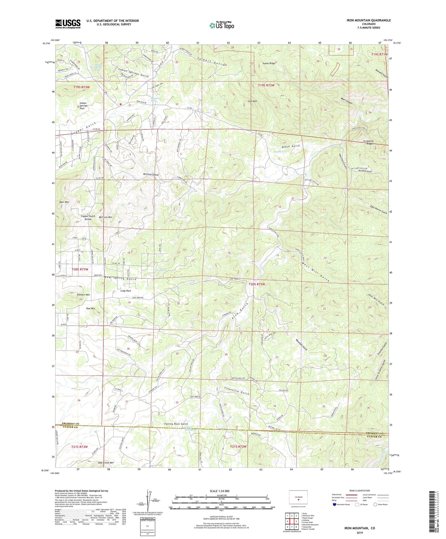
2022 topographic map quadrangle Iron Mountain in the state of Colorado. Scale: 1:24000. Based on the newly updated USGS 7.5' US Topo map series, this map is in the following counties: Fremont, Custer. The map contains contour data, water features, and other items you are used to seeing on USGS maps, but also has updated roads and other features. This is the next generation of topographic maps. Printed on high-quality waterproof paper with UV fade-resistant inks.
Quads adjacent to this one:
West: Hillside
Northwest: Echo
North: McIntyre Hills
Northeast: Royal Gorge
East: Curley Peak
Southeast: Mount Tyndall
South: Westcliffe
Southwest: Beckwith Mountain
This map covers the same area as the classic USGS quad with code o38105c4.
Contains the following named places: Black Gulch, Brown Lava Lode Mine, Buckskin Gulch, Cody Park, Copper Girl Mine, Copper Gulch Divide, Deadhorse Spring, Deer Mountain, Deer Mountain Volunteer Fire Protection District Station 1, Elkhorn Mountain, Falling Rock Gulch, Falling Rock Spring, Granite Country, Green Mountain Mine, Indian Springs, Indian Springs Gulch, Indian Springs Park, Iron Mountain, Iron Mountain Mine, Max Canyon, McClure Gulch, McClure Mountain, Mow Spring, Mow Spring Gulch, Red Mountain, Sandy Creek, Susies Ridge, Talbert Gulch, Titusville Gulch, West Mill Gulch, West Pierce Gulch, Westfall Gulch