MyTopo
Fairview Peak Colorado US Topo Map
Couldn't load pickup availability
Also explore the Fairview Peak Forest Service Topo of this same quad for updated USFS data
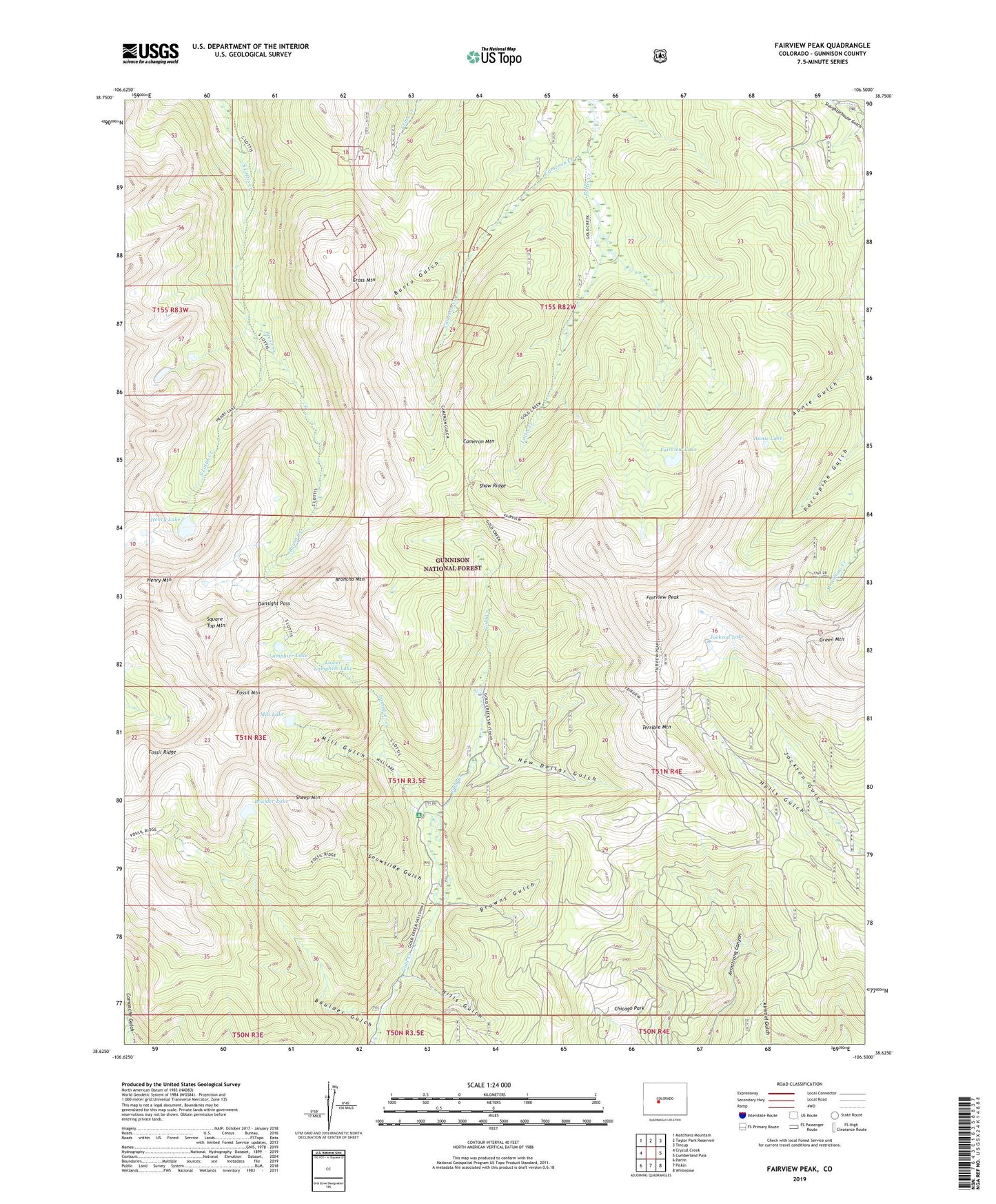
2022 topographic map quadrangle Fairview Peak in the state of Colorado. Scale: 1:24000. Based on the newly updated USGS 7.5' US Topo map series, this map is in the following counties: Gunnison. The map contains contour data, water features, and other items you are used to seeing on USGS maps, but also has updated roads and other features. This is the next generation of topographic maps. Printed on high-quality waterproof paper with UV fade-resistant inks.
Quads adjacent to this one:
West: Crystal Creek
Northwest: Matchless Mountain
North: Taylor Park Reservoir
Northeast: Tincup
East: Cumberland Pass
Southeast: Whitepine
South: Pitkin
Southwest: Parlin
This map covers the same area as the classic USGS quad with code o38106f5.
Contains the following named places: Annie Gulch, Annie Lake, Boulder Gulch, Boulder Lake, Broncho Mountain, Browns Gulch, Brush Creek, Burro Gulch, Cameron Creek, Cameron Mountain, Chicago Park, Cross Mountain, Fairview Lake, Fairview Mine, Fairview Peak, Fossil Mountain, Fossil Ridge, Gold Creek Campground, Gold Creek Union Park Trail, Gold Links Mine, Green Mountain, Gunsight Pass, Gunsight Trail, Henry Lake, Henry Mountain, Hills Gulch, Hotrocks Mine, Jackson Lake, Lamphier Creek, Lamphier Lake, Lower Lamphier Lake, Mill Gulch, Mill Lake, New Dollar Gulch, Onemile Trail, Pitkin Mine, Sandy Hook Mine, Shaw Ridge, Sheep Mountain, Snowslide Gulch, Square Top Mountain, Terrible Mountain