
MyTopo
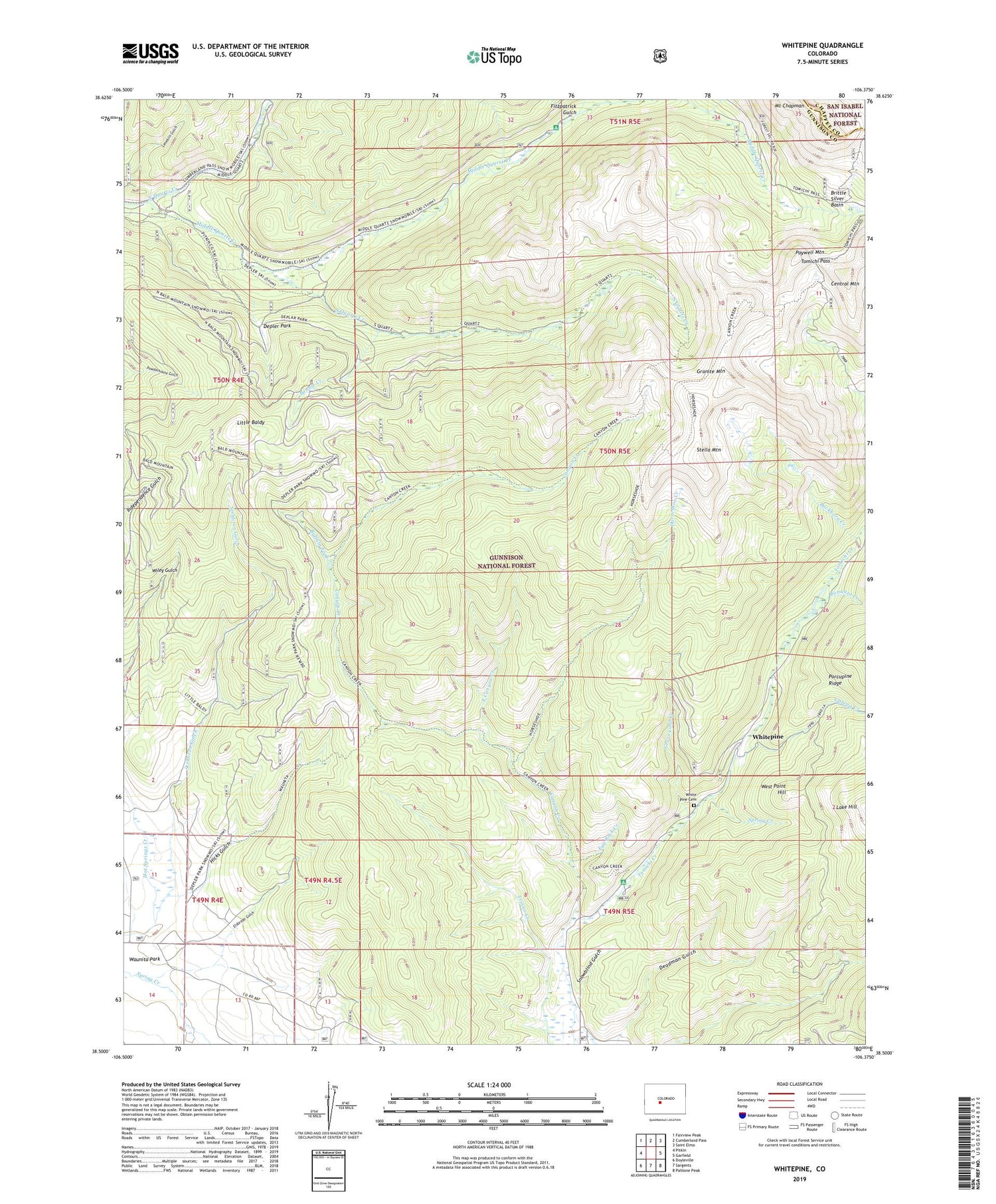
Whitepine Colorado US Topo Map
Couldn't load pickup availability
Also explore the Whitepine Forest Service Topo of this same quad for updated USFS data
2022 topographic map quadrangle Whitepine in the state of Colorado. Scale: 1:24000. Based on the newly updated USGS 7.5' US Topo map series, this map is in the following counties: Gunnison, Chaffee. The map contains contour data, water features, and other items you are used to seeing on USGS maps, but also has updated roads and other features. This is the next generation of topographic maps. Printed on high-quality waterproof paper with UV fade-resistant inks.
Quads adjacent to this one:
West: Pitkin
Northwest: Fairview Peak
North: Cumberland Pass
Northeast: Saint Elmo
East: Garfield
Southeast: Pahlone Peak
South: Sargents
Southwest: Doyleville
This map covers the same area as the classic USGS quad with code o38106e4.
Contains the following named places: Akron Mine, Big Red Twenty-two Mine, Bonanza Creek, Bonnie Creek, Brittle Basin Mine, Brittle Silver Basin, Buckhorn Creek, Buffalo Fork, Canyon Creek, Central Mountain, Coyote Park Trail, David H Shaft Mine, Deadman Gulch, Depler Park, East Canyon Creek, Egg Rock Creek, Eldorado Gulch, Ensign Tunnel Mine, Erie Mine, Fitzpatrick Gulch, Galena Creek, Granite Mountain, Graphite Basin Mine, Graveyard Creek, Hicks Gulch, Horseshoe Creek, Little Baldy, Middle Quartz Campground, Middle Quartz Creek, Morning Star Mine, Nest Egg Mine, North Quartz Creek, North Star, North Star Mine, Parole Mine, Paywell Mountain, Pitkin Stock Driveway, Porcupine Ridge, Princeton and Blackhawk Mine, Snowblind Campground, Snowblind Gulch, South Quartz Creek, Spring Creek, Stella Mountain, Stridiron Gulch, Tomichi Mine, Tomichi Pass, Victor Mine, West Point Hill, White Pine Cemetery, White Pine Mine, Whitepine


