MyTopo
Matchless Mountain Colorado US Topo Map
Couldn't load pickup availability
Also explore the Matchless Mountain Forest Service Topo of this same quad for updated USFS data
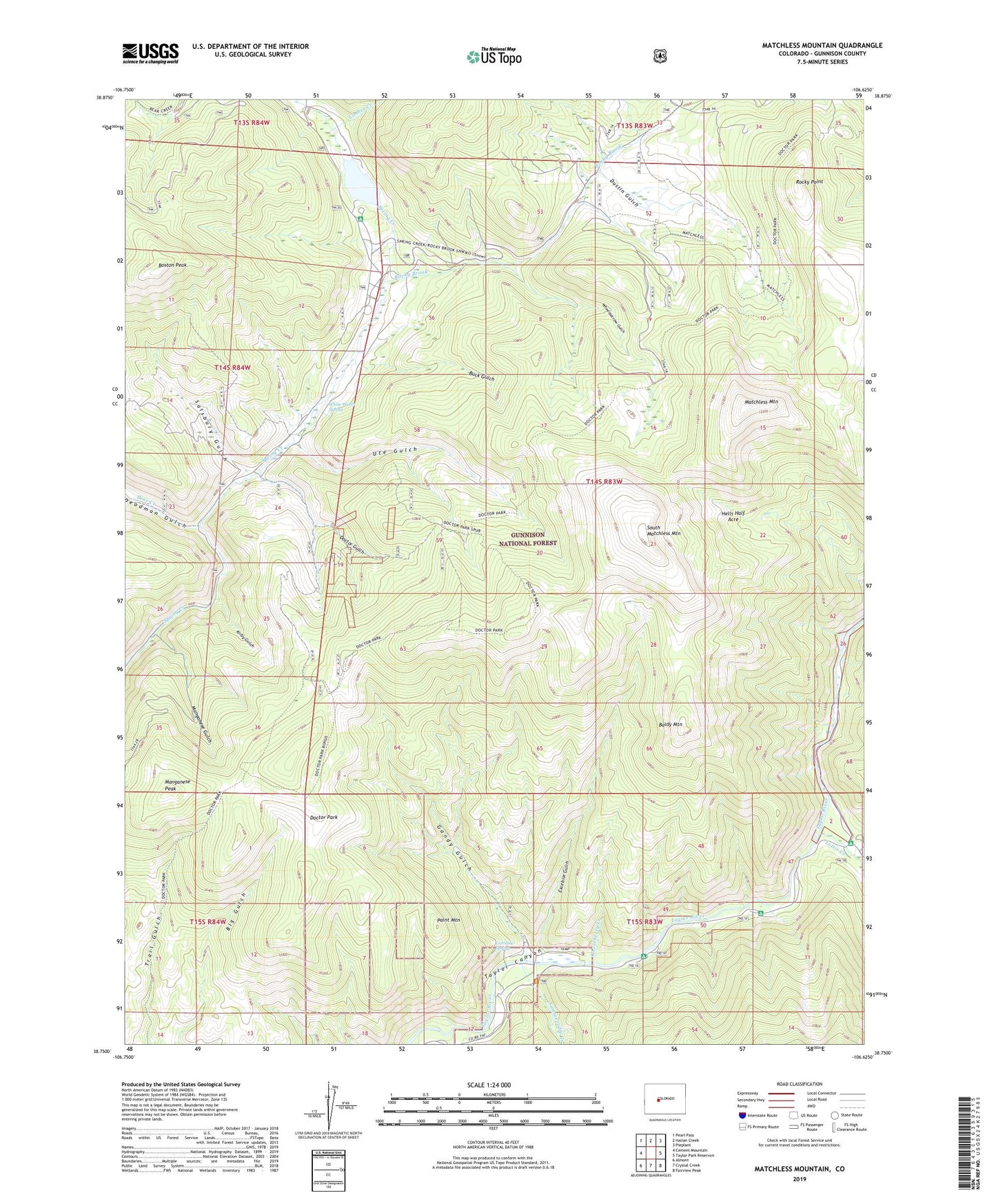
2022 topographic map quadrangle Matchless Mountain in the state of Colorado. Scale: 1:24000. Based on the newly updated USGS 7.5' US Topo map series, this map is in the following counties: Gunnison. The map contains contour data, water features, and other items you are used to seeing on USGS maps, but also has updated roads and other features. This is the next generation of topographic maps. Printed on high-quality waterproof paper with UV fade-resistant inks.
Quads adjacent to this one:
West: Cement Mountain
Northwest: Pearl Pass
North: Italian Creek
Northeast: Pieplant
East: Taylor Park Reservoir
Southeast: Fairview Peak
South: Crystal Creek
Southwest: Almont
This map covers the same area as the classic USGS quad with code o38106g6.
Contains the following named places: Baldy Mountain, Barium-Maggie Manganese Prospect, Bear Creek, Boiler Shaft Mine, Boston Peak, Buck Gulch, Caroline Spring, Cold Spring Campground, Crystal Creek, Deadman Gulch, Doctor Gulch, Doctor Mine, Doctor Park, Dustin Gulch, Excelsior Gulch, Gandy Gulch, Gooseberry Creek, Hells Half Acre, Jack Shaft Mine, Kirby Gulch, Limber Creek, Lodgepole Campground, Lottis Creek, Lottis Creek Campground, Manganese Gulch, Manganese Peak, Matchless Mountain, Matchless Trail, Mosca Campground, Nash Shaft Mine, Nash Tunnel Mine, Old Shaft Mine, Paint Mountain, Rocky Brook, Rocky Point, Salsbury Gulch, South Matchless Mountain, Spring Creek Dam, Spring Creek Reservoir, Summerville Creek, Summerville Trailhead, Ute Gulch, Wheelbarrow Gulch, Whip Shaft Mine, White Water Spring, ZIP Code: 81210