MyTopo
Trail Ridge Colorado US Topo Map
Couldn't load pickup availability
Also explore the Trail Ridge Forest Service Topo of this same quad for updated USFS data
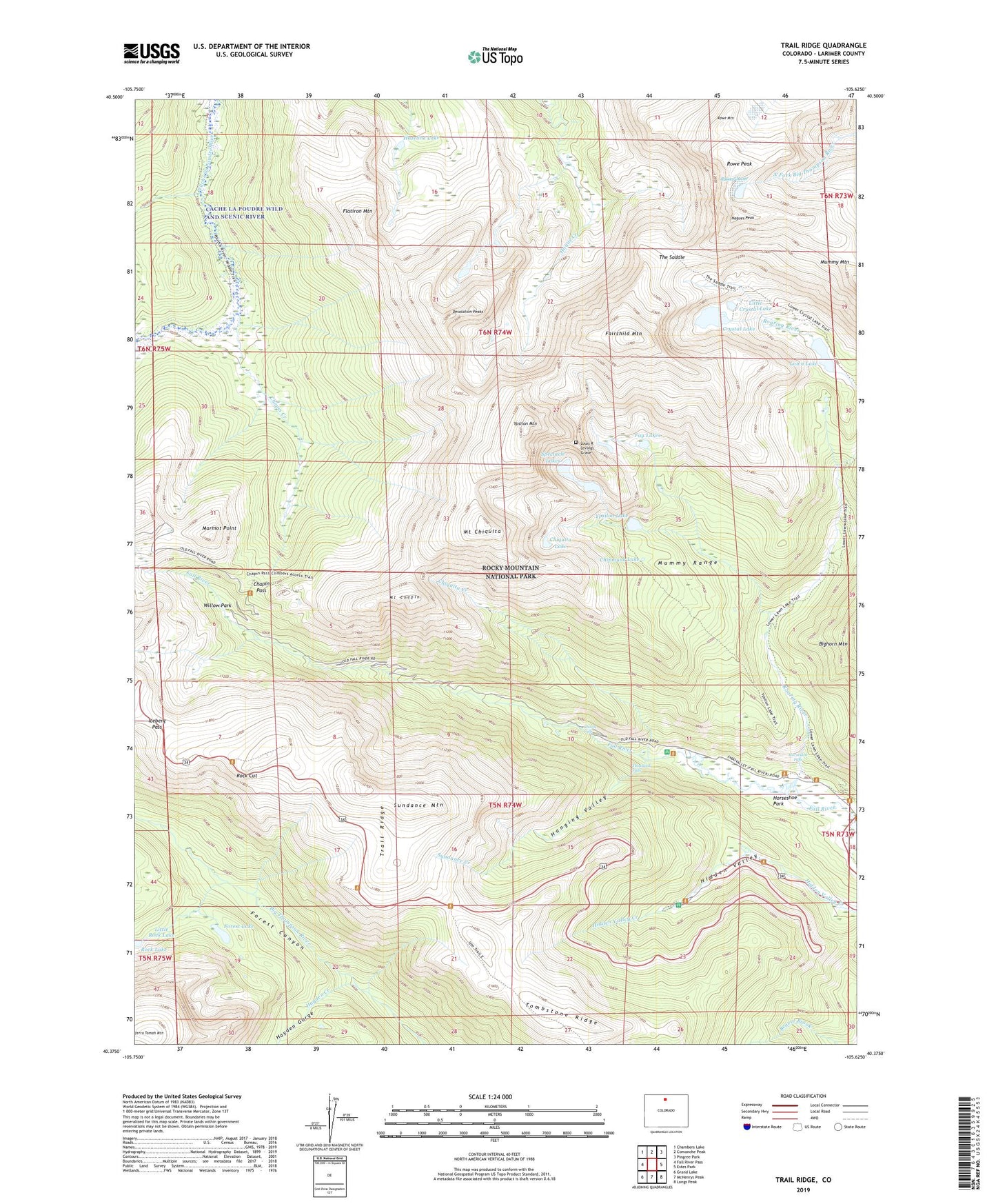
2022 topographic map quadrangle Trail Ridge in the state of Colorado. Scale: 1:24000. Based on the newly updated USGS 7.5' US Topo map series, this map is in the following counties: Larimer. The map contains contour data, water features, and other items you are used to seeing on USGS maps, but also has updated roads and other features. This is the next generation of topographic maps. Printed on high-quality waterproof paper with UV fade-resistant inks.
Quads adjacent to this one:
West: Fall River Pass
Northwest: Chambers Lake
North: Comanche Peak
Northeast: Pingree Park
East: Estes Park
Southeast: Longs Peak
South: McHenrys Peak
Southwest: Grand Lake
This map covers the same area as the classic USGS quad with code o40105d6.
Contains the following named places: Beaver Ponds Picnic Area, Black Canyon Trail, Chapin Creek, Chapin Creek Trail, Chapin Pass, Chasm Falls, Chipmunk Lake, Chiquita Creek, Chiquita Lake, Crystal Lake, Desolation Peaks, Endovalley Campground, Fairchild Mountain, Fay Lakes, Flatiron Mountain, Forest Canyon Overlook, Forest Lake, Hagues Peak, Hanging Valley, Hayden Creek, Hayden Gorge, Hazeline Lake, Hidden Valley Trail, Horseshoe Falls, Iceberg Pass, Lawn Dam, Lawn Lake, Lawn Lake Trail, Little Crystal Lake, Little Rock Lake, Louis R Levings Grave, Many Parks Curve, Marmot Point, Mount Chapin, Mount Chiquita, Poudre River Trail, Rainbow Curve, Roaring River, Rock Cut, Rock Lake, Rowe Glacier, Rowe Mountain, Rowe Peak, Spectacle Lakes, Sundance Creek, Sundance Mountain, Terra Tomah Mountain, The Saddle, Thousand Falls, Timberline Pass, Tombstone Ridge, Trail Ridge, Tundra Curves, Willow Park, Ypsilon Lake, Ypsilon Lake Trail, Ypsilon Mountain