
MyTopo
Fawn Creek Colorado US Topo Map
Couldn't load pickup availability
Also explore the Fawn Creek Forest Service Topo of this same quad for updated USFS data
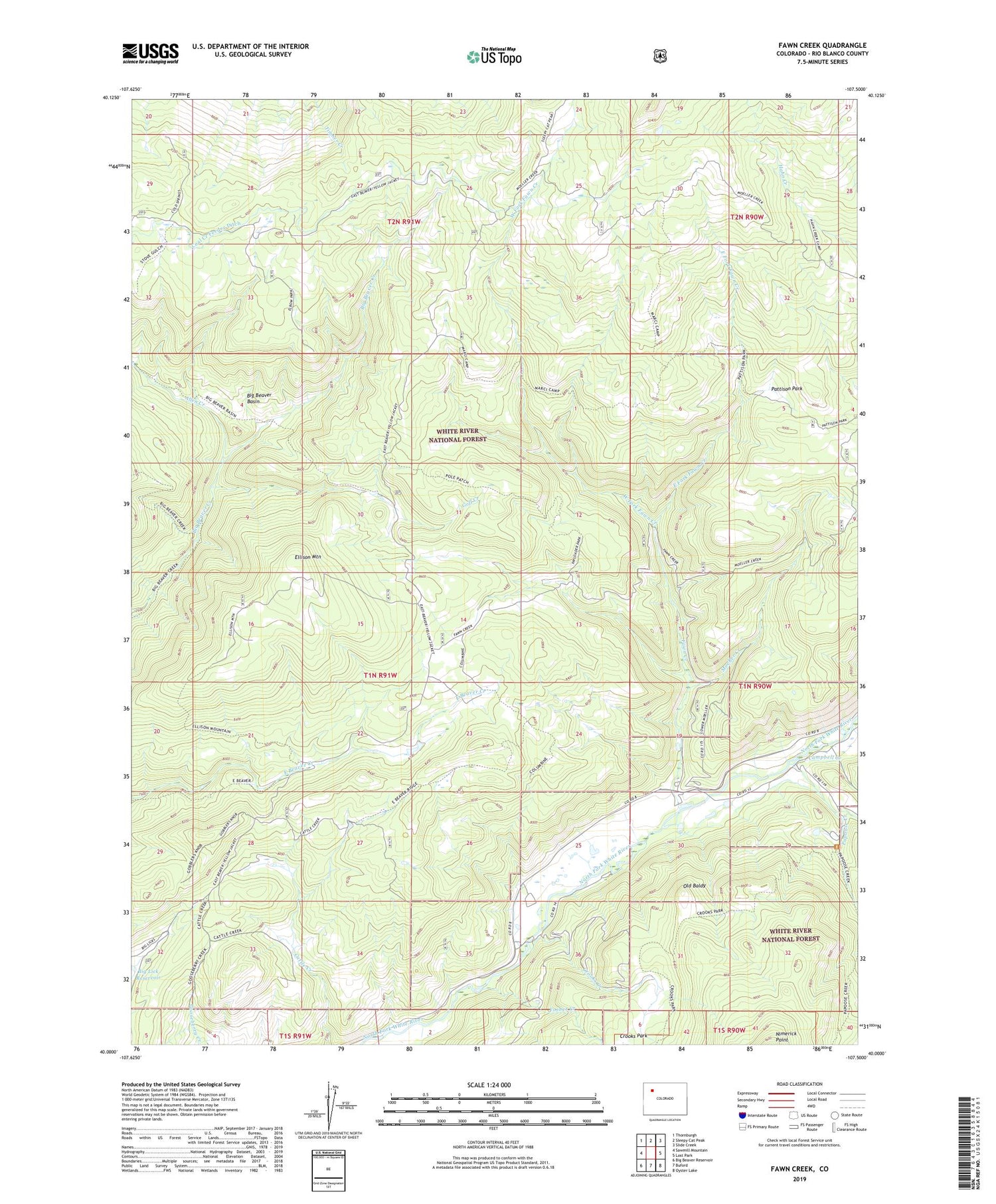
2022 topographic map quadrangle Fawn Creek in the state of Colorado. Scale: 1:24000. Based on the newly updated USGS 7.5' US Topo map series, this map is in the following counties: Rio Blanco. The map contains contour data, water features, and other items you are used to seeing on USGS maps, but also has updated roads and other features. This is the next generation of topographic maps. Printed on high-quality waterproof paper with UV fade-resistant inks.
Quads adjacent to this one:
West: Sawmill Mountain
Northwest: Thornburgh
North: Sleepy Cat Peak
Northeast: Slide Creek
East: Lost Park
Southeast: Oyster Lake
South: Buford
Southwest: Big Beaver Reservoir
This map covers the same area as the classic USGS quad with code o40107a5.
Contains the following named places: Allen Creek, Big Beaver Basin, Campbell Creek, Coal Creek Feeder Ditch, Crooks Creek, East Fork Fawn Creek, Ellison Mountain, Fawn Creek, Forbes Creek, Goff Creek, Moeller Creek, Old Baldy, Papoose Creek, Pattison Park, Schneider Creek, Sleepy Cat Trail, Stove Gulch, Ute Creek, West Fork Fawn Creek, Windy Bill Cow Camp


