MyTopo
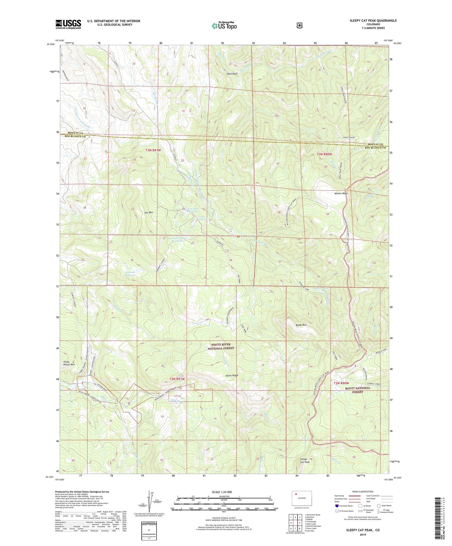
Sleepy Cat Peak Colorado US Topo Map
Couldn't load pickup availability
Also explore the Sleepy Cat Peak Forest Service Topo of this same quad for updated USFS data
2022 topographic map quadrangle Sleepy Cat Peak in the state of Colorado. Scale: 1:24000. Based on the newly updated USGS 7.5' US Topo map series, this map is in the following counties: Rio Blanco, Moffat. The map contains contour data, water features, and other items you are used to seeing on USGS maps, but also has updated roads and other features. This is the next generation of topographic maps. Printed on high-quality waterproof paper with UV fade-resistant inks.
Quads adjacent to this one:
West: Thornburgh
Northwest: Monument Butte
North: Hamilton
Northeast: Pagoda
East: Slide Creek
Southeast: Lost Park
South: Fawn Creek
Southwest: Sawmill Mountain
This map covers the same area as the classic USGS quad with code o40107b5.
Contains the following named places: Baldy Mountain, Carrigan Averil Ditch, Cove Dam, Cove Lake Dam, Cove Lake Reservoir, Cove Reservoir, Horse Ridge, Iles Mountain, Konopik Reservoir, Mooapos Cow Camp, Morapos Cow Camp, Morapos Trailhead, Owen Carrigan Ditch, Owen-Carrigan Reservoir, Sleepy Cat Peak, Snell Rock, Snell Rock Creek, Timber Creek, Wilson Mesa, Wymore Lake