MyTopo
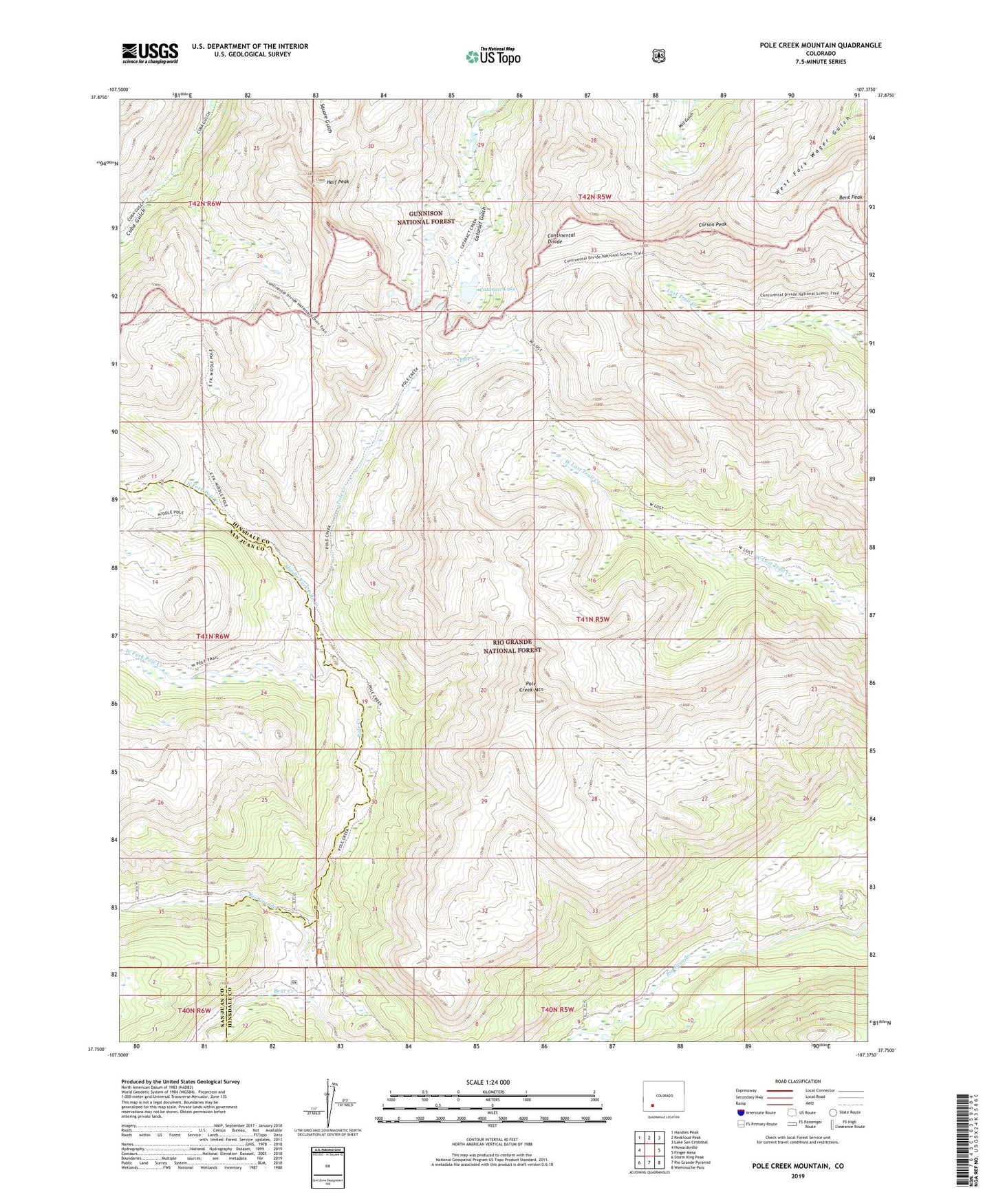
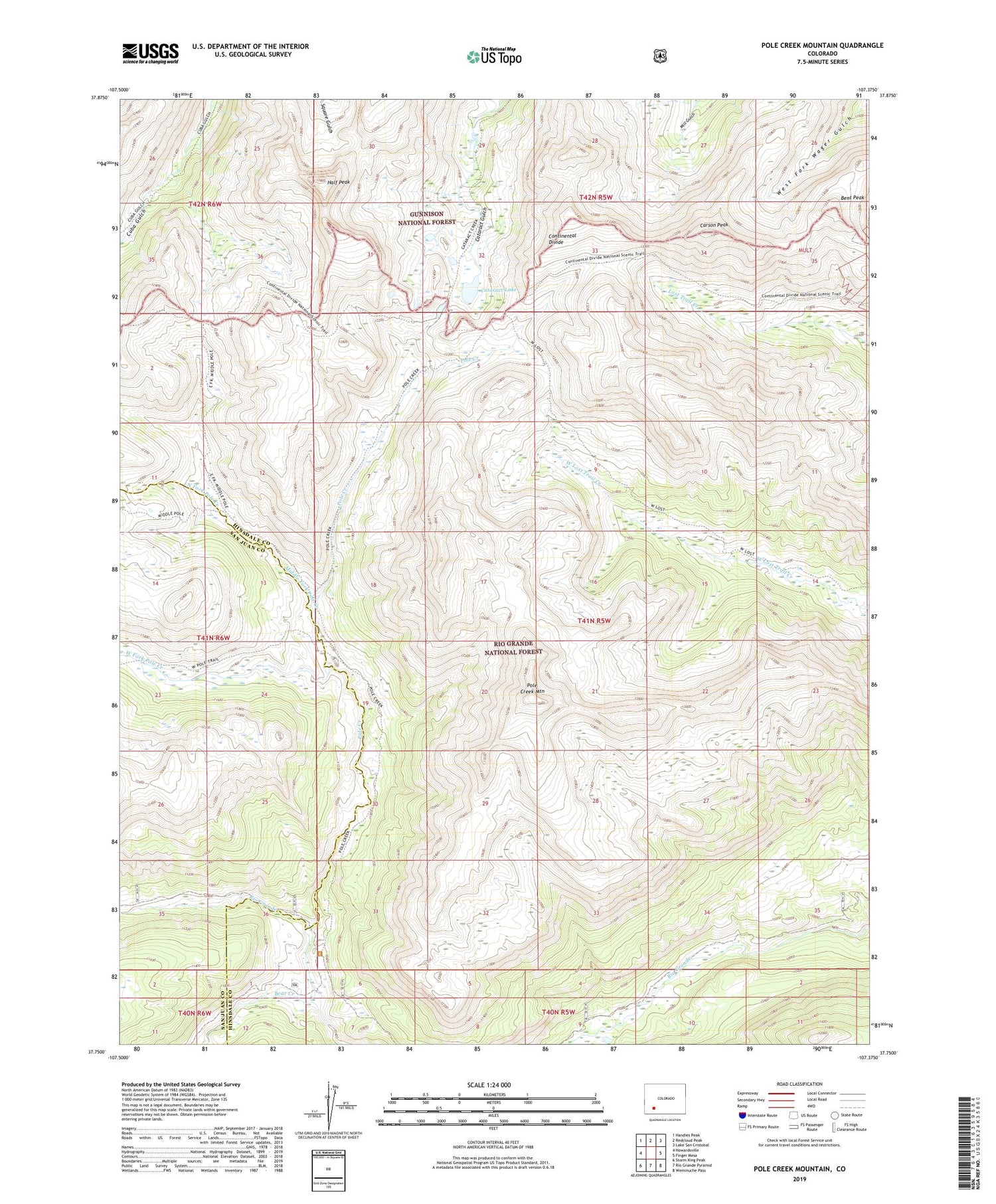
Pole Creek Mountain Colorado US Topo Map
Couldn't load pickup availability
Also explore the Pole Creek Mountain Forest Service Topo of this same quad for updated USFS data
2022 topographic map quadrangle Pole Creek Mountain in the state of Colorado. Scale: 1:24000. Based on the newly updated USGS 7.5' US Topo map series, this map is in the following counties: Hinsdale, San Juan. The map contains contour data, water features, and other items you are used to seeing on USGS maps, but also has updated roads and other features. This is the next generation of topographic maps. Printed on high-quality waterproof paper with UV fade-resistant inks.
Quads adjacent to this one:
West: Howardsville
Northwest: Handies Peak
North: Redcloud Peak
Northeast: Lake San Cristobal
East: Finger Mesa
Southeast: Weminuche Pass
South: Rio Grande Pyramid
Southwest: Storm King Peak
This map covers the same area as the classic USGS quad with code o37107g4.
Contains the following named places: Bear Creek, Bent Peak, Bristol Head Number 1 Dam, Bristol Head Reservoir Number 1, Carson Peak, Cataract Lake, Half Peak, Middle Fork Pole Creek, Napoleon Mine, North Fork Pole Creek, Pole Creek, Pole Creek Mountain, West Fork Pole Creek