MyTopo
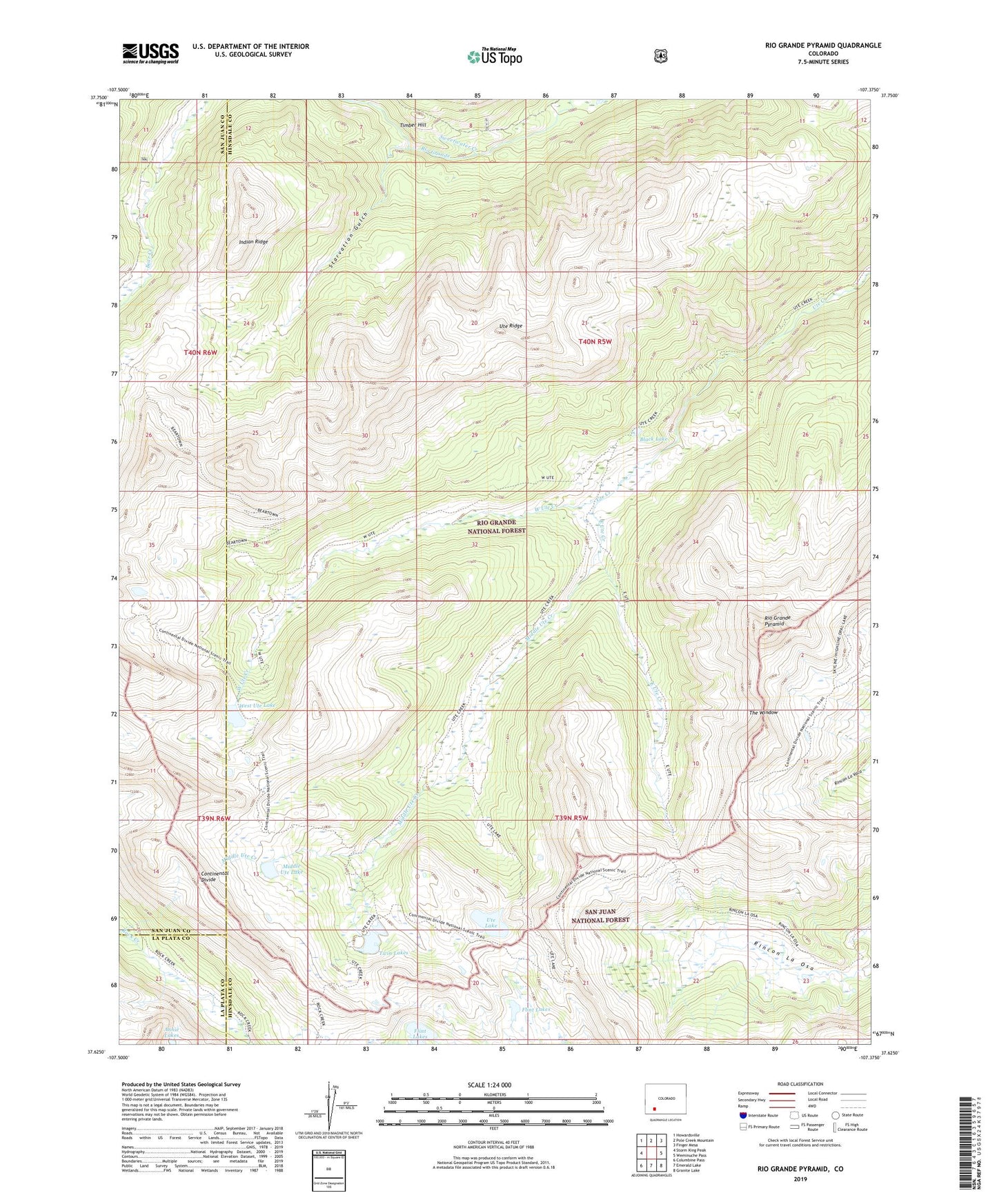
Rio Grande Pyramid Colorado US Topo Map
Couldn't load pickup availability
Also explore the Rio Grande Pyramid Forest Service Topo of this same quad for updated USFS data
2022 topographic map quadrangle Rio Grande Pyramid in the state of Colorado. Scale: 1:24000. Based on the newly updated USGS 7.5' US Topo map series, this map is in the following counties: Hinsdale, San Juan, La Plata. The map contains contour data, water features, and other items you are used to seeing on USGS maps, but also has updated roads and other features. This is the next generation of topographic maps. Printed on high-quality waterproof paper with UV fade-resistant inks.
Quads adjacent to this one:
West: Storm King Peak
Northwest: Howardsville
North: Pole Creek Mountain
Northeast: Finger Mesa
East: Weminuche Pass
Southeast: Granite Lake
South: Emerald Lake
Southwest: Columbine Pass
This map covers the same area as the classic USGS quad with code o37107f4.
Contains the following named places: Annie Lakes, Black Lake, East Ute Creek, Flint Lakes, Indian Ridge, Middle Ute Creek, Middle Ute Lake, Rio Grande Pyramid, Starvation Gulch, Sweetwater Creek, The Window, Timber Hill, Twin Lakes, Ute Lake, Ute Ridge, West Ute Creek, West Ute Lake