
MyTopo
Gould Colorado US Topo Map
Couldn't load pickup availability
Also explore the Gould Forest Service Topo of this same quad for updated USFS data
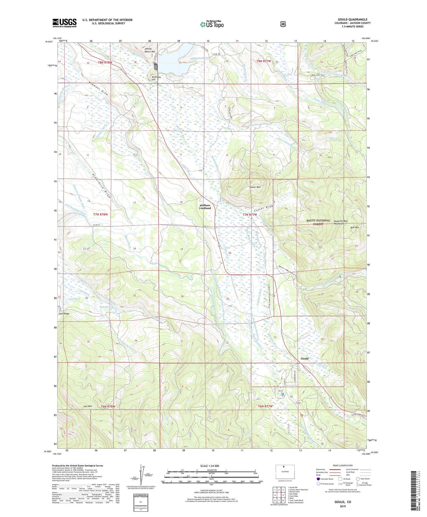
2022 topographic map quadrangle Gould in the state of Colorado. Scale: 1:24000. Based on the newly updated USGS 7.5' US Topo map series, this map is in the following counties: Jackson. The map contains contour data, water features, and other items you are used to seeing on USGS maps, but also has updated roads and other features. This is the next generation of topographic maps. Printed on high-quality waterproof paper with UV fade-resistant inks.
Quads adjacent to this one:
West: Owl Ridge
Northwest: Gould NW
North: Johnny Moore Mountain
Northeast: Rawah Lakes
East: Clark Peak
Southeast: Mount Richthofen
South: Jack Creek Ranch
Southwest: Rand
This map covers the same area as the classic USGS quad with code o40106e1.
Contains the following named places: Aspen Campground, Bradfield Ditch, Bull Mountain, Cameron Pass 4-H Club Camp, Custer Draw, Custer Mountain, Domestic Supply Ditch, Dry Fork Owl Creek, Endomile Ditch, Fox Ditch, Georgia Ditch, Gibbs Ditch, Gould, Gould Ditch, Gould Ranch, Haworth School, Hoover Roundup, Johnson Ranch, Kermode Ditch, Last Treasure and Georgia Ditch, Lobau Ranch, Longhorn Ditch, Lost Treasure Ditch, Lynch Ditch, Mason Ditch, Meadow Creek Reservoir, Michigan Hill, Michigan River Ranger Station, Mill Creek, No Name Creek, North Fork Canadian River, North Fork Michigan River, North Michigan Creek Dam, Orb Ditch, Overland Ditch, Overton Ranch, Owl Ditch, Owl Mountain and Domestic Supply and Mason Ditch, Peterson Creek, Poverty Flat Ditch Number 1, Poverty Flat Ditch Number 2, Ravine Ditch, Riley Extension Ditch, Riley Ranch, Sales Creek, Sales Ditch Number 2, Smith Ranch, South Fork Canadian River, South Fork Michigan River, Squibob Ditch, Stelbars Connor Ranch, Stelbars Lindland, Stelbars Michigan River Ranch, Stemmer Ditch, Wagon Wheel Ditch


