MyTopo
Johnny Moore Mountain Colorado US Topo Map
Couldn't load pickup availability
Also explore the Johnny Moore Mountain Forest Service Topo of this same quad for updated USFS data
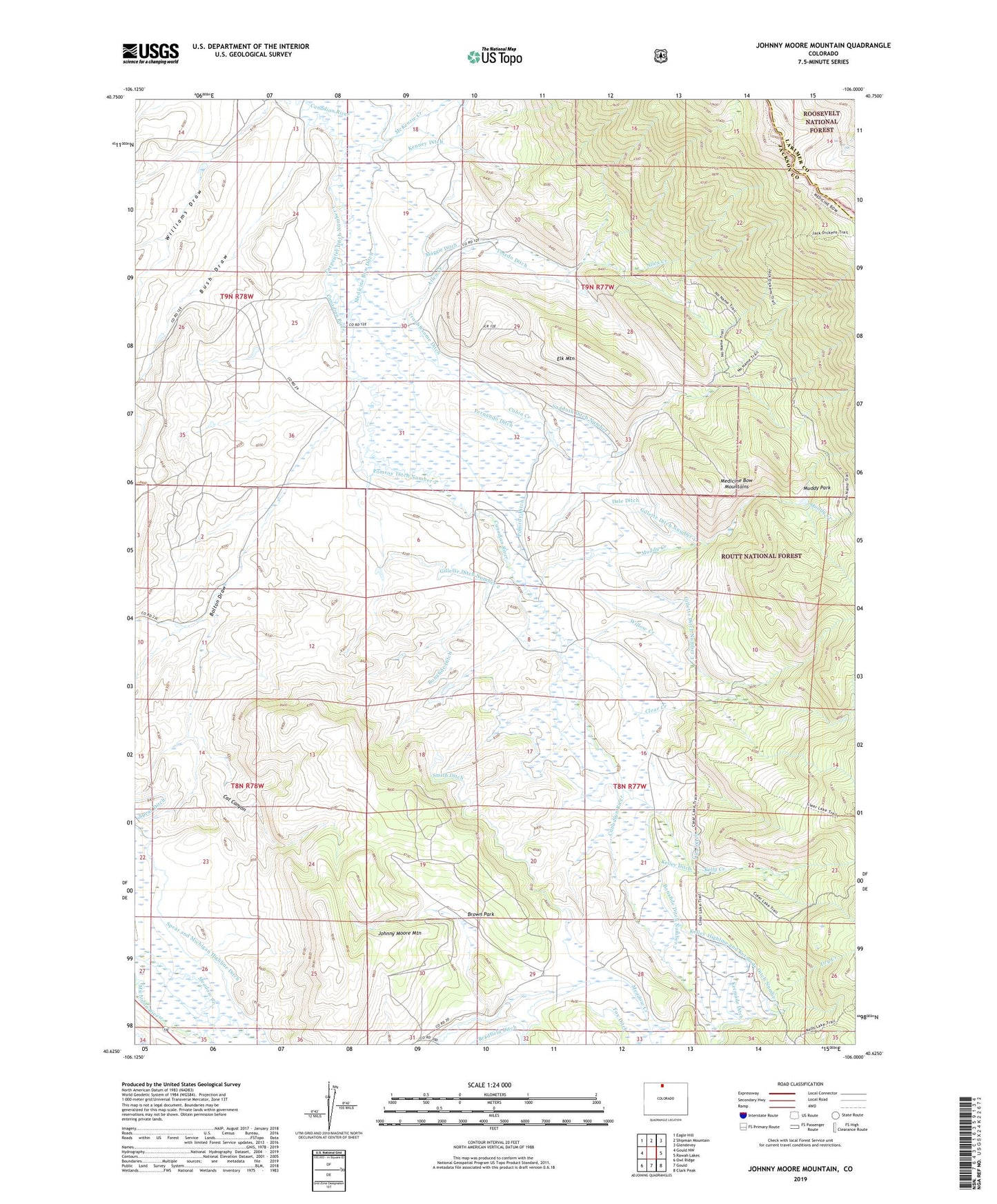
2022 topographic map quadrangle Johnny Moore Mountain in the state of Colorado. Scale: 1:24000. Based on the newly updated USGS 7.5' US Topo map series, this map is in the following counties: Jackson, Larimer. The map contains contour data, water features, and other items you are used to seeing on USGS maps, but also has updated roads and other features. This is the next generation of topographic maps. Printed on high-quality waterproof paper with UV fade-resistant inks.
Quads adjacent to this one:
West: Gould NW
Northwest: Eagle Hill
North: Shipman Mountain
Northeast: Glendevey
East: Rawah Lakes
Southeast: Clark Peak
South: Gould
Southwest: Owl Ridge
This map covers the same area as the classic USGS quad with code o40106f1.
Contains the following named places: Allen Creek, Bolton Draw, Bonafide Ditch, Bonafide Ditch Number 2, Brown Park, Bush Draw, Cabin Creek, Canadian Strip Mine, Carpenter Ditch Number 1, Cat Canyon, Clear Creek, Colter Ranch, Dale Ditch, Dickens Ranch, Dodge Ranch, Dry Creek, Elk Mountain, Fernando Ditch, Freeman Ditch, Gillette Ditch Number 1, Gillette Ditch Number 2, Gillette Ditch Number 3, Jack Dickens Trail, Johnny Moore Mountain, Kelley Ditch, Kelley Highline and Kermode Ditch Number 2, Kelly Creek, Kenney Ditch, Kerr Mine, Lang Prospect, Mace Ranch, Marr Mine, Marr Mines, McKenzie Creek, McNally Creek, Muddy Creek, Muddy Park, Phelan Ditch, Pomroy Ditch, Pomroy Ditch Number 2, Ray Ranch, Rogerson Ranch, Smith Ditch, Spear and Michigan Highline Ditch, Spear Ditch, Sudduth Ditch Number 1, Sudduth Ditch Number 5, Toledo Ditch, Troublesome Ditch, Vita Ditch, Willow Creek, Winscom Mine