
MyTopo
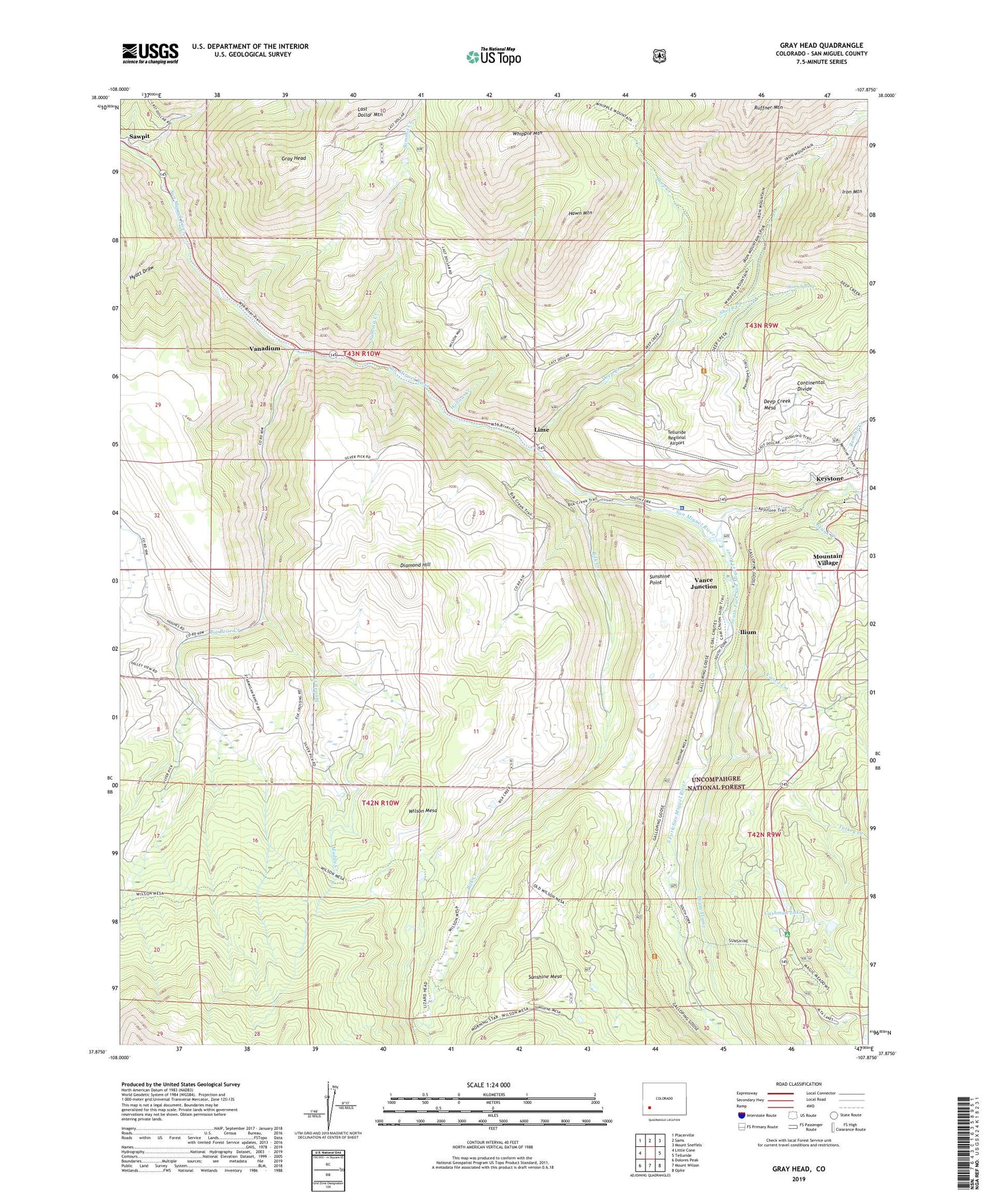
Gray Head Colorado US Topo Map
Couldn't load pickup availability
Also explore the Gray Head Forest Service Topo of this same quad for updated USFS data
2022 topographic map quadrangle Gray Head in the state of Colorado. Scale: 1:24000. Based on the newly updated USGS 7.5' US Topo map series, this map is in the following counties: San Miguel. The map contains contour data, water features, and other items you are used to seeing on USGS maps, but also has updated roads and other features. This is the next generation of topographic maps. Printed on high-quality waterproof paper with UV fade-resistant inks.
Quads adjacent to this one:
West: Little Cone
Northwest: Placerville
North: Sams
Northeast: Mount Sneffels
East: Telluride
Southeast: Ophir
South: Mount Wilson
Southwest: Dolores Peak
This map covers the same area as the classic USGS quad with code o37107h8.
Contains the following named places: Belle Champion Mine, Belvedere Mine, Big Bear Creek, Bilk Creek, Blue Bell Mine, Blue Bird Mine, Carpenter Tunnel Mine, Cushman Dam, Cushman Lake, Deep Creek, Deep Creek Mine, Diamond Creek, Diamond Hill, Fighting Chance Mine, Gray Head, Hawn Mountain, Hyatt Draw, Ilium, Ilium Flume, Iron Crown Mine, Joe Dandy Group Mine, Keystone, Lime, Lone Wolf Mine, Major Mine, Manhattan Mine, Morning Star Mine, Muddy Creek, Northern Ohio Mine, Polaris Mine, Providence Mine, Remine Creek, San Miguel County Sheriff's Office, Sheep Creek, Sheep Spring, Skunk Creek, Skyline Ranch, South Fork San Miguel River, Summit Creek, Sunshine Campground, Sunshine Mesa, Sunshine Point, Telluride Division, Telluride Regional Airport, Turkey Creek, Vanadium, Vance Creek, Vance Junction, Whipple Mountain, Willow Creek, Wilson Mesa


