MyTopo
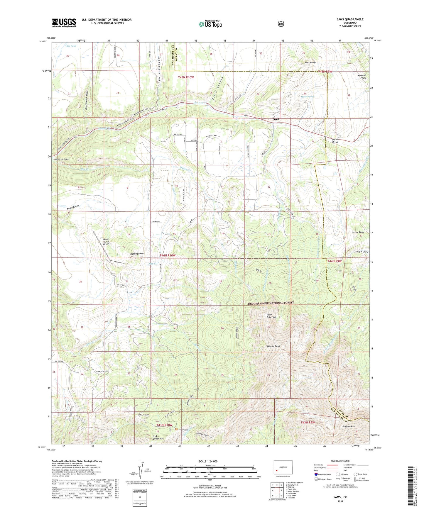
Sams Colorado US Topo Map
Couldn't load pickup availability
Also explore the Sams Forest Service Topo of this same quad for updated USFS data
2022 topographic map quadrangle Sams in the state of Colorado. Scale: 1:24000. Based on the newly updated USGS 7.5' US Topo map series, this map is in the following counties: San Miguel, Ouray. The map contains contour data, water features, and other items you are used to seeing on USGS maps, but also has updated roads and other features. This is the next generation of topographic maps. Printed on high-quality waterproof paper with UV fade-resistant inks.
Quads adjacent to this one:
West: Placerville
Northwest: Hotchkiss Reservoir
North: Horsefly Peak
Northeast: Ridgway
East: Mount Sneffels
Southeast: Telluride
South: Gray Head
Southwest: Little Cone
This map covers the same area as the classic USGS quad with code o38107a8.
Contains the following named places: A1 Mine, Alder Creek Trail, Bear Creek Mine, Big Pond, Buck Canyon, Dallas Divide, Dead Horse Canyon, Dki Dallas, East Fork Leopard Creek, Hastings Mesa, Hastings Ranch, Hay Creek, Hayden Peak, Howard Flats, Last Dollar Mountain, Middle Fork Leopard Creek, Moston Spring, Noel, North Pole Peak, Price Canyon, Ruffner Mountain, Sams, Spruce Ridge, West Baldy, West Fork Leopard Creek, Willow Creek, Wilson Ranch Airport, Yellow Medicine Mine