MyTopo
Gypsum Colorado US Topo Map
Couldn't load pickup availability
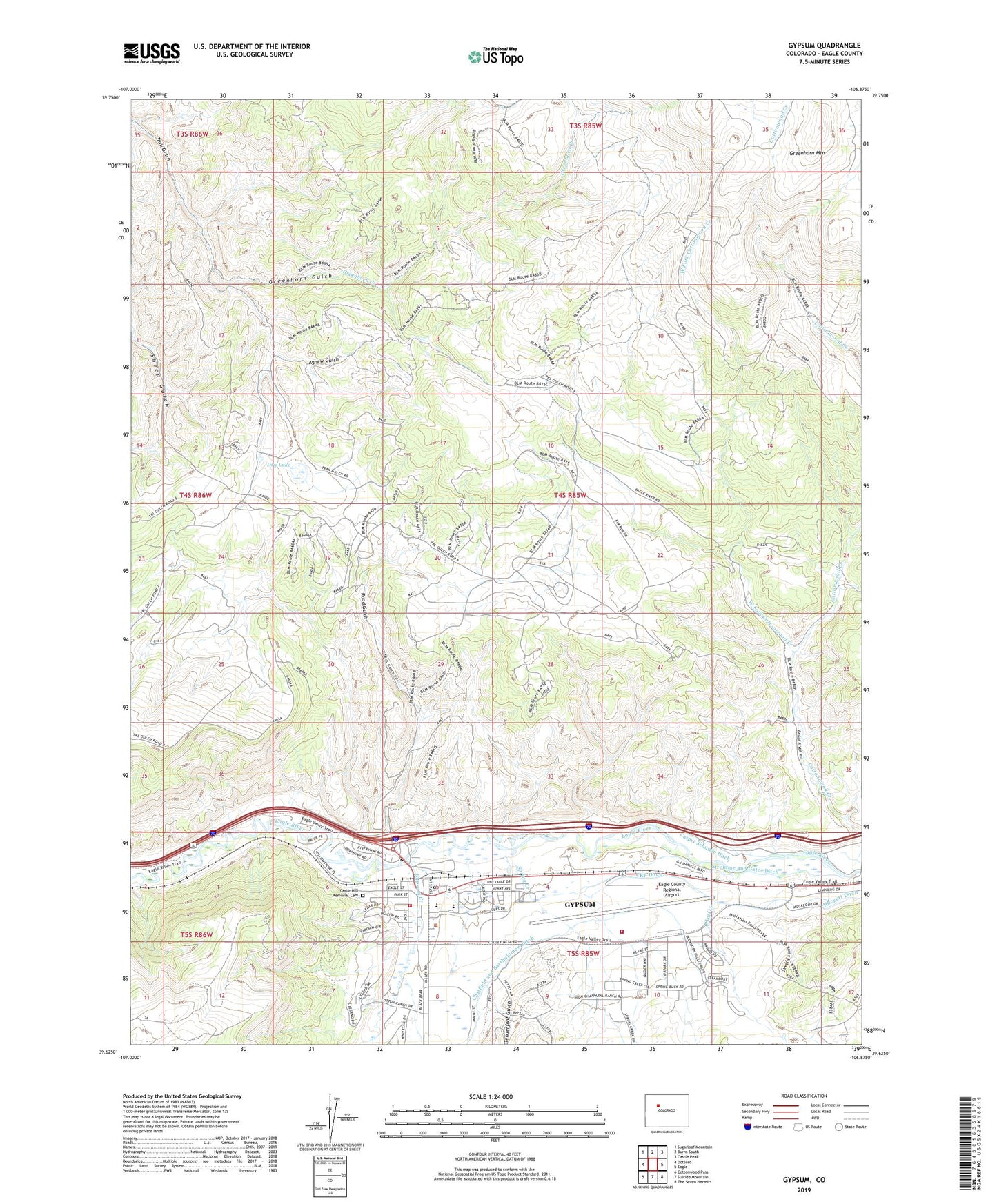
2022 topographic map quadrangle Gypsum in the state of Colorado. Scale: 1:24000. Based on the newly updated USGS 7.5' US Topo map series, this map is in the following counties: Eagle. The map contains contour data, water features, and other items you are used to seeing on USGS maps, but also has updated roads and other features. This is the next generation of topographic maps. Printed on high-quality waterproof paper with UV fade-resistant inks.
Quads adjacent to this one:
West: Dotsero
Northwest: Sugarloaf Mountain
North: Burns South
Northeast: Castle Peak
East: Eagle
Southeast: The Seven Hermits
South: Suicide Mountain
Southwest: Cottonwood Pass
This map covers the same area as the classic USGS quad with code o39106f8.
Contains the following named places: Agnew Gulch, Alkali Creek, Casper Schumm Ditch, Cedar Hill Memorial Cemetery, Chatfield and Bartholomew Ditch, Cottonwood Creek, Dry Lake, Eagle County Airport Fire Department, Eagle County Ambulance District, Eagle County Regional Airport, Greenhorn Creek, Greenhorn Gulch, Gypsum, Gypsum Creek, Gypsum Fire Protection District Station 14, Gypsum Post Office, McHatten Creek, Road Gulch, Spring Creek, Stremme and Gates Ditch, Tenderfoot Gulch, Town of Gypsum, TriState Care Flight, West Fork Cottonwood Creek