MyTopo
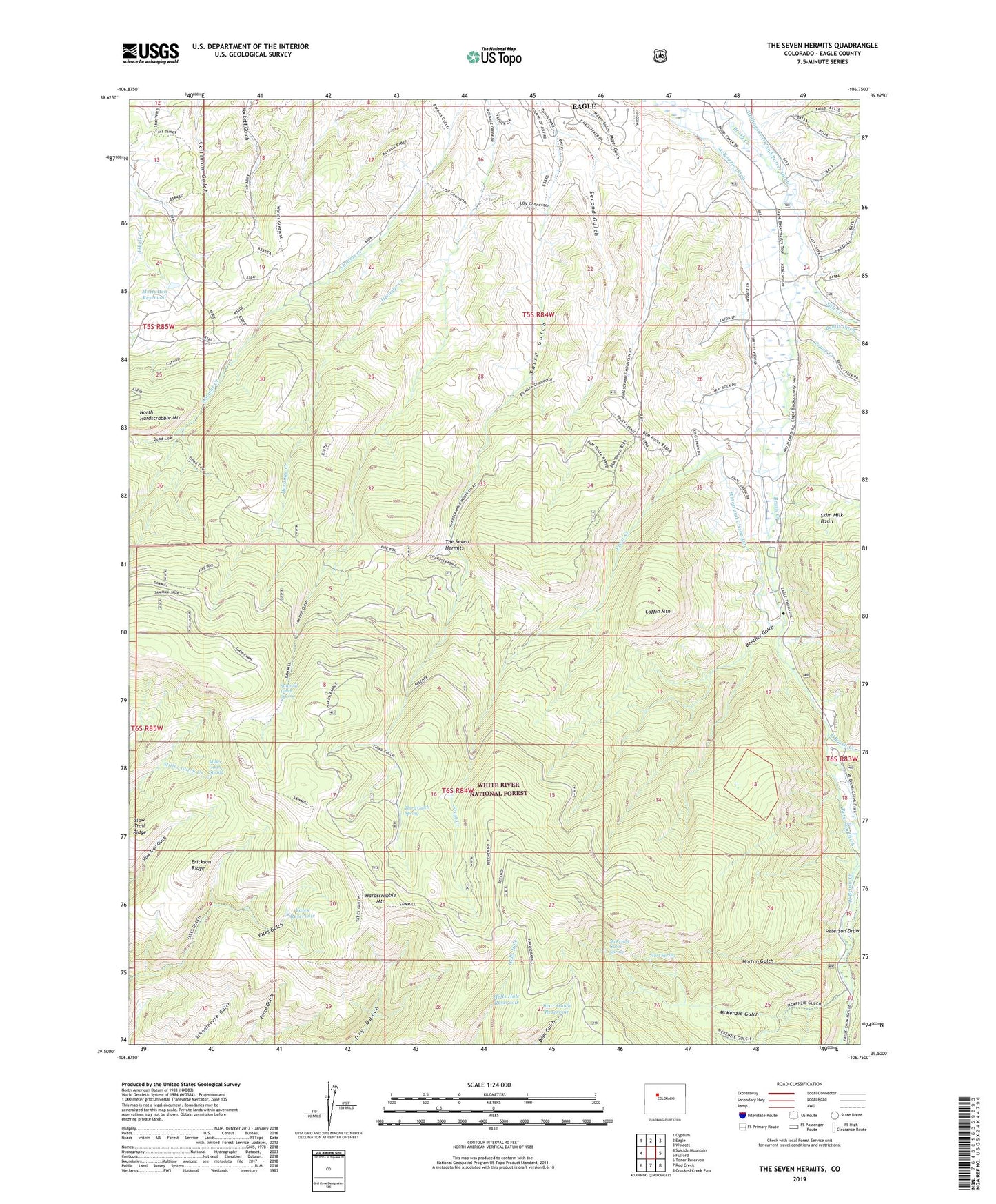
The Seven Hermits Colorado US Topo Map
Couldn't load pickup availability
Also explore the The Seven Hermits Forest Service Topo of this same quad for updated USFS data
2022 topographic map quadrangle The Seven Hermits in the state of Colorado. Scale: 1:24000. Based on the newly updated USGS 7.5' US Topo map series, this map is in the following counties: Eagle. The map contains contour data, water features, and other items you are used to seeing on USGS maps, but also has updated roads and other features. This is the next generation of topographic maps. Printed on high-quality waterproof paper with UV fade-resistant inks.
Quads adjacent to this one:
West: Suicide Mountain
Northwest: Gypsum
North: Eagle
Northeast: Wolcott
East: Fulford
Southeast: Crooked Creek Pass
South: Red Creek
Southwest: Toner Reservoir
This map covers the same area as the classic USGS quad with code o39106e7.
Contains the following named places: Bear Gulch Reservoir, Beecher Gulch, Bruce Creek, Coffin Mountain, East Brush Creek, Erickson Ridge, Frost Creek, Ground Hog Mine, Hardscrabble Mountain, Hart Spring, Hells Hole Reservoir, Hollingsworth and Potter Ditch, Horse Mountain Uranium Mines, Horton Gulch, McHatten Reservoir, McKenzie Ditch, McKenzie Gulch, McKenzie Gulch Spring, Miller Gulch Spring, Peterson Ditch, Peterson Ditch Number 1, Peterson Draw, Sawmill Gulch, Sawmill Gulch Spring, Second Gulch, Skim Milk Basin, Slow Trail Ridge, Staton and Cissna Ditch, The Seven Hermits, Third Gulch Spring, Town of Eagle, Trail Gulch, West Brush Creek, Yates Reservoir