MyTopo
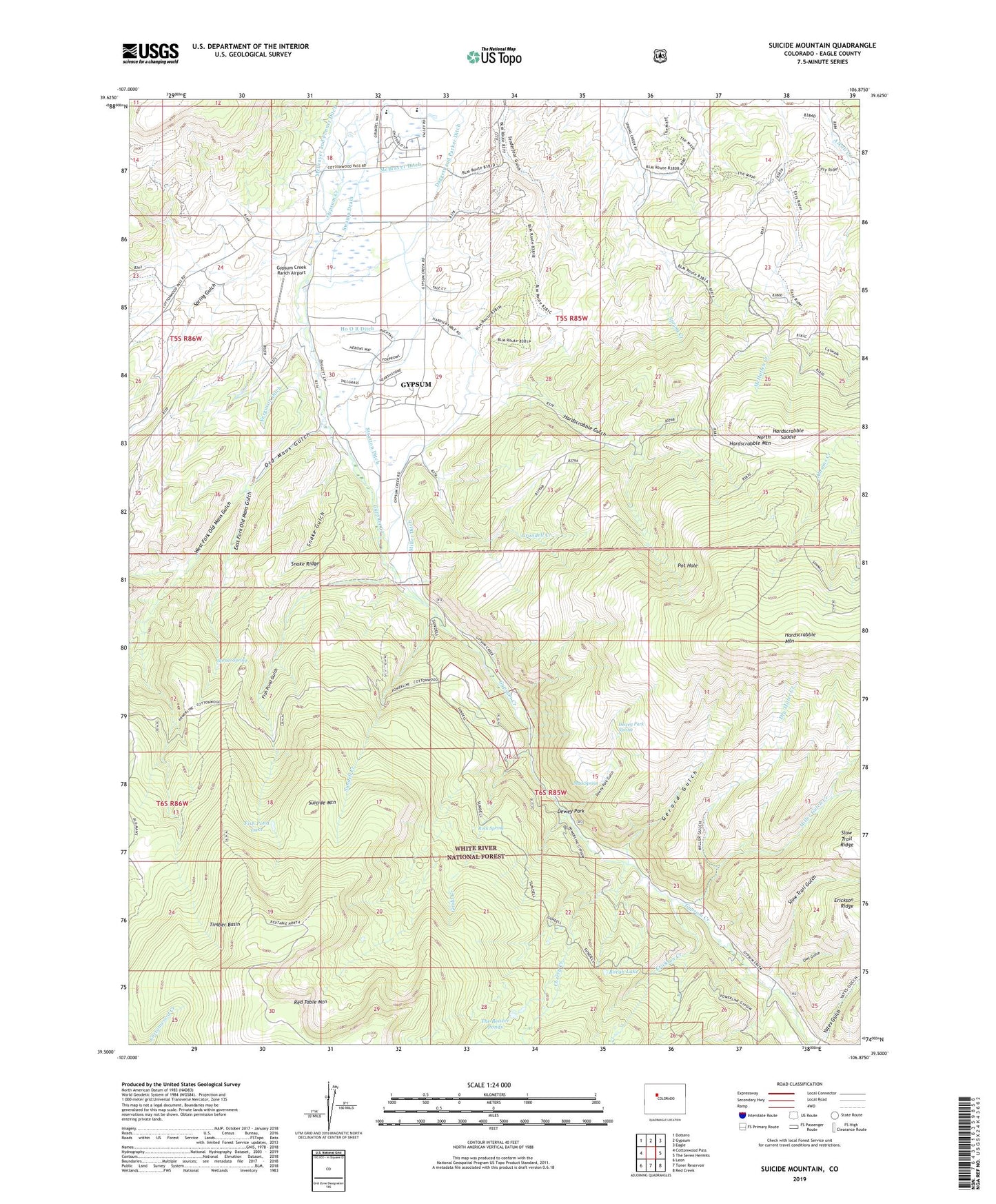
Suicide Mountain Colorado US Topo Map
Couldn't load pickup availability
Also explore the Suicide Mountain Forest Service Topo of this same quad for updated USFS data
2022 topographic map quadrangle Suicide Mountain in the state of Colorado. Scale: 1:24000. Based on the newly updated USGS 7.5' US Topo map series, this map is in the following counties: Eagle. The map contains contour data, water features, and other items you are used to seeing on USGS maps, but also has updated roads and other features. This is the next generation of topographic maps. Printed on high-quality waterproof paper with UV fade-resistant inks.
Quads adjacent to this one:
West: Cottonwood Pass
Northwest: Dotsero
North: Gypsum
Northeast: Eagle
East: The Seven Hermits
Southeast: Red Creek
South: Toner Reservoir
Southwest: Leon
This map covers the same area as the classic USGS quad with code o39106e8.
Contains the following named places: Borah Lake, Cherry Creek, Daggett and Parker Ditch, Dewey Park, Dewey Park Gulch, Dewey Park Spring, Dry Miller Creek, East Fork Old Mans Gulch, Erickson Creek, Ferguson Ditch, Fish Pond Gulch, Fish Pond Lake, Gerard Gulch, Gould Creek, Grundell Creek, Gypsum Creek Campground, Gypsum Creek Ranch Airport, Hardscrabble Gulch, Hardscrabble Saddle, Ho O R Ditch, McBrayer and Fenner Ditch, McBrayer Ditch, Miller Ditch, Miller Gulch Creek, Mud Spring, North Hardscrabble Mountain, Old Mans Gulch, Owl Gulch, Pot Hole, Quaker Corral, Rock Spring, Slow Trail Gulch, Snake Gulch, Snake Ridge, Spring Gulch, Spruce Spring, Stratton Ditch, Suicide Mountain, Sundell Creek, Swamp Drain, The Beaver Ponds, Timber Basin, West Fork Old Mans Gulch, White River National Forest, Yates Gulch