MyTopo
Eagle Colorado US Topo Map
Couldn't load pickup availability
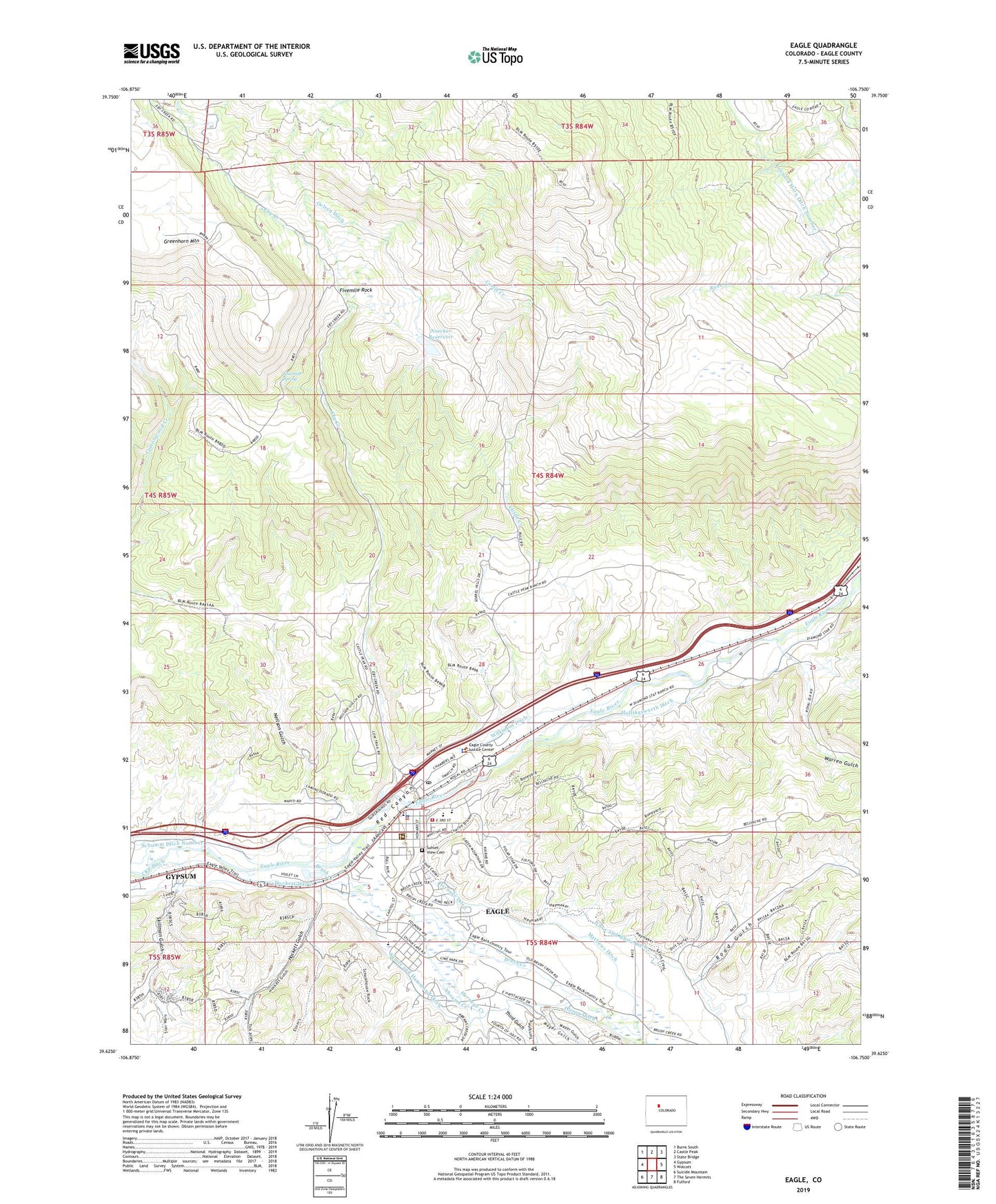
2022 topographic map quadrangle Eagle in the state of Colorado. Scale: 1:24000. Based on the newly updated USGS 7.5' US Topo map series, this map is in the following counties: Eagle. The map contains contour data, water features, and other items you are used to seeing on USGS maps, but also has updated roads and other features. This is the next generation of topographic maps. Printed on high-quality waterproof paper with UV fade-resistant inks.
Quads adjacent to this one:
West: Gypsum
Northwest: Burns South
North: Castle Peak
Northeast: State Bridge
East: Wolcott
Southeast: Fulford
South: The Seven Hermits
Southwest: Suicide Mountain
This map covers the same area as the classic USGS quad with code o39106f7.
Contains the following named places: Abrams Creek, Castle Creek, Castle Peak Heliport, Colorado State Patrol Eagle Post, Eagle, Eagle County Detention Center, Eagle County Historical Museum, Eagle County Sheriff's Office, Eagle Mine, Eagle Police Department, Eagle Post Office, Eagle-Gypsum Division, Eby Creek, Fivemile Rock, Fourmile Spring, Greater Eagle Fire Protection District, Hernage Creek, Hockett Ditch, Hockett Gulch, Hollingsworth Ditch, KWLI-FM (Eagle), Love and White Ditch, Mathews Ditch, Mayer Gulch, Neilson Gucch, Noecker Dam, Noecker Reservoir, Oelsen Ditch, Oleson Ditch, Red Canyon, Road Gulch, Schumm Ditch Number 1, Skillman Gulch, Sunset View Cemetery, Third Gulch, Warren Ditch, Warren Gulch, Western Eagle County Ambulance District Eagle Station, Wilkinson Ditch, ZIP Code: 81631