MyTopo
Hells Kitchen Colorado US Topo Map
Couldn't load pickup availability
Also explore the Hells Kitchen Forest Service Topo of this same quad for updated USFS data
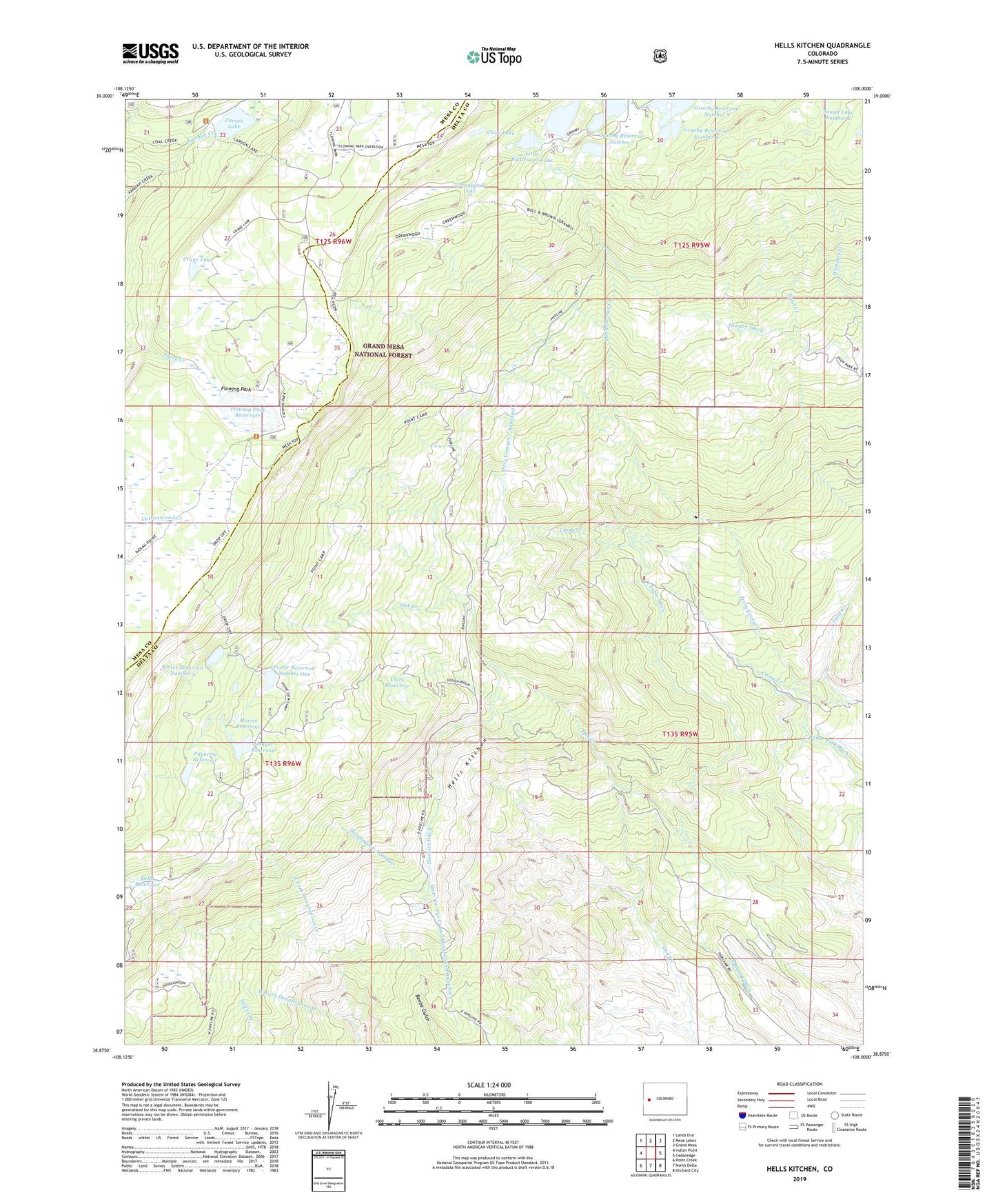
2022 topographic map quadrangle Hells Kitchen in the state of Colorado. Scale: 1:24000. Based on the newly updated USGS 7.5' US Topo map series, this map is in the following counties: Delta, Mesa. The map contains contour data, water features, and other items you are used to seeing on USGS maps, but also has updated roads and other features. This is the next generation of topographic maps. Printed on high-quality waterproof paper with UV fade-resistant inks.
Quads adjacent to this one:
West: Indian Point
Northwest: Lands End
North: Mesa Lakes
Northeast: Grand Mesa
East: Cedaredge
Southeast: Orchard City
South: North Delta
Southwest: Point Creek
This map covers the same area as the classic USGS quad with code o38108h1.
Contains the following named places: Big Battlement Dam, Big Battlement Lake, Blue Grouse Trail, Bull and Brown Trail, Camp Creek, Carson Lake, Carson Lake Trail, Cedar Park Ditch, Clark Dam, Clark Reservoir, Clear Lake, Crane Lake, Delta Number 3 Dam, Delta Reservoir, Dirty George Creek and Doughspoon Aqueduct, Dirty George Creek Aqueduct, Doughspoon Aqueduct, Dugger Dam, Dugger Reservoir, Eagle Ditch, East Fork Doughspoon Creek, Fairview Mine, Flowing Park, Flowing Park Dam, Flowing Park Reservoir, Granby Ditch, Granby Number 11 Dam, Granby Number 12 Dam, Granby Number 6 Dam, Granby Number 7 Dam, Granby Number 9 Dam, Granby Reservoir Number 11, Granby Reservoir Number 12, Granby Reservoir Number 6, Granby Reservoir Number 7, Granby Reservoir Number 9, Greenwood Lake, Hells Kitchen, Hogchute Dam, Hoosier Ditch, Little Battlement Dam, Little Battlement Lake, Morris Reservoir, Pitcairne Number 1 Dam, Pitcairne Reservoir, Point Camp Trail, Point Trail, Porter Number 1 Dam, Porter Number 4 Dam, Porter Reservoir Number 4, Porter Reservoir Number One, Rollins Mine, Sanburg Ditch, Sand Creek, Tomahawk Mine, West Fork Doughspoon Creek