MyTopo
Hightower Mountain Colorado US Topo Map
Couldn't load pickup availability
Also explore the Hightower Mountain Forest Service Topo of this same quad for updated USFS data
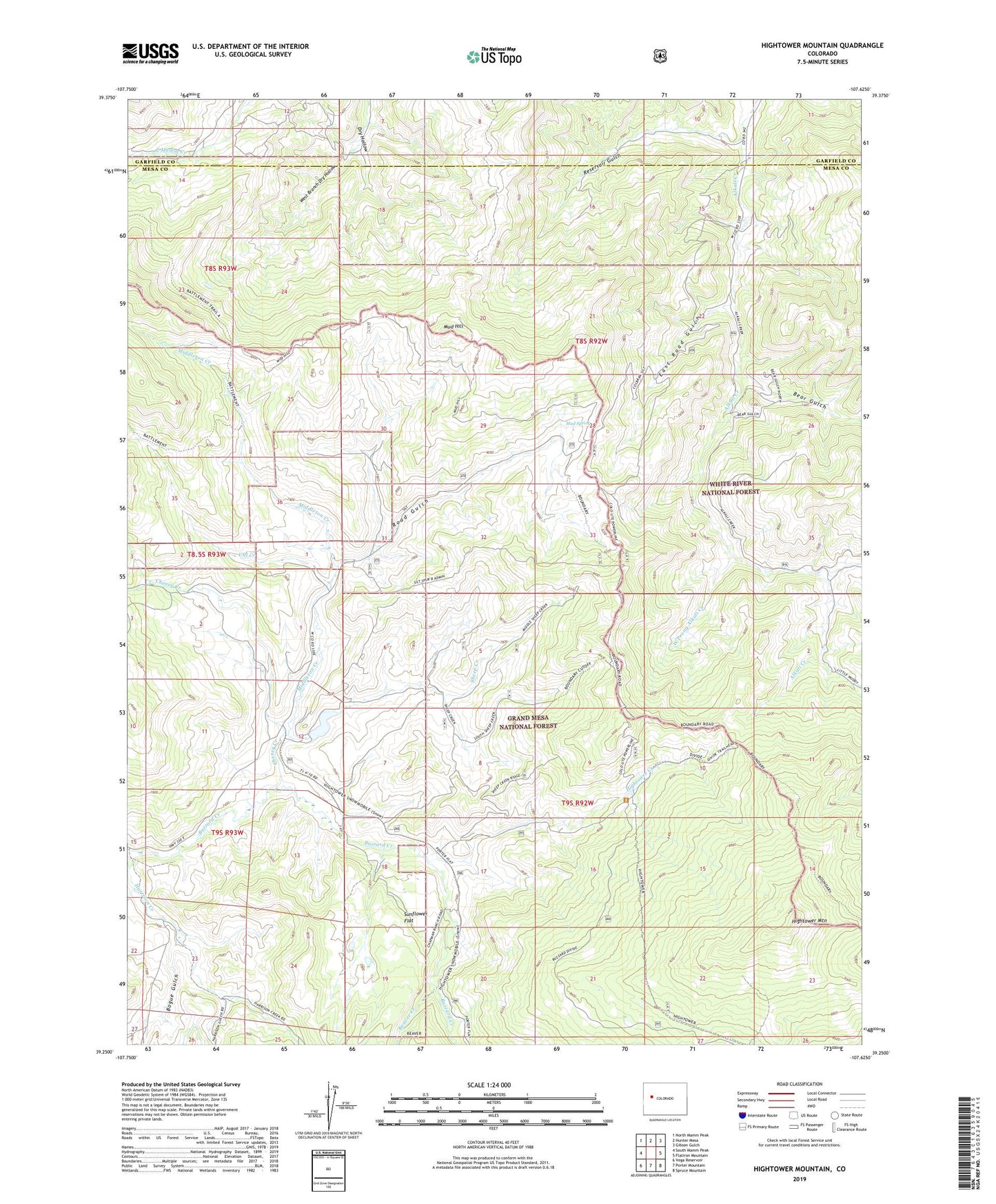
2022 topographic map quadrangle Hightower Mountain in the state of Colorado. Scale: 1:24000. Based on the newly updated USGS 7.5' US Topo map series, this map is in the following counties: Mesa, Garfield. The map contains contour data, water features, and other items you are used to seeing on USGS maps, but also has updated roads and other features. This is the next generation of topographic maps. Printed on high-quality waterproof paper with UV fade-resistant inks.
Quads adjacent to this one:
West: South Mamm Peak
Northwest: North Mamm Peak
North: Hunter Mesa
Northeast: Gibson Gulch
East: Flatiron Mountain
Southeast: Spruce Mountain
South: Porter Mountain
Southwest: Vega Reservoir
This map covers the same area as the classic USGS quad with code o39107c6.
Contains the following named places: Bear Gulch, Beaver Creek, Bogue Gulch, Buzzard Campground, Cheney Creek, Currier Number 2 Dam, Currier Number 2 Reservoir, East Road Gulch, Hightower Creek, Hightower Guard Station, Hightower Mountain, Middleton Creek, Mud Hill, Mud Spring, North Fork Cheney Creek, Reservoir Gulch, Road Gulch, Sheep Creek, Sunflower Flat, Uhl Creek, West Branch Dry Hollow, West Prong Alkali Creek