MyTopo
Spruce Mountain Colorado US Topo Map
Couldn't load pickup availability
Also explore the Spruce Mountain Forest Service Topo of this same quad for updated USFS data
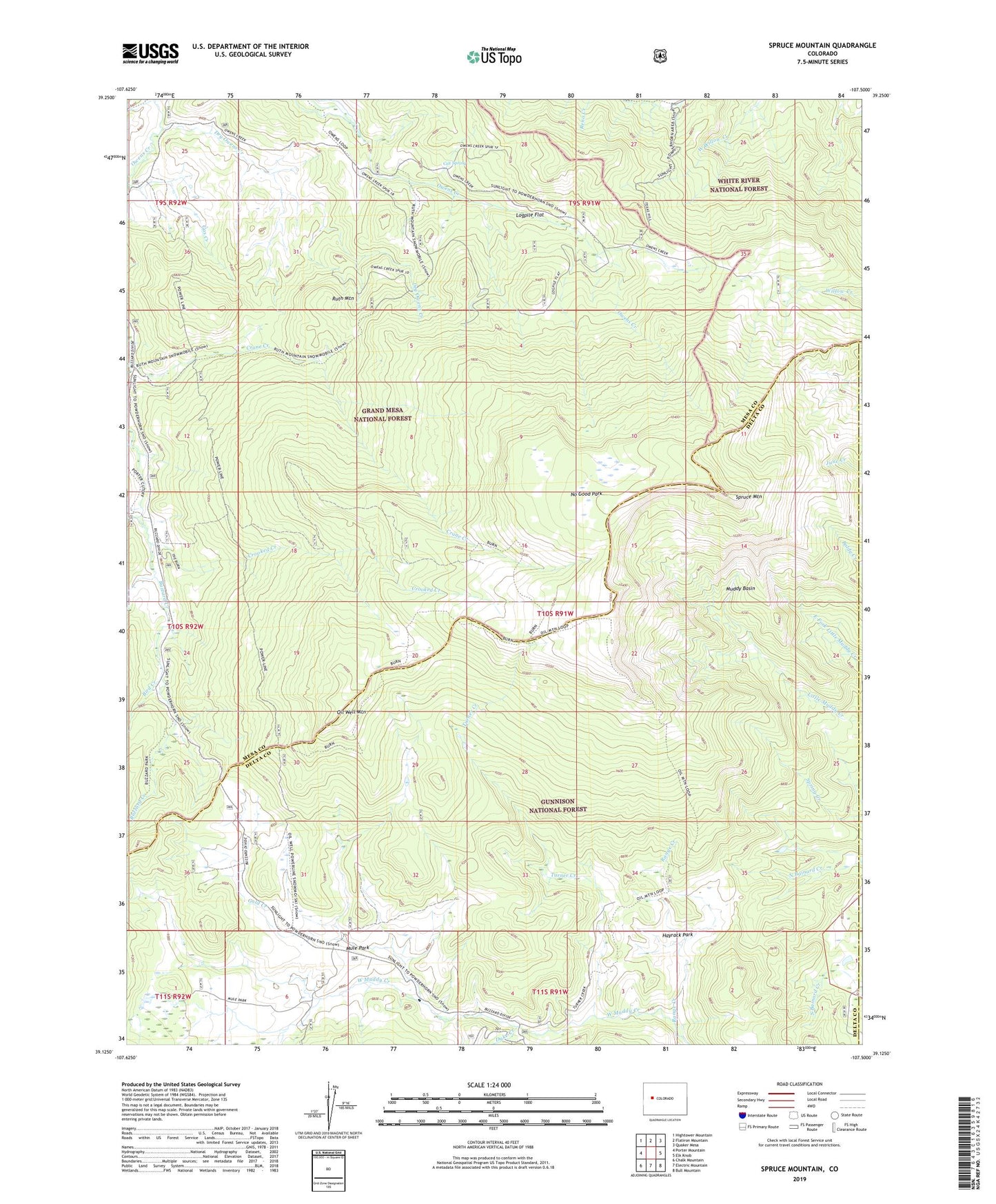
2022 topographic map quadrangle Spruce Mountain in the state of Colorado. Scale: 1:24000. Based on the newly updated USGS 7.5' US Topo map series, this map is in the following counties: Mesa, Delta, Gunnison. The map contains contour data, water features, and other items you are used to seeing on USGS maps, but also has updated roads and other features. This is the next generation of topographic maps. Printed on high-quality waterproof paper with UV fade-resistant inks.
Quads adjacent to this one:
West: Porter Mountain
Northwest: Hightower Mountain
North: Flatiron Mountain
Northeast: Quaker Mesa
East: Elk Knob
Southeast: Bull Mountain
South: Electric Mountain
Southwest: Chalk Mountain
This map covers the same area as the classic USGS quad with code o39107b5.
Contains the following named places: Bird Creek, Buzzard Cow Camp, Cox Spring, Crane Creek, Crooked Creek, Dry Owens Creek, Dyke Creek, Dyke Creek Campground, Gas Creek, Gold Creek, Hayrack Park, Logpile Flat, Muddy Basin, Mule Park, No Good Park, Oil Well Camp, Oil Well Mountain, Range Creek, Ruth Mountain, Spruce Mountain, The Burn, Turner Creek, Willow Creek