MyTopo
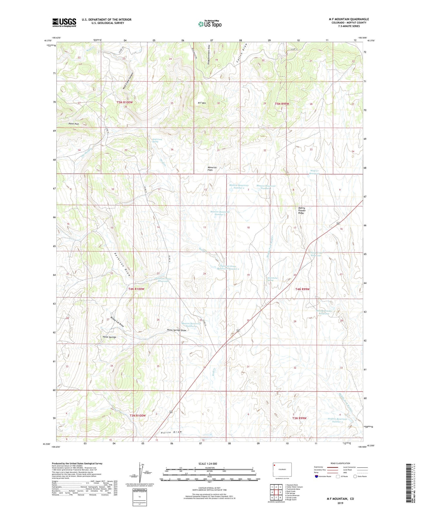
M F Mountain Colorado US Topo Map
Couldn't load pickup availability
2022 topographic map quadrangle M F Mountain in the state of Colorado. Scale: 1:24000. Based on the newly updated USGS 7.5' US Topo map series, this map is in the following counties: Moffat. The map contains contour data, water features, and other items you are used to seeing on USGS maps, but also has updated roads and other features. This is the next generation of topographic maps. Printed on high-quality waterproof paper with UV fade-resistant inks.
Quads adjacent to this one:
West: Skull Creek
Northwest: Haystack Rock
North: Indian Water Canyon
Northeast: Twelvemile Mesa
East: Elk Springs
Southeast: Rough Gulch
South: Divide Creek
Southwest: Cactus Reservoir
This map covers the same area as the classic USGS quad with code o40108c5.
Contains the following named places: Bailey Place, Baking Powder Reservoir, Baking Powder Ridge, Bar 74 Ranch, Horse Draw, Horse Draw Well, Little Star Number One Mine, M F Mountain, Mancos Reservoir Number 1, Mancos Reservoir Number 2, Mancos Reservoir Number 3, Mancos Reservoir Number 4, Maverick Flats, Mobley Place, Peterson Draw, Peterson Draw Reservoir, Peterson Draw Reservoir Number 2, Sheep Trail Reservoir, The Sloughs, Three Springs, Three Springs Draw, Weir Place, Wild Horse Spring, Wolf Creek Canyon, Wolf Creek Reservoir, Wolf Creek Reservoir Number 2, Wolf Creek Spring, Yellow Cat Draw