MyTopo
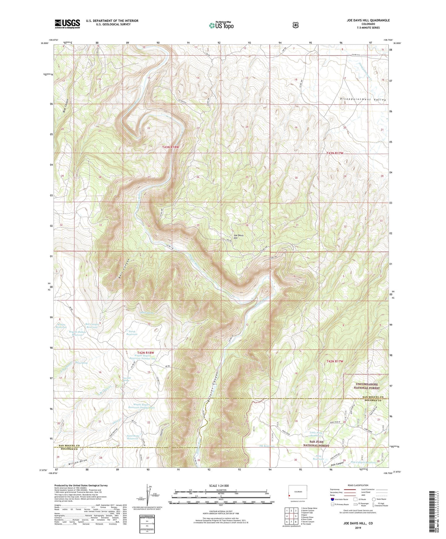
Joe Davis Hill Colorado US Topo Map
Couldn't load pickup availability
Also explore the Joe Davis Hill Forest Service Topo of this same quad for updated USFS data
2022 topographic map quadrangle Joe Davis Hill in the state of Colorado. Scale: 1:24000. Based on the newly updated USGS 7.5' US Topo map series, this map is in the following counties: San Miguel, Dolores. The map contains contour data, water features, and other items you are used to seeing on USGS maps, but also has updated roads and other features. This is the next generation of topographic maps. Printed on high-quality waterproof paper with UV fade-resistant inks.
Quads adjacent to this one:
West: Egnar
Northwest: Horse Range Mesa
North: Hamm Canyon
Northeast: Gypsum Gap
East: Dawson Draw
Southeast: The Glade
South: Secret Canyon
Southwest: Dove Creek
This map covers the same area as the classic USGS quad with code o37108h7.
Contains the following named places: Bell Canyon, Bell Canyon Reservoir, Betty Ruth Mine, Buckhorn Mine, Clear View Claims, Curtis Mine, Dan Mine, Depression Mine, Dolores River Mine, DR Reservoir, Egnar Heliport, Fox Mine, France Mine, Full Moon Group Mine, Full Moon Mine, Horseshoe One through Seven Mines, Joe Davis Hill, Joe Davis Hill Mine, Little Max Mine, Little Pony Reservoir, Little Roy Mine, Mardi Mine, Marne Mine, Mucho Grande Mine, Muleshoe Six Mine, Mystery Mine, Norma Jean Mine, Norma Jean Number 2 Mine, North Reservoir, Owensby Mine, Park Reservoir, Parrot Group Mine, Parrot Mine, Philura Group Mine, Piney Spring, Pole Canyon Reservoir, Pony Reservoir, Powder Drift Mine, Quakie Spring, Red Rock Four and Five Mines, Red Rock Mine, Red Top Mine, Rim Mine, Rogers-Dalton Reservoir, Roy Lee Mine, S.B. Group Mine, Sand Rock Reservoir, Sara M. Mine, Sarah Ellen Mine, Sawmill Spring, South Branch Chico Creek, Space Ship Number One Mine, Spud Patch Camp, Spud Patch Mine, Suncup Mine, Suncup Two Mine, Uncle Sam Mine, Uncle Sammy Mine, Wally Mine, Wayne Rogers Reservoir Number One, Wayne Rogers Reservoir Number Two, Wilson Reservoir