MyTopo
Gypsum Gap Colorado US Topo Map
Couldn't load pickup availability
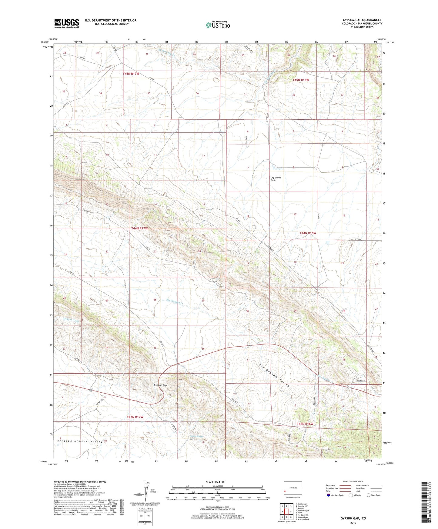
2022 topographic map quadrangle Gypsum Gap in the state of Colorado. Scale: 1:24000. Based on the newly updated USGS 7.5' US Topo map series, this map is in the following counties: San Miguel. The map contains contour data, water features, and other items you are used to seeing on USGS maps, but also has updated roads and other features. This is the next generation of topographic maps. Printed on high-quality waterproof paper with UV fade-resistant inks.
Quads adjacent to this one:
West: Hamm Canyon
Northwest: Bull Canyon
North: Naturita NW
Northeast: Naturita
East: Basin
Southeast: McKenna Peak
South: Dawson Draw
Southwest: Joe Davis Hill
This map covers the same area as the classic USGS quad with code o38108a6.
Contains the following named places: Bald Eagle Mines, Big Gyp Mine, C and C Drilling Mine, Centennial Mine, Cliff Dweller Mine, Du-Vanderwilt Mine, Early Morn Group Mine, Early Morning Mine, Gypsum Gap, Gypsum Valley Claims Mine, Jungle Basin Mine, Klondike Mine, Larson Spring, Long Ridge Mines, Mike Number One Mine, Mike One Mine, Phillips 66 One Mine, Pitchfork Mines, Polar Mine, Pond Mine, Rambler Mine, Red Wing Mine, Tiny Mine, Truck Group Mine, Two Bar Mine, Wilmarth Mine, Windswept Mine, Z-Bar Mine