MyTopo
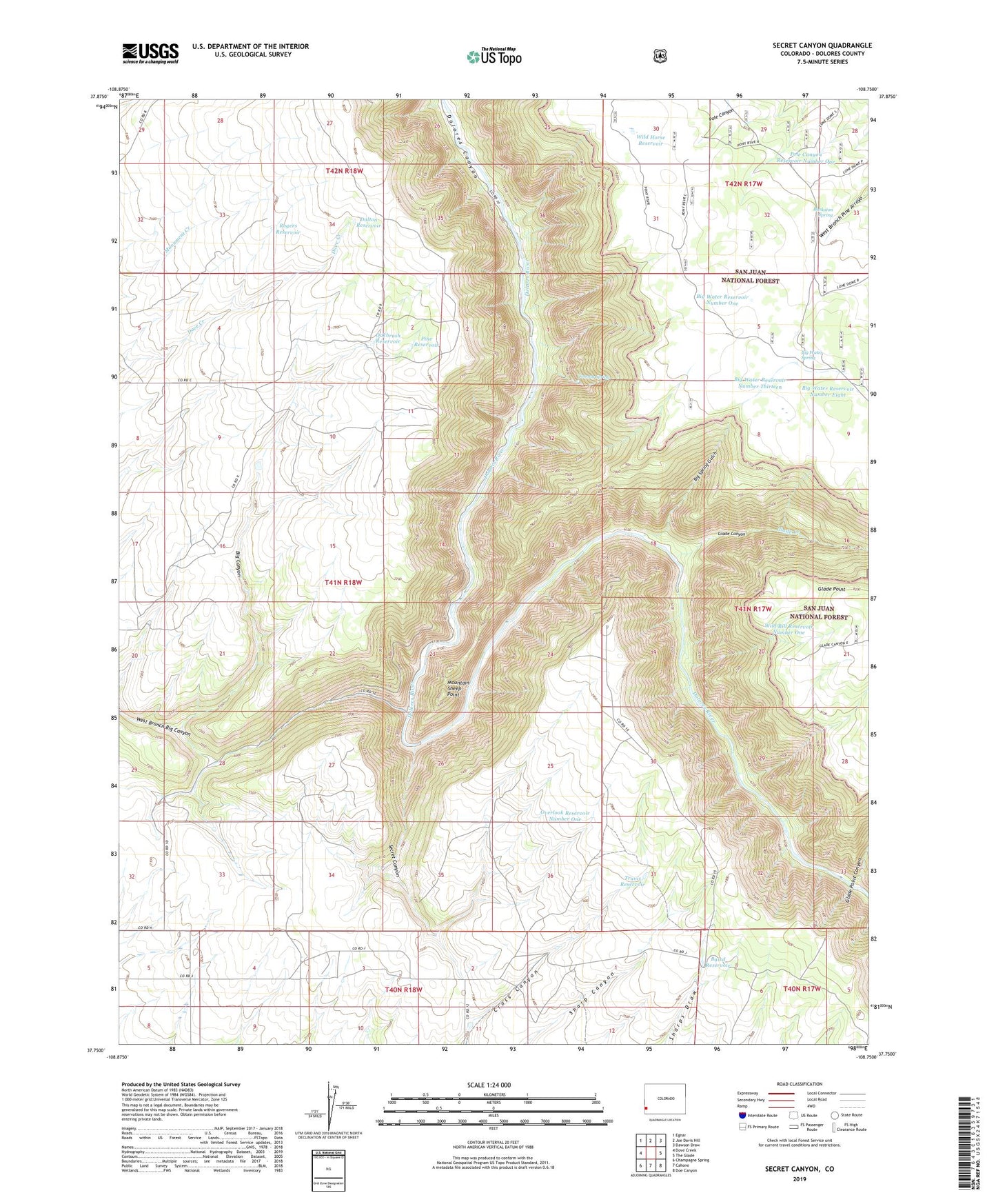
Secret Canyon Colorado US Topo Map
Couldn't load pickup availability
Also explore the Secret Canyon Forest Service Topo of this same quad for updated USFS data
2022 topographic map quadrangle Secret Canyon in the state of Colorado. Scale: 1:24000. Based on the newly updated USGS 7.5' US Topo map series, this map is in the following counties: Dolores. The map contains contour data, water features, and other items you are used to seeing on USGS maps, but also has updated roads and other features. This is the next generation of topographic maps. Printed on high-quality waterproof paper with UV fade-resistant inks.
Quads adjacent to this one:
West: Dove Creek
Northwest: Egnar
North: Joe Davis Hill
Northeast: Dawson Draw
East: The Glade
Southeast: Doe Canyon
South: Cahone
Southwest: Champagne Spring
This map covers the same area as the classic USGS quad with code o37108g7.
Contains the following named places: Arrowhead Mine, Baird Reservoir, Bankston Spring, Big Canyon, Big Spring Gulch, Big Water Reservoir Number Eight, Big Water Reservoir Number One, Big Water Reservoir Number Thirteen, Big Water Spring, Dalton Reservoir, Dolores Canyon Overlook Picnic Area, Dove Creek Pumping Station, Glade Canyon, Glade Canyon Prospect, Glade Creek, Glade Point Canyon, Mountain Sheep Point, Oakbrush Reservoir, Overlook Reservoir Number One, Pack Rat Mine, Pine Reservoir, Pole Canyon Reservoir Number One, Rainy Day Mine, Rogers Reservoir, Secret Canyon, Tommy Spring, Travis Reservoir, West Branch Big Canyon, Wild Bill Reservoir Number Eight, Wild Bill Reservoir Number One, Wild Horse Reservoir