MyTopo
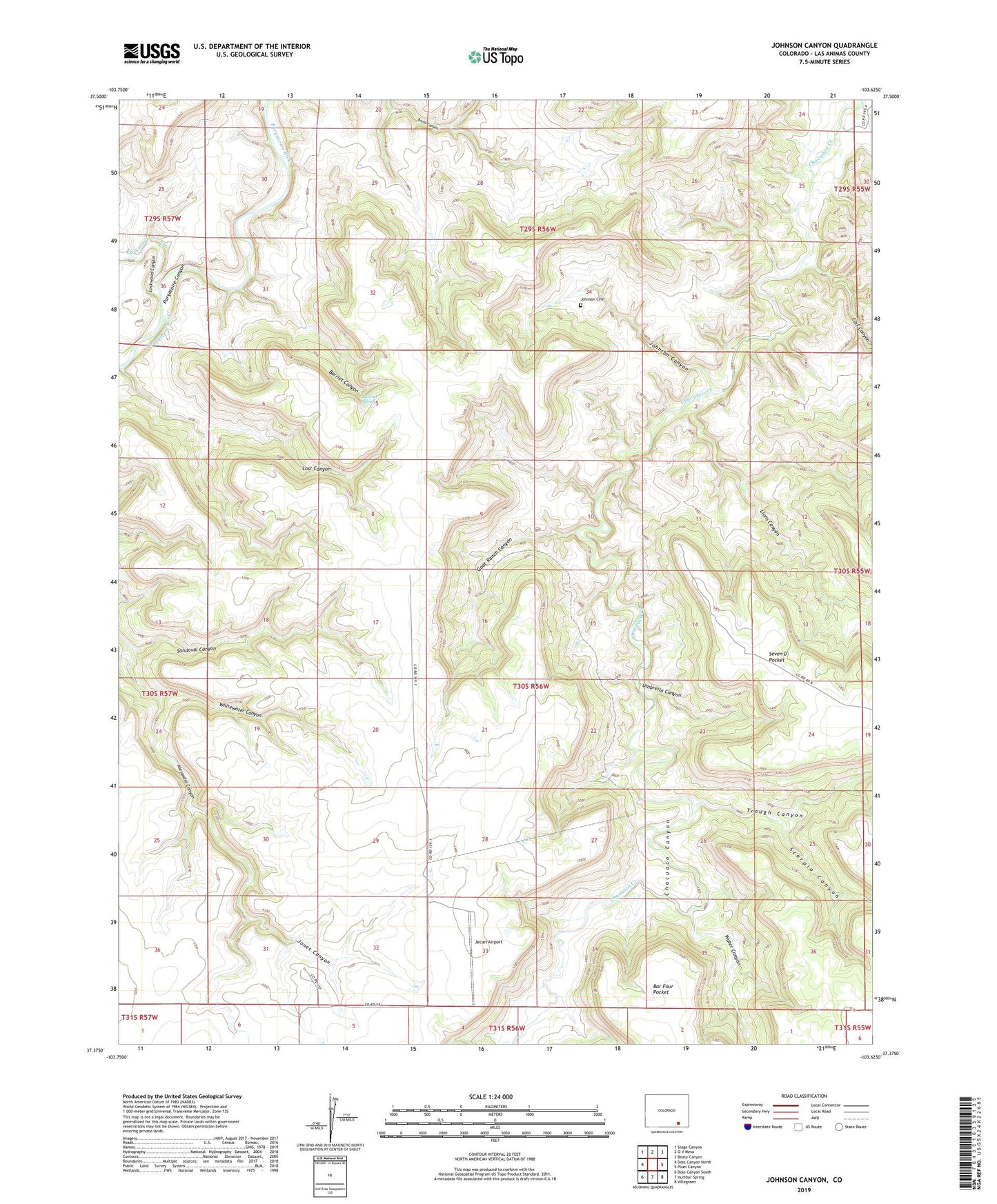
Johnson Canyon Colorado US Topo Map
Couldn't load pickup availability
Also explore the Johnson Canyon Forest Service Topo of this same quad for updated USFS data
2022 topographic map quadrangle Johnson Canyon in the state of Colorado. Scale: 1:24000. Based on the newly updated USGS 7.5' US Topo map series, this map is in the following counties: Las Animas. The map contains contour data, water features, and other items you are used to seeing on USGS maps, but also has updated roads and other features. This is the next generation of topographic maps. Printed on high-quality waterproof paper with UV fade-resistant inks.
Quads adjacent to this one:
West: Doss Canyon North
Northwest: Stage Canyon
North: O V Mesa
Northeast: Beaty Canyon
East: Plum Canyon
Southeast: Villegreen
South: Humbar Spring
Southwest: Doss Canyon South
This map covers the same area as the classic USGS quad with code o37103d6.
Contains the following named places: Barriet Canyon, Barriet Spring, Calf Canyon, Chacuaco Canyon, Double Tank Windmill, Garfield Windmill, Goat Ranch Canyon, Jecan Airport, Johnson Canyon, Johnson Cemetery, Jones Canyon, Lions Canyon, Lockwood Arroyo, Lockwood Canyon, Lost Canyon, Lower Windmill, Plum Creek, Round Corral Windmill, Sandoval Canyon, Scorpio Canyon, Trough Canyon, Umbrella Canyon, Upper Windmill, Water Canyon, Whitewater Canyon