MyTopo
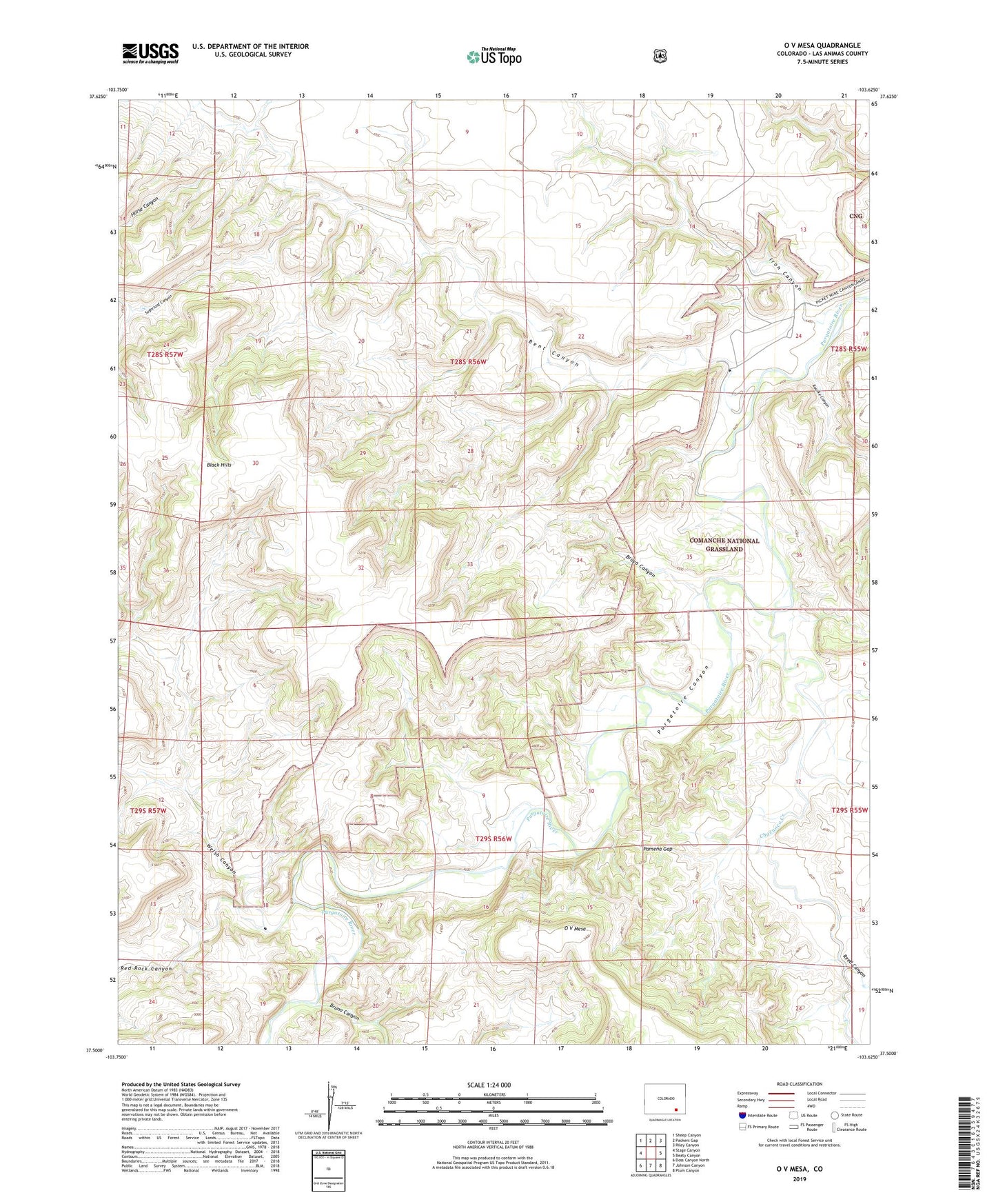
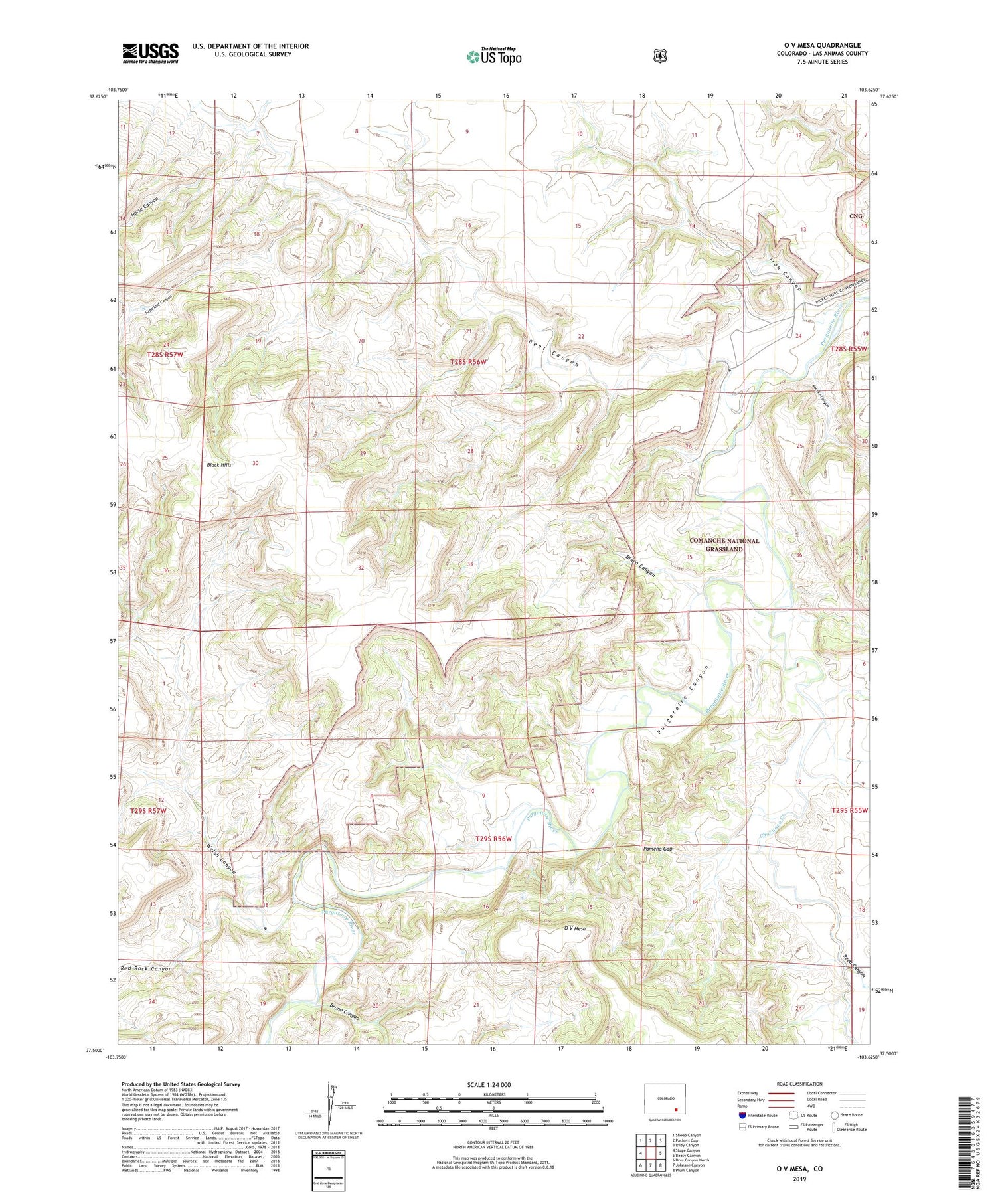
O V Mesa Colorado US Topo Map
Couldn't load pickup availability
Also explore the O V Mesa Forest Service Topo of this same quad for updated USFS data
2022 topographic map quadrangle O V Mesa in the state of Colorado. Scale: 1:24000. Based on the newly updated USGS 7.5' US Topo map series, this map is in the following counties: Las Animas. The map contains contour data, water features, and other items you are used to seeing on USGS maps, but also has updated roads and other features. This is the next generation of topographic maps. Printed on high-quality waterproof paper with UV fade-resistant inks.
Quads adjacent to this one:
West: Stage Canyon
Northwest: Sheep Canyon
North: Packers Gap
Northeast: Riley Canyon
East: Beaty Canyon
Southeast: Plum Canyon
South: Johnson Canyon
Southwest: Doss Canyon North
This map covers the same area as the classic USGS quad with code o37103e6.
Contains the following named places: Bent Canyon, Black Hills, Bravo Canyon, Bruno Canyon, Chacuaco Creek, Cistern Windmill, Horse Canyon, Iron Canyon, Mesa Windmill, O V Mesa, Pamena Gap, Pamena Windmill, Red Rock Canyon, Reed Canyon, Rourke Canyon, Rourke Ranch, Sugarloaf Canyon, Welsh Canyon