MyTopo
Johnstown Colorado US Topo Map
Couldn't load pickup availability
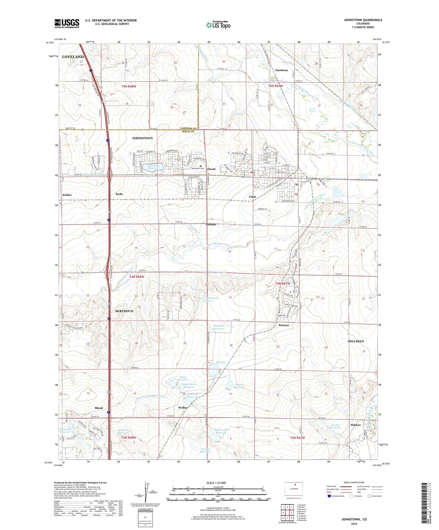
2022 topographic map quadrangle Johnstown in the state of Colorado. Scale: 1:24000. Based on the newly updated USGS 7.5' US Topo map series, this map is in the following counties: Weld, Larimer. The map contains contour data, water features, and other items you are used to seeing on USGS maps, but also has updated roads and other features. This is the next generation of topographic maps. Printed on high-quality waterproof paper with UV fade-resistant inks.
Quads adjacent to this one:
West: Berthoud
Northwest: Loveland
North: Windsor
Northeast: Bracewell
East: Milliken
Southeast: Platteville
South: Gowanda
Southwest: Longmont
This map covers the same area as the classic USGS quad with code o40104c8.
Contains the following named places: Akers and Tarr Dam, Ballinger Reservoir, Buda, Bunyan, Clark, Clennon Dam, Clennon Reservoir, Davis Reservoir, Elwell, Erkenbeck School, Farmers Extension Canal, Front Range Fire Rescue Station 1, Hardman, Hartford Dam, Hartford Reservoir, Hill and Brush Ditch, Hill Lake, Hillsboro Ditch, Isabel Myron Dam, Isabel Myron Reservoir, Johnstown, Johnstown Cemetery, Johnstown Dam, Johnstown Police Department, Johnstown Post Office, Johnstown Reservoir, Johnstown-Milliken Division, Kahler, Little Gem Dam, Little Gem Reservoir, Little Thompson Dam, Little Thompson Reservoir, Longs Peak Dairy, M and J Dairy, Marshall Number 2 Dam, Marshall Reservoir Number 2, Miantenoma Dam, Miantenoma Reservoir, Miner Longan Ditch, Minnie Dam, Minnie Reservoir, Moeller Dam, Moeller Reservoir, Parmalee Dam, Parmalee Reservoir, Pulliam, Second Wind Dairy, Town of Johnstown, Twin Mounds School, Walker, Walker Elevator, Wildcat, ZIP Code: 80534