MyTopo
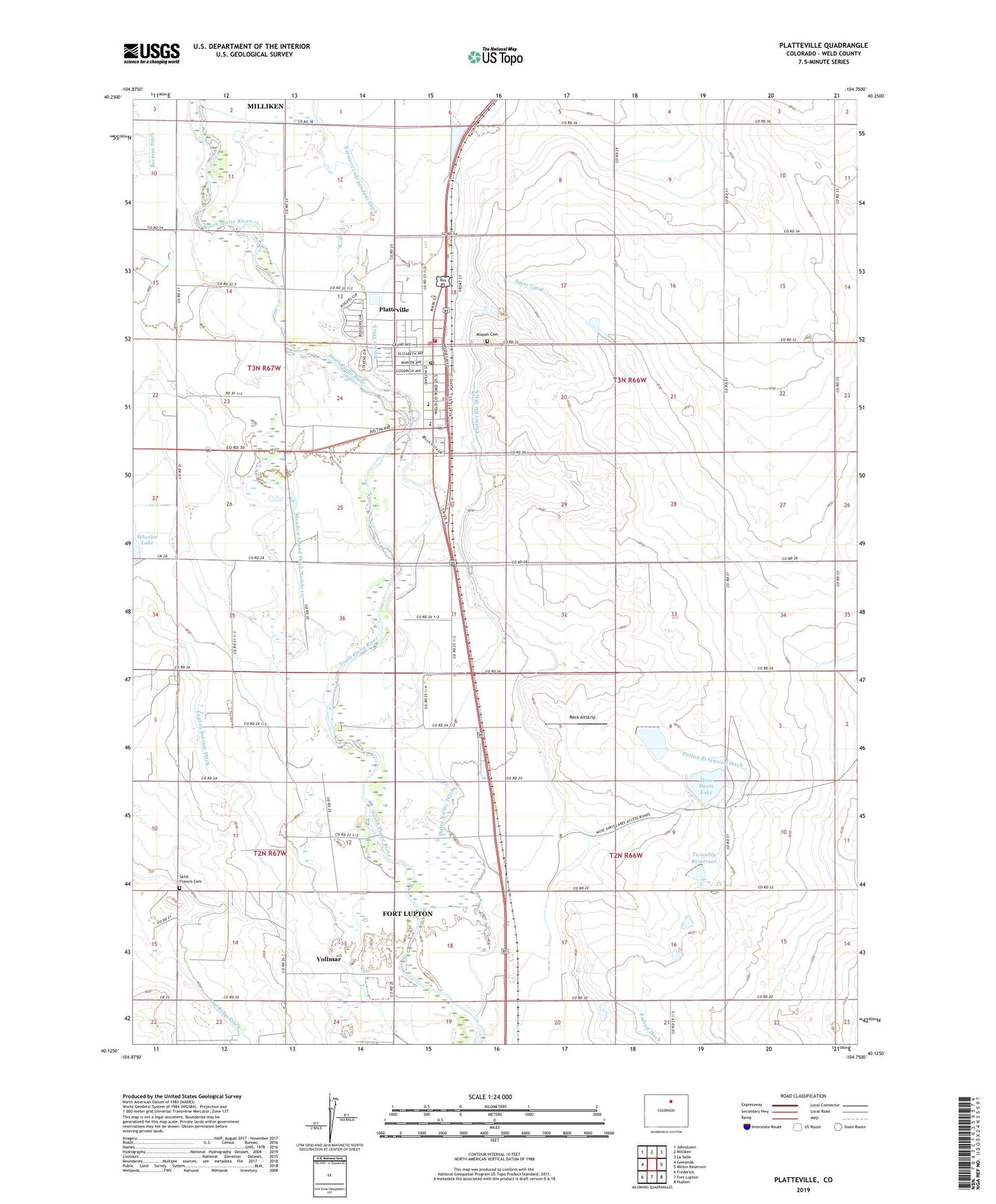
Platteville Colorado US Topo Map
Couldn't load pickup availability
2022 topographic map quadrangle Platteville in the state of Colorado. Scale: 1:24000. Based on the newly updated USGS 7.5' US Topo map series, this map is in the following counties: Weld. The map contains contour data, water features, and other items you are used to seeing on USGS maps, but also has updated roads and other features. This is the next generation of topographic maps. Printed on high-quality waterproof paper with UV fade-resistant inks.
Quads adjacent to this one:
West: Gowanda
Northwest: Johnstown
North: Milliken
Northeast: La Salle
East: Milton Reservoir
Southeast: Hudson
South: Fort Lupton
Southwest: Frederick
This map covers the same area as the classic USGS quad with code o40104b7.
Contains the following named places: Beeman Ditch, Bella Holstein Dairy, Bucker Ditch, Fulton Extension Ditch, Fulton Waste Dam, Ione, Lupton Bottom Ditch, Maddux, Meadow Island Ditch Number 2, Medow Island Ditch Number 1, Mizpah Cemetery, Moore, Morning Fresh Farms, Mose Davis Lake, Mose Davis Number 2 Dam, Mose Davis Reservoir Number 2, Old Fort Vasquez, Platteville, Platteville - Gilcrest Fire Protection District Platteville Station, Platteville Ditch, Platteville Post Office, Platteville Town Police Department, Reck Airstrip, Saint Francis Cemetery, Spear Canal, Town of Platteville, Twombley Dam, Twombly Reservoir, Vollmar, ZIP Code: 80651