MyTopo
Bracewell Colorado US Topo Map
Couldn't load pickup availability
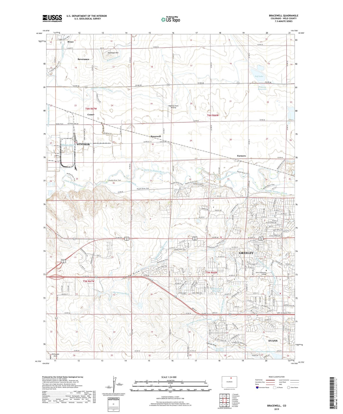
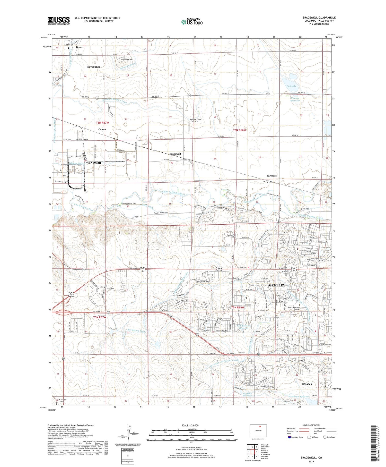
2022 topographic map quadrangle Bracewell in the state of Colorado. Scale: 1:24000. Based on the newly updated USGS 7.5' US Topo map series, this map is in the following counties: Weld. The map contains contour data, water features, and other items you are used to seeing on USGS maps, but also has updated roads and other features. This is the next generation of topographic maps. Printed on high-quality waterproof paper with UV fade-resistant inks.
Quads adjacent to this one:
West: Windsor
Northwest: Timnath
North: Severance
Northeast: Eaton
East: Greeley
Southeast: La Salle
South: Milliken
Southwest: Johnstown
This map covers the same area as the classic USGS quad with code o40104d7.
Contains the following named places: Antelope Hill, Arrowhead Reservoir, Ashton School, Boomerang Ditch, Bracewell, Bruce, Buxman Dairy and Farms, City of Greeley, Colorado State Patrol Troop 3A Greeley, Comer, Company Ditch, Consolidated Law Ditch, Erickson Reservoir, Farmers, Grapevine Ditch, Greeley Country Club, Greeley Fire Department Station 5, Greeley Fire Department Station 7, Hazelton School, Highline Farm Airstrip, Hogarty Reservoir, Jones Ditch, La Grange School, Lucas School, Neff Lake, Neill Brothers Reservoir, Neuman Lake, North Boomerang Extension, Plain View School, Sheep Draw, West Grapevine Ditch, Windsor Division, ZIP Code: 80634