MyTopo
Milliken Colorado US Topo Map
Couldn't load pickup availability
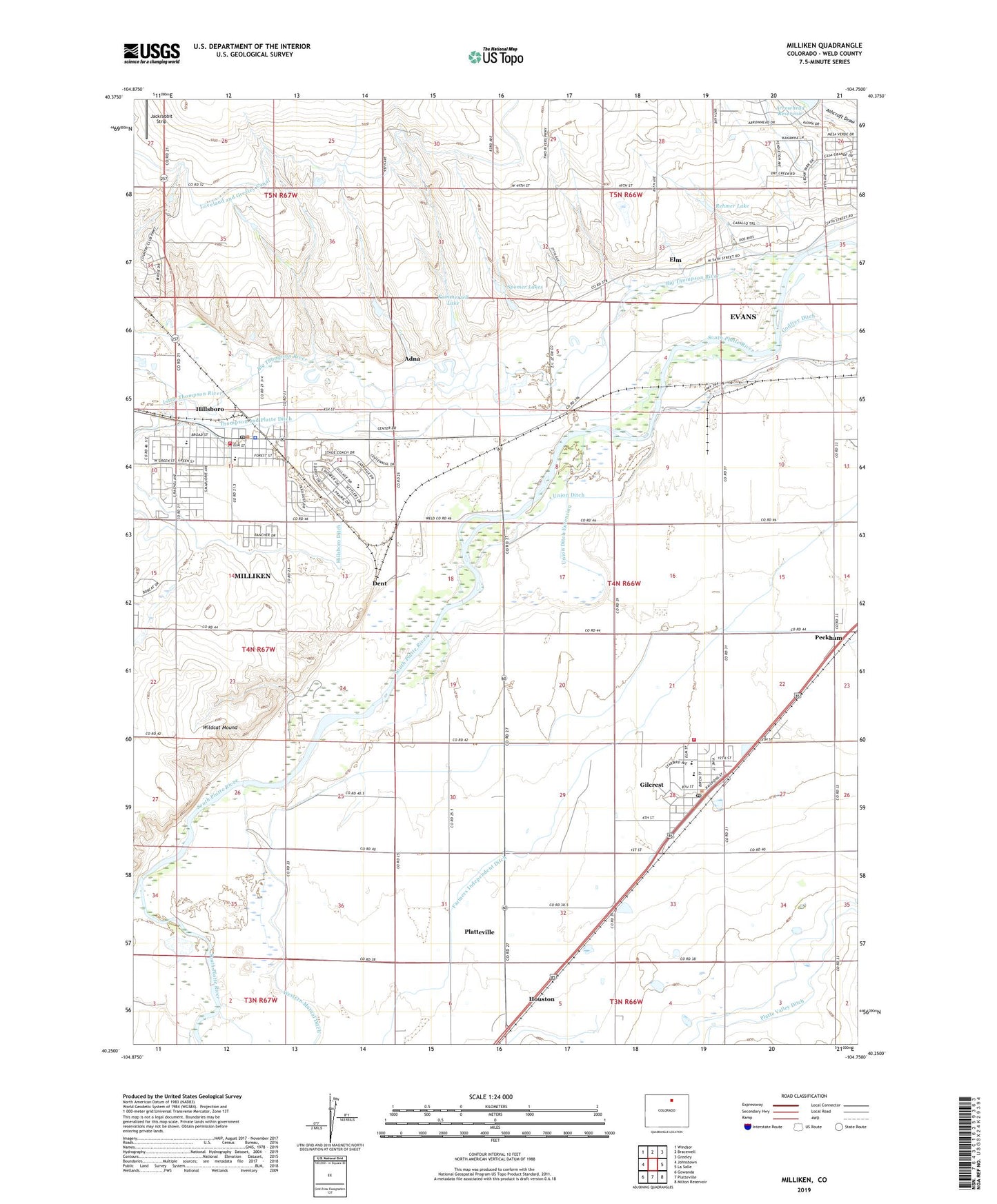
2022 topographic map quadrangle Milliken in the state of Colorado. Scale: 1:24000. Based on the newly updated USGS 7.5' US Topo map series, this map is in the following counties: Weld. The map contains contour data, water features, and other items you are used to seeing on USGS maps, but also has updated roads and other features. This is the next generation of topographic maps. Printed on high-quality waterproof paper with UV fade-resistant inks.
Quads adjacent to this one:
West: Johnstown
Northwest: Windsor
North: Bracewell
Northeast: Greeley
East: La Salle
Southeast: Milton Reservoir
South: Platteville
Southwest: Gowanda
This map covers the same area as the classic USGS quad with code o40104c7.
Contains the following named places: Adna, Arrowhead Dam, Ash Lane Dairy, Big Thompson River, Central Weld Sanitary Landfill, City of Evans, Daniels School, Dent, Elm, Fairview School, Farmers Independent Ditch, Fort Saint Vrain, Gilcrest, Gilcrest Feedlot, Gilcrest Post Office, Hillsboro, Houston, Jackrabbit Strip, Kammerzell Lake, Little Thompson Ditch, Little Thompson River, Milliken, Milliken Fire Protection District Station 1, Milliken Police Department, Milliken Post Office, Peckham, Platte Valley Ditch, Platteville - Gilcrest Fire Protection District Gilcrest Station 2, Rehmer Lake, Saint Vrain Creek, Spomer Lakes, Thompson and Platte Ditch, Town of Gilcrest, Town of Milliken, Union Ditch Extension, Western Mutual Ditch, Wildcat Mound, ZIP Codes: 80543, 80623