MyTopo
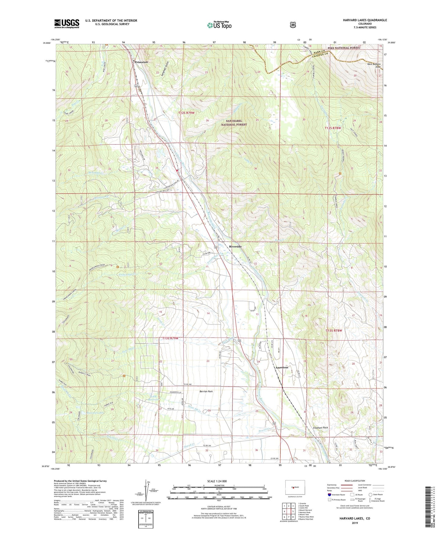
Harvard Lakes Colorado US Topo Map
Couldn't load pickup availability
Also explore the Harvard Lakes Forest Service Topo of this same quad for updated USFS data
2022 topographic map quadrangle Harvard Lakes in the state of Colorado. Scale: 1:24000. Based on the newly updated USGS 7.5' US Topo map series, this map is in the following counties: Chaffee, Park. The map contains contour data, water features, and other items you are used to seeing on USGS maps, but also has updated roads and other features. This is the next generation of topographic maps. Printed on high-quality waterproof paper with UV fade-resistant inks.
Quads adjacent to this one:
West: Mount Harvard
Northwest: Granite
North: South Peak
Northeast: Jones Hill
East: Marmot Peak
Southeast: Buena Vista East
South: Buena Vista West
Southwest: Mount Yale
This map covers the same area as the classic USGS quad with code o38106h2.
Contains the following named places: 3 Elk Dam, 3 Elk Reservoir, Americus, Berrian Park, Berrian School, Buena Vista Division, Buffalo Creek, Chaffee County Fire Protection District Station 15, Elephant Rock, Ferris Creek, Four Elk Creek, Fourmile Creek - Buffalo Meadows Trail, Frenchman Creek, Gable Creek, Harvard Lakes, Harvard Trail, Langhoff Gulch, Little Annie Mine, McFadden Creek, Morris Creek, Morrison Creek, Pine Creek School, Powell Creek, Princeton, Riverside, Riverside Ditch, Riverside School, Rock Creek, Sevenmile Creek, Three Elk Creek, Tumble Creek, Wapaca Trail