
MyTopo
Washboard Rock Colorado US Topo Map
Couldn't load pickup availability
Also explore the Washboard Rock Forest Service Topo of this same quad for updated USFS data
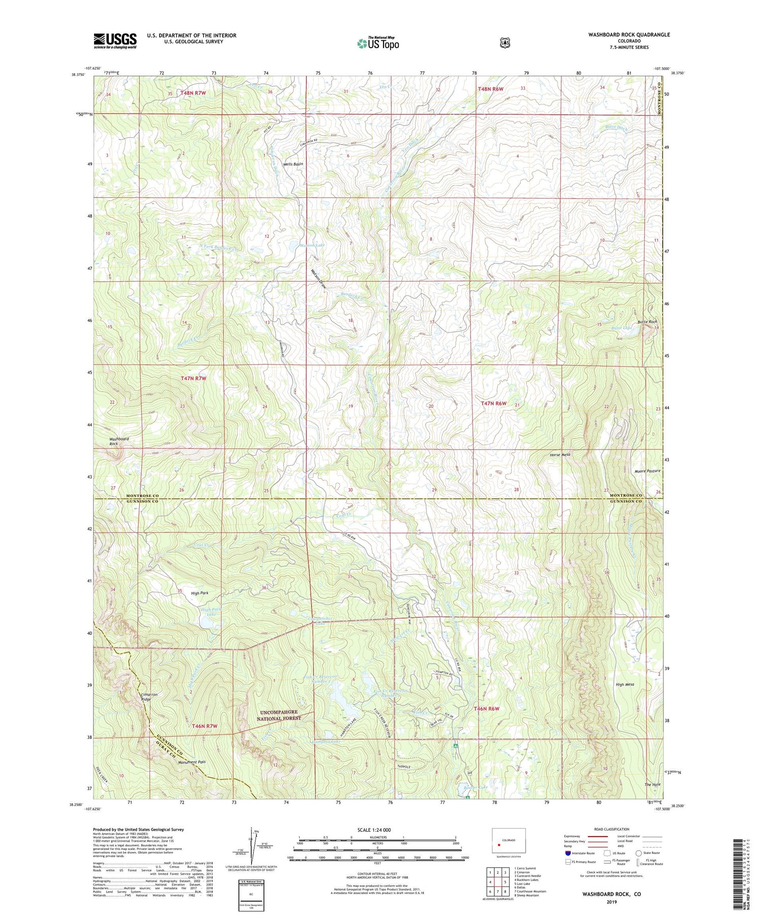
2022 topographic map quadrangle Washboard Rock in the state of Colorado. Scale: 1:24000. Based on the newly updated USGS 7.5' US Topo map series, this map is in the following counties: Montrose, Gunnison, Ouray. The map contains contour data, water features, and other items you are used to seeing on USGS maps, but also has updated roads and other features. This is the next generation of topographic maps. Printed on high-quality waterproof paper with UV fade-resistant inks.
Quads adjacent to this one:
West: Buckhorn Lakes
Northwest: Cerro Summit
North: Cimarron
Northeast: Curecanti Needle
East: Lost Lake
Southeast: Sheep Mountain
South: Courthouse Mountain
Southwest: Dallas
This map covers the same area as the classic USGS quad with code o38107c5.
Contains the following named places: Beaver Lake, Beaver Lake Dam, Big Cimarron Campground, Big Cimarron Ranch, Burdeck Creek, Butte Lake, Butte Rock, Cimarron Coal Mine, Cimarron Reservoirs, Cimarron State Wildlife Area, Coal Creek, Cowpuncher Lake, Fish Creek, Fish Creek Number 1 Dam, Fish Creek Number 2 Dam, Fish Creek Reservoir Number 1, Fish Creek Reservoir Number 2, Hampton Lake, High Park, High Park Creek, High Park Lake, High Park Lake Dam, Horse Mesa, Monument Pass, Moore Pasture, North Fork Burdeck Creek, Stewart Creek, Veo Creek, Veo Ditch, Washboard Rock, Watson Draw, Watson Lake, Wells Basin


