MyTopo
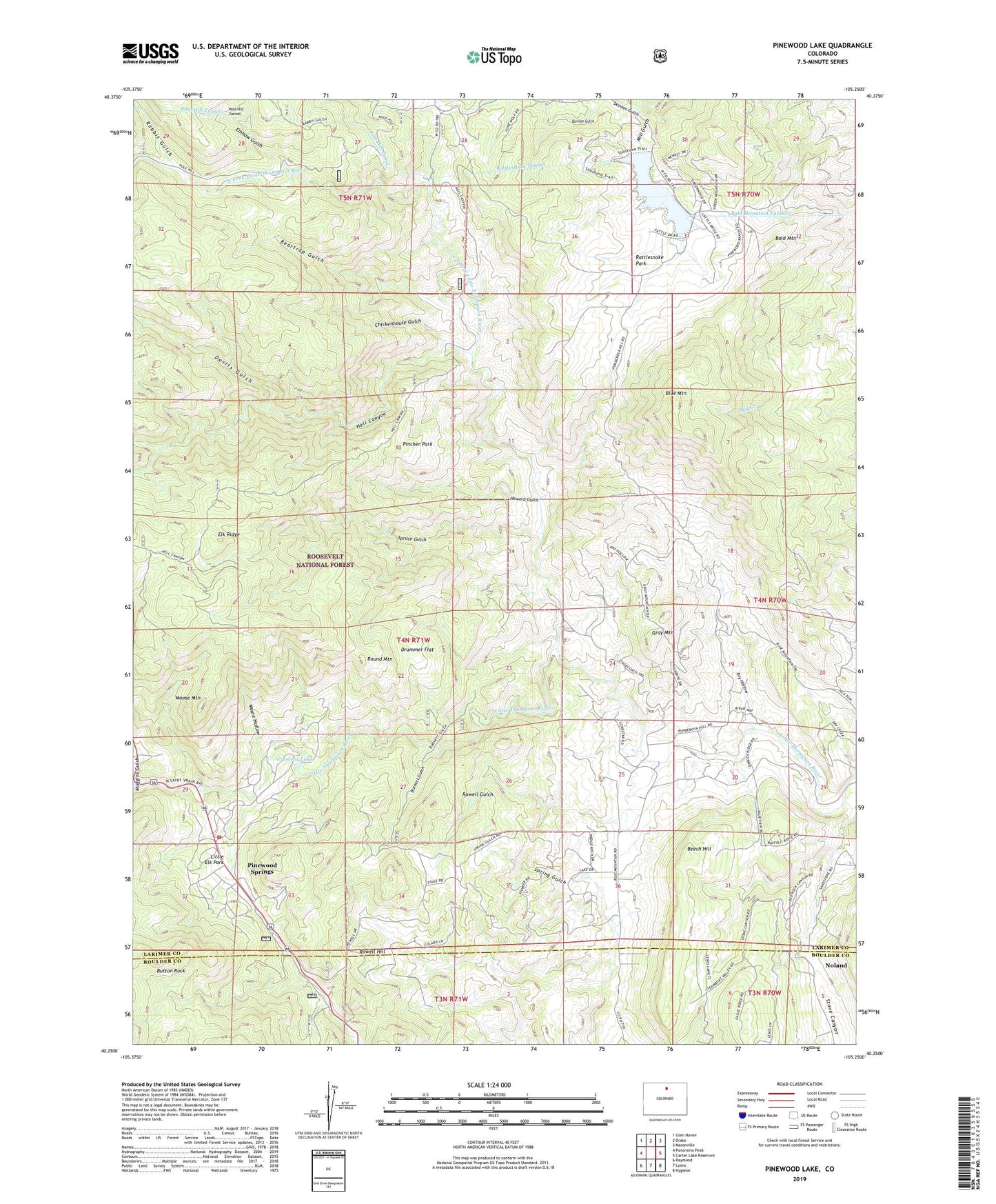
Pinewood Lake Colorado US Topo Map
Couldn't load pickup availability
Also explore the Pinewood Lake Forest Service Topo of this same quad for updated USFS data
2022 topographic map quadrangle Pinewood Lake in the state of Colorado. Scale: 1:24000. Based on the newly updated USGS 7.5' US Topo map series, this map is in the following counties: Larimer, Boulder. The map contains contour data, water features, and other items you are used to seeing on USGS maps, but also has updated roads and other features. This is the next generation of topographic maps. Printed on high-quality waterproof paper with UV fade-resistant inks.
Quads adjacent to this one:
West: Panorama Peak
Northwest: Glen Haven
North: Drake
Northeast: Masonville
East: Carter Lake Reservoir
Southeast: Hygiene
South: Lyons
Southwest: Raymond
This map covers the same area as the classic USGS quad with code o40105c3.
Contains the following named places: Bald Mountain, Bald Mountain Gate House, Bald Mountain Tunnel, Beartrap Gulch, Beech Hill, Blue Mountain, Burnett Gulch, Button Rock, Chickenhouse Gulch, Cojade Mine, Colard Ranch, Colorado Rose Red Quarry, Crescent Lake, Devils Gulch, Diamond K Quarry, Drummer Flat, Dry Hollow, Emhaw Gulch, Gray Mountain, Hell Canyon, Howard Gulch, Howe Quarry, Indian Mountain, Jacobson and Lyons Quarry, Kirts Quarry, Linger Ranch, Little Elk Park, Maure Hollow, Mill Gulch, Moose Mountain, Muggins Gulch, Noland, North Fork Little Thompson River, Ohline Mine, Pincher Park, Pinewood Lake, Pinewood Ranch, Pinewood School, Pinewood Springs, Pinewood Springs Fire Protection District, Pole Hill Canal, Pole Hill Gate House, Pole Hill Power Plant, Rabbit Gulch, Rattlesnake Dam, Rattlesnake Park, Rattlesnake Park Mine, Rattlesnake Tunnel, Redstone Quarry, Round Mountain, Rowell Gulch, Rowell Hill, Skinner Gulch, South Side Dam, Spruce Gulch, Stevens Ranch, X Bar 7 Ranch