
MyTopo
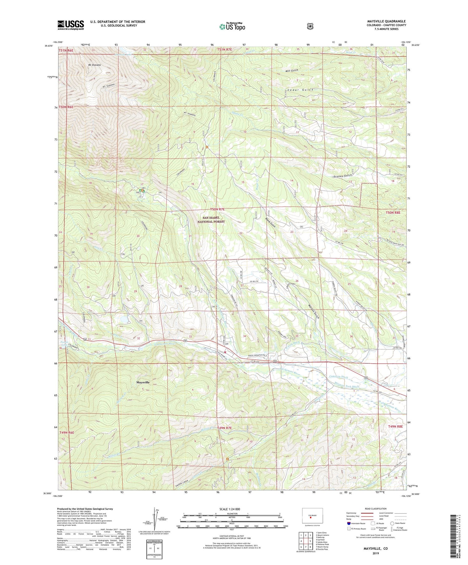
Maysville Colorado US Topo Map
Couldn't load pickup availability
Also explore the Maysville Forest Service Topo of this same quad for updated USFS data
2023 topographic map quadrangle Maysville in the state of Colorado. Scale: 1:24000. Based on the newly updated USGS 7.5' US Topo map series, this map is in the following counties: Chaffee. The map contains contour data, water features, and other items you are used to seeing on USGS maps, but also has updated roads and other features. This is the next generation of topographic maps. Printed on high-quality waterproof paper with UV fade-resistant inks.
Quads adjacent to this one:
West: Garfield
Northwest: Saint Elmo
North: Mount Antero
Northeast: Nathrop
East: Salida West
Southeast: Poncha Pass
South: Mount Ouray
Southwest: Pahlone Peak
This map covers the same area as the classic USGS quad with code o38106e2.
Contains the following named places: Angel of Shavano Campground, Blank Cabin, Cameron Ditch, Cedar Gulch, Chaffee County Fire Protection District Station 5, Colorado Fire Camp, Como Creek, Copper King Mine, Cree Creek, Fooses Creek, Fooses Dam, Fooses Lake, Green Creek, Independence Mine, Lost Creek, Maysville, Maysville Census Designated Place, McClure Creek, Mill Gulch, Mount Shavano, North Fork Ditch, North Fork South Arkansas River, Pass Creek, Placer Creek, Redman Creek, Salida Division, Shavano Lake, South Sand Creek, Springfield Mine, Weldon Gulch, Willow Creek


