MyTopo
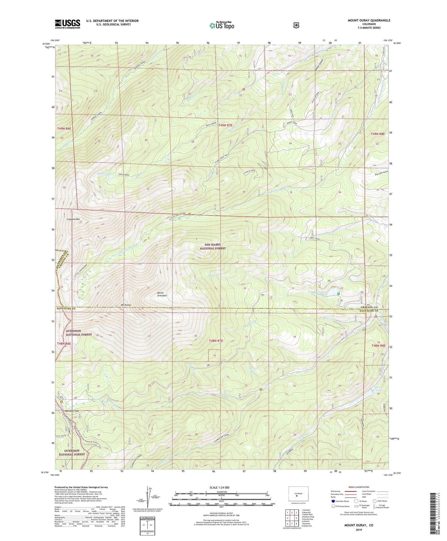
Mount Ouray Colorado US Topo Map
Couldn't load pickup availability
Also explore the Mount Ouray Forest Service Topo of this same quad for updated USFS data
2022 topographic map quadrangle Mount Ouray in the state of Colorado. Scale: 1:24000. Based on the newly updated USGS 7.5' US Topo map series, this map is in the following counties: Chaffee, Saguache, Gunnison. The map contains contour data, water features, and other items you are used to seeing on USGS maps, but also has updated roads and other features. This is the next generation of topographic maps. Printed on high-quality waterproof paper with UV fade-resistant inks.
Quads adjacent to this one:
West: Pahlone Peak
Northwest: Garfield
North: Maysville
Northeast: Salida West
East: Poncha Pass
Southeast: Whale Hill
South: Bonanza
Southwest: Chester
This map covers the same area as the classic USGS quad with code o38106d2.
Contains the following named places: Beaver Creek, Blanchard Ranch, Bonita Group Mine, Box Creek, Browns Creek, Chipeta Mountain, Cinderella South Mine, Devils Armchair, Dry Lake, Dry Lake Gulch, Grays Creek, Grays Creek Dam, Hunter Gulch, Marshall Pass, Mount Ouray, O Haver Lake Campground, O Haver Lake Dam, O'Haver Lake, Ouray Creek, Pass Creek Lake, Shirley, Silver Creek, Silver Creek Lakes, Spruce Creek, Starvation Creek, Stumpy Creek, Tent Creek, Valley View Mine