
MyTopo
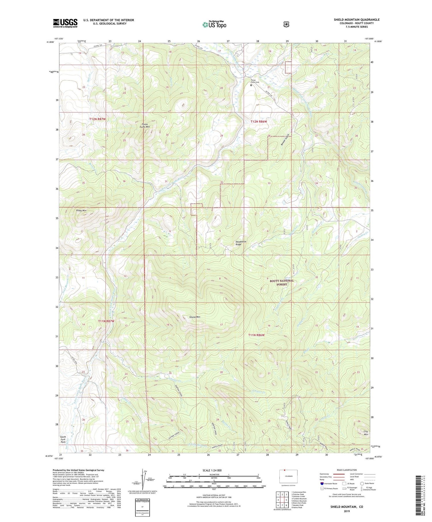
Shield Mountain Colorado US Topo Map
Couldn't load pickup availability
Also explore the Shield Mountain Forest Service Topo of this same quad for updated USFS data
2022 topographic map quadrangle Shield Mountain in the states of Colorado, Wyoming. Scale: 1:24000. Based on the newly updated USGS 7.5' US Topo map series, this map is in the following counties: Routt. The map contains contour data, water features, and other items you are used to seeing on USGS maps, but also has updated roads and other features. This is the next generation of topographic maps. Printed on high-quality waterproof paper with UV fade-resistant inks.
Quads adjacent to this one:
West: Tumble Mountain
Northwest: Cottonwood Rim
North: Fletcher Peak
Northeast: Solomon Creek
East: Elkhorn Mountain
Southeast: Hahns Peak
South: Meaden Peak
Southwest: Bears Ears Peaks
This map covers the same area as the classic USGS quad with code o40107h1.
Contains the following named places: Bedrock Creek, Beeler Gulch, Burton Creek, Burton Creek Trail, City Mountain, Deadhorse Ridge, Dudley Creek, East Fork Oliver Creek, Johnson Creek, King Solomon Creek, Middle Fork Little Snake River, Nipple Peak Trail, North Fork Little Snake River, Oliver Creek, Oliver Creek Trail, Piney Mountain, Shield Mountain, South Fork Little Snake River, Tennessee Creek, Three Forks, Three Forks Cemetery, Three Forks Mountain, Three Forks Ranch, Tunnel Creek


