MyTopo
Medano Pass Colorado US Topo Map
Couldn't load pickup availability
Also explore the Medano Pass Forest Service Topo of this same quad for updated USFS data
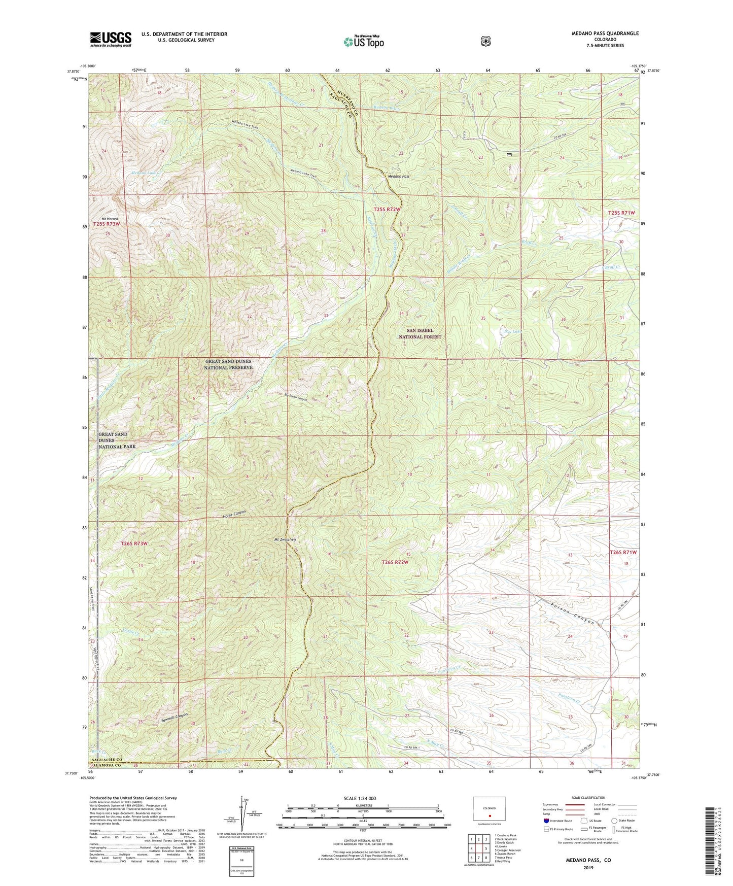
2022 topographic map quadrangle Medano Pass in the state of Colorado. Scale: 1:24000. Based on the newly updated USGS 7.5' US Topo map series, this map is in the following counties: Huerfano, Saguache, Alamosa. The map contains contour data, water features, and other items you are used to seeing on USGS maps, but also has updated roads and other features. This is the next generation of topographic maps. Printed on high-quality waterproof paper with UV fade-resistant inks.
Quads adjacent to this one:
West: Liberty
Northwest: Crestone Peak
North: Beck Mountain
Northeast: Devils Gulch
East: Creager Reservoir
Southeast: Red Wing
South: Mosca Pass
Southwest: Zapata Ranch
This map covers the same area as the classic USGS quad with code o37105g4.
Contains the following named places: Big South Canyon, Dry Lake, Hudson Branch Medano Creek, Hudson Ditch, McKinley Clay Dam, McKinley Clay Reservoir, McMahon Arroyo, Medano Ditch, Medano Lake, Medano Pass, Middle Bruff Creek, Mount Herard, Mount Zwischen, North Bruff Creek