MyTopo
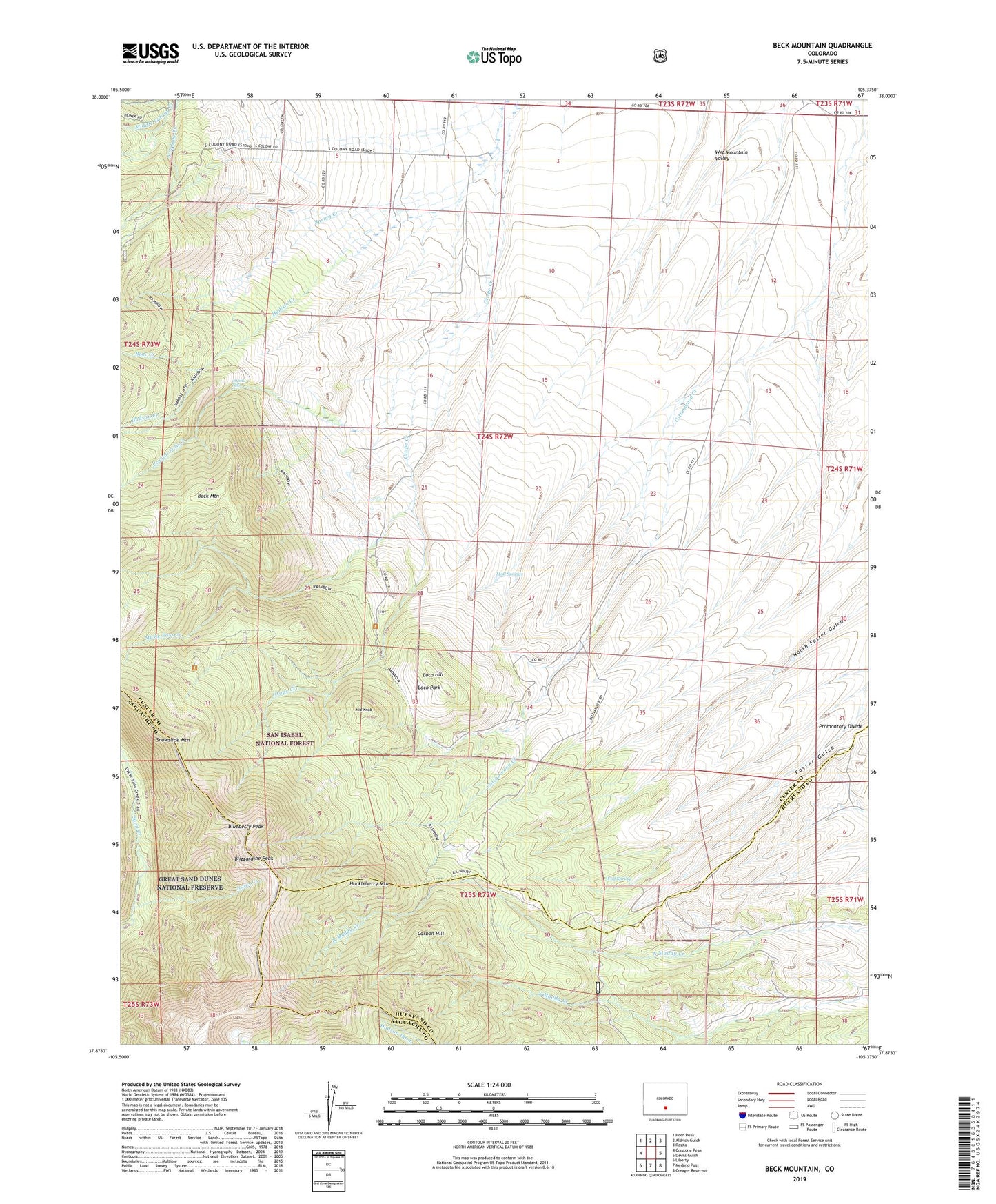
Beck Mountain Colorado US Topo Map
Couldn't load pickup availability
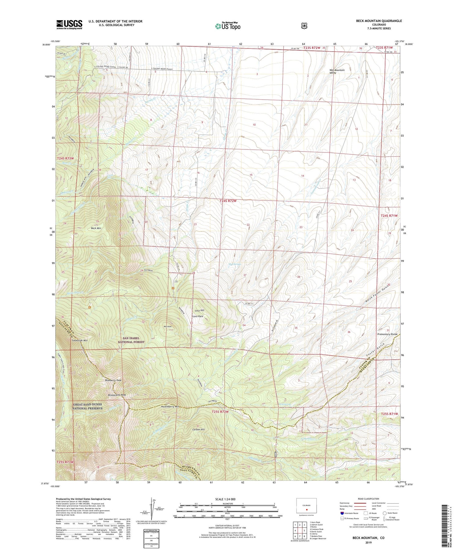
Also explore the Beck Mountain Forest Service Topo of this same quad for updated USFS data
2022 topographic map quadrangle Beck Mountain in the state of Colorado. Scale: 1:24000. Based on the newly updated USGS 7.5' US Topo map series, this map is in the following counties: Custer, Huerfano, Saguache. The map contains contour data, water features, and other items you are used to seeing on USGS maps, but also has updated roads and other features. This is the next generation of topographic maps. Printed on high-quality waterproof paper with UV fade-resistant inks.
Quads adjacent to this one:
West: Crestone Peak
Northwest: Horn Peak
North: Aldrich Gulch
Northeast: Rosita
East: Devils Gulch
Southeast: Creager Reservoir
South: Medano Pass
Southwest: Liberty
This map covers the same area as the classic USGS quad with code o37105h4.
Contains the following named places: Bear Creek, Beaver Lodge, Beck Mountain, Beck School, Blizzardine Peak, Blueberry Peak, Carbon Hill, Crystal Falls, Crystal Falls Creek, Doc Watkins Windmill, Henrich Ranch, Huckleberry Mountain, Hudson Creek, Jones Creek, Loco Hill, Loco Park, Marble Mountain Trail, Middle Knob, Mud Springs, Music Pass Creek, Music Pass Trail, Rainbow Trail, Snowslide Mountain, Spring Creek, Wolf Spring, Wolf Windmill